Hawksbill to Swift Run via Laurel Prong in Shenandoah National Park

Shenandoah National Park, VA

Hawksbill to Swift Run via Laurel Prong

Four days from the highest summit to Swift Run Gap, with waterfalls.

Length
25.6mi
Time
4days
Elev. change
1,470ft
Difficulty
Easy
  • Dogs allowed
  • High point 3,878 ft
  • #64 of 163 in Shenandoah

Hear the audio tour

Hawksbill Gap: The Short, Steep Summit Route

Overview

About Hawksbill to Swift Run via Laurel Prong

This is a four-day, 25.6-mile point-to-point backcountry traverse from Hawksbill Gap to Swift Run Gap. It climbs the park’s highest summit, then links the Salamander Trail, Appalachian Trail, Lewis Falls Trail, Mill Prong, Rapidan Camp, and Laurel Prong before continuing south to Swift Run. The planned three-night sequence uses Big Meadows Campground, a backcountry site in the Laurel Prong area, and Lewis Mountain Campground. Expect a route assembled from several trails rather than one continuous named footpath.

Why go

  • Combines the park high point, Lewis Falls, and the historic Rapidan Camp.
  • A varied four-day route across several named mountain trails.
  • Clear point-to-point start and finish for a full backcountry traverse.

Heads up

  • Requires four days, overnight gear, and a shuttle or vehicles at both ends.
  • The complete mapped line is longer than the commonly listed 23-mile itinerary.
  • Steep rocky ground and rain-swollen stream crossings can slow progress.

Map & elevation

The route

Loading the Shenandoah map
Full map
Elevation2,408–3,878 ft
TrailheadHawksbill Gap Parking Area, Skyline Drive mile 45.638.55631, -78.38681
Keep this map with you offline in the Parkwolf app

Plan your hike

Before you go

Parking

Begin at Hawksbill Gap Parking Area on Skyline Drive near mile 45.6; the full route ends at the north access to Swift Run Gap. Arrange a shuttle or a vehicle at each end, and confirm current parking and entrance arrangements before setting out.

Safety

Backcountry camping requires a current permit. Campsites are prohibited above 3,200 feet on Hawksbill and within 0.5 mile of Rapidan Camp. Confirm current registration and access for the Big Meadows and Lewis Mountain campground nights; the itinerary’s campground instructions are old. Treat water and use caution at stream crossings after rain. Dogs must stay leashed to six feet or less; pets are barred from the optional Bearfence Rock Scramble.

2 active Shenandoah alerts

  • ClosureOld Rag Trailhead main lot closedThe Old Rag Trailhead main parking lot is closed to vehicles and pedestrians for infrastructure improvements; use the existing overflow lots. - Work is expected to be completed by November 2026.Official details
  • ClosureBackcountry camping and zone closuresBackcountry camping is prohibited on the Appalachian Trail from Lewis Mountain to Big Meadows, and the Naked Creek backcountry zone is closed.Official details
Shenandoah alerts
A park ranger sits on a dash-mounted phone, talking, as Parkwolf’s Tour Guide plays “Army Cutworm Moths: A Grizzly Bear Buffet” on Grand Loop Road below Dunraven Pass in Yellowstone
Parkwolf Tour GuideThe highest, rockiest slopes around here are a summer buffet for grizzly bears.

Shenandoah Tour Guide

Your drive to Hawksbill to Swift Run via Laurel Prong, narrated.

Parkwolf is a GPS audio tour guide for Shenandoah National Park. As you drive, it chimes in with what’s ahead: hidden gems, upcoming stops, history, geology, and wildlife, right through your car’s speakers.

See the Shenandoah audio tour

Recorded for this area

Hawksbill Gap: The Short, Steep Summit Route
0:00 / 0:23
“You're approaching Hawksbill Gap, where a steep hike leads to the park's highest summit. For a shorter outing, take Lower Hawksbill: one point seven miles round trip, allowing an hour and a half to two hours.”

Plays near this trailhead in the Parkwolf Shenandoah Tour Guide.

More stories near here in the app

  • Crescent Rock Overlook: Hawksbill Without the Hike
  • Old Rag View Overlook: A Distant Mountain Profile
  • Upper Hawksbill: The Gentler Summit Approach
  • Timber Hollow Overlook: Beyond Nakedtop Mountain
  • 146 audio storiesacross Shenandoah’s roads, triggered by GPS as you drive
  • Wildlife heatmapsfor Black Bear, Bald Eagle, White-tailed Deer, and 13 more
  • Works offlinemaps, 163 trails, 142 places, and audio download before you lose signal
  • CarPlay readysimple controls built for the drive
★★★★★
“Fantastic app with many points of information… It’s great to just turn on while you’re driving and it gives you an audio tour of the national Park. We love it!!!!”
JMJamesApp Store review
Download Parkwolf on the App StoreGet Parkwolf on Google Play

4.7 from 8,600+ ratings

Trail guide

Hiking Hawksbill to Swift Run via Laurel Prong

Choose your endpoint before you startThe 23-mile figure often attached to this trip does not match the full line to Swift Run.

The 23-mile figure often attached to this trip does not match the full line to Swift Run. The written itinerary’s last suggested exit is South River Picnic Area after a 5.3-mile day on the Appalachian Trail; the line stored here continues south from there to the north access at Swift Run Gap and measures 25.6 miles. That is the full point-to-point version represented by the trail name. The distance is one way, and the stored line omits short, site-specific walks from the trails to individual campground sites. If you plan to stop at South River instead, arrange the pickup there and follow a route plan for that shorter version.

How the four days unfoldDay 1: From Hawksbill Gap, climb Lower Hawksbill to the summit, descend Salamander to the…
  • Day 1: From Hawksbill Gap, climb Lower Hawksbill to the summit, descend Salamander to the Appalachian Trail, then follow it toward Big Meadows. The planned day is about 5.1 miles before any extra walking to a specific campsite.
  • Day 2: Start near Big Meadows Amphitheatre, visit Lewis Falls by its steep, rocky path and connecting fire road, then cross Skyline Drive to Mill Prong and Rapidan Camp. Continue toward a backcountry campsite in the Laurel Prong area. The planned distance is about 6.1–7.1 miles.
  • Day 3: Follow Laurel Prong back to the Appalachian Trail and head south to Lewis Mountain Campground, about 5.7–6.7 miles. An optional Bearfence rock scramble is a separate add-on and is not part of the route line.
  • Day 4: Return to the Appalachian Trail and walk south. South River Picnic Area is the described 5.3-mile exit; reaching Swift Run Gap adds the remaining southbound section shown in the stored route.
Summit, falls, and forested ridgesThe summit is the big opening view: a platform looks out across the Shenandoah Valley, the Blue…

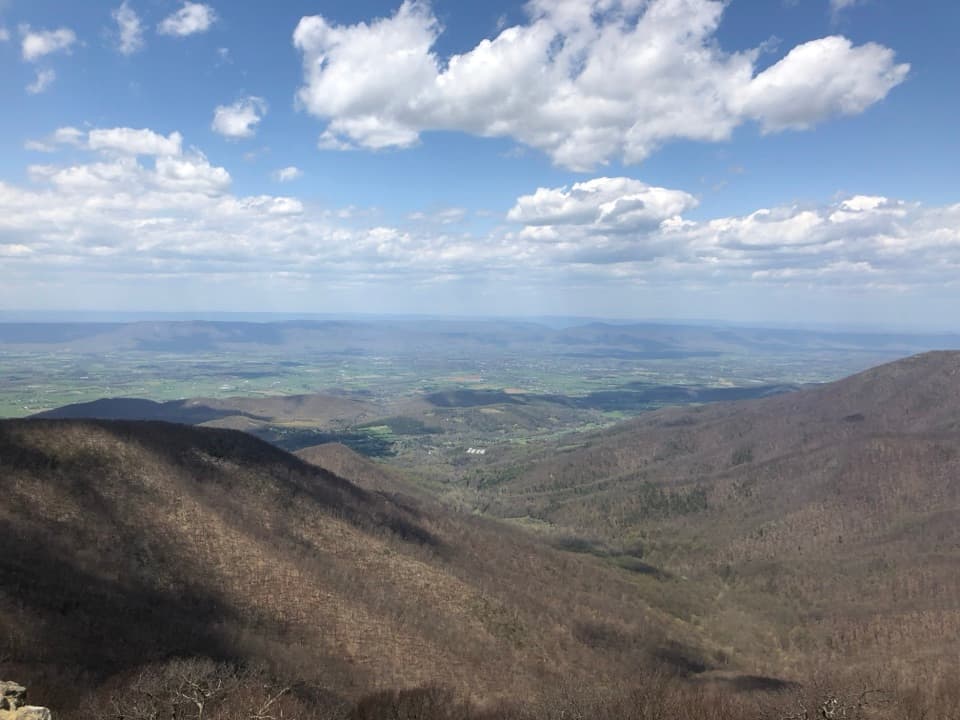
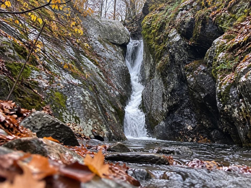
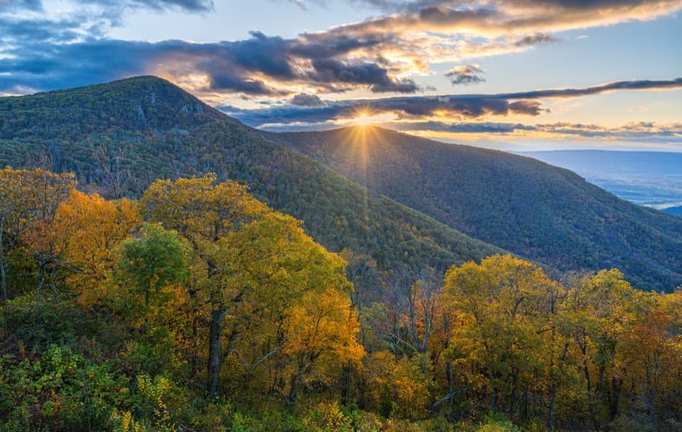
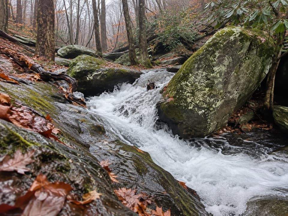
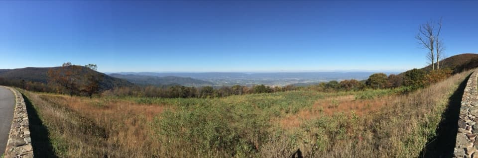
The summit is the big opening view: a platform looks out across the Shenandoah Valley, the Blue Ridge, and the Piedmont. The climb and descent over Hawksbill give this trip a high start, then the route trades exposed rocky ground for long forested stretches. Lewis Falls is a short, steep-sided visit within the second day’s route; take care on wet rock. Streams in the Mill and Laurel Prong area can become difficult after rain, so check conditions and turn back from a crossing that does not feel safe. The optional Bearfence scramble involves hands-on rock travel, so do not count it as an easy extension.

A visit to Rapidan CampMill Prong leads to Rapidan Camp, the rustic retreat used by Herbert and Lou Henry Hoover from…

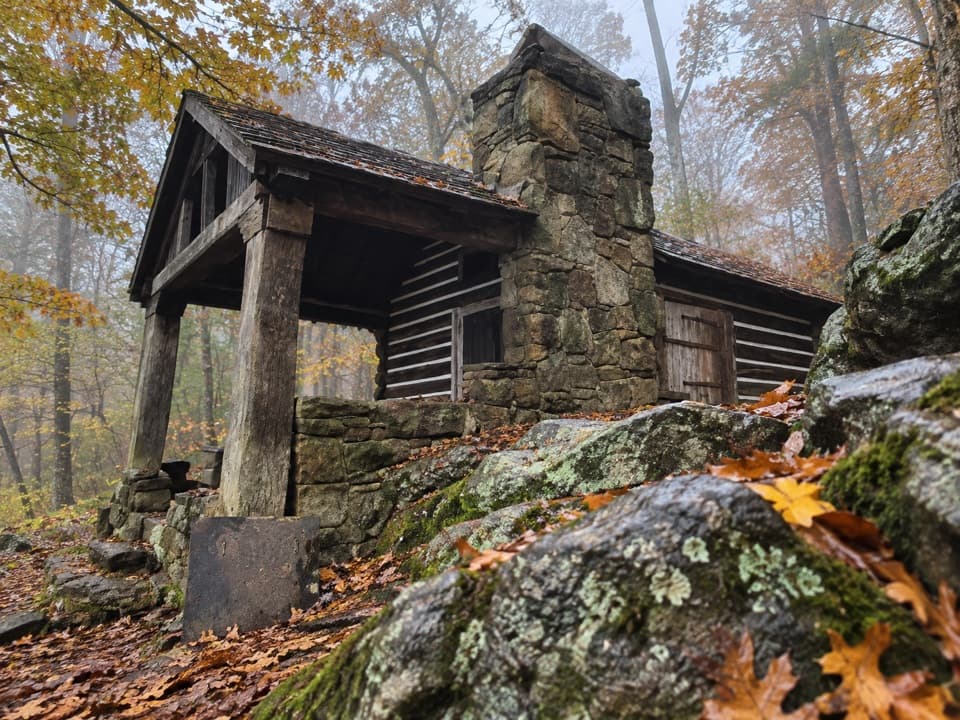
Mill Prong leads to Rapidan Camp, the rustic retreat used by Herbert and Lou Henry Hoover from 1929 to 1933. The historic buildings and stone bridge make a striking pause between the waterfall section and the longer Laurel Prong crossing. Keep the visit on established public paths; camping within half a mile of the camp is prohibited. The camp is a destination along the route, not an overnight site.

Overnight rules, dogs, and logisticsAn overnight backcountry permit is required, and campsites must follow current distance rules.

An overnight backcountry permit is required, and campsites must follow current distance rules. Camping is prohibited on Hawksbill above 3,200 feet as well as within half a mile of Rapidan Camp. The older itinerary’s frontcountry campground instructions may have changed, so confirm current registration, reservation, fees, and site access for Big Meadows and Lewis Mountain before relying on its schedule. Do not assume water along the route is treated or available at a particular stop; plan to carry and treat water. Dogs are allowed on the required trails when leashed to no more than six feet. Leave the optional Bearfence Rock Scramble out of a dog itinerary because pets are not allowed there. This is a point-to-point walk: leave a vehicle at each end or arrange a shuttle, and confirm the current entrance and parking arrangements for both Skyline Drive access points.

Wildlife

Wildlife in Shenandoah

All Shenandoah wildlife maps

Sighting maps show where each species has been reported across Shenandoah. Wildlife moves, so no sighting is guaranteed.

Keep exploring

Near Hawksbill to Swift Run via Laurel Prong

See it all on the map

Trails that start nearby

Places near the trailhead

Parkwolf’s Shenandoah ranking

Top-rated trails in Shenandoah

All 163 trails
  1. 1Old Rag Summit via Berry HollowChallenging · 5.4 mi
  2. 2Hawksbill LoopModerate · 2.9 mi
  3. 3Marys Rock Summit TrailModerate · 3.7 mi
  4. 4Stony Man HikeEasy · 1.6 mi
  5. 5Cedar Run - Whiteoak CircuitChallenging · 8.1 mi
  6. 6Blackrock Summit LoopEasy · 1 mi

Take Parkwolf to Shenandoah.

The audio tour guide for the drive, plus offline maps, trails, and wildlife heatmaps for when the signal drops.

4.7 from 8,600+ ratings

Download Parkwolf on the App StoreGet Parkwolf on Google Play