Parking
Hawksbill Gap Parking Area on Skyline Drive at mile 45.5. Follow the blue-blazed Lower Hawksbill Trail; the separate Hawksbill Gap loop also starts from this lot.
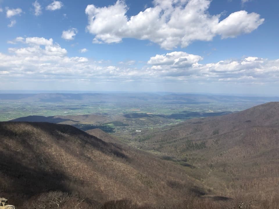
#13 of 163 trails in Shenandoah
Shenandoah National Park, VA
A short, steep climb to Shenandoah's highest summit.
Overview
Hawksbill Summit via Lower Hawksbill is a 1.7-mile out-and-back from Hawksbill Gap Parking Area, following Lower Hawksbill Trail to Byrds Nest 2 and the summit viewing platform, then returning the same way. It climbs 690 feet over roughly 0.85 mile to Shenandoah's highest peak. The reward is a broad panorama across the Shenandoah Valley, the Blue Ridge and the Virginia Piedmont. Choose this route if you want the quickest walk from Skyline Drive to the summit and don't mind repeating the trail on the way down. It is rated moderate, but the grade is steep for such a short hike. Allow about 1½ hours, or closer to two if you want a relaxed stop at the top.
 Parkwolf’s verdictIs the short route for you?
Map & elevation
Plan your hike

The highest, rockiest slopes around here are a summer buffet for grizzly bears.
Shenandoah Tour Guide
Parkwolf is a GPS audio tour guide for Shenandoah National Park. As you drive, it chimes in with what’s ahead: hidden gems, upcoming stops, history, geology, and wildlife, right through your car’s speakers.
See the Shenandoah audio tourRecorded for this trailhead
Hawksbill Gap: The Short, Steep Summit Route“You're approaching Hawksbill Gap, where a steep hike leads to the park's highest summit. For a shorter outing, take Lower Hawksbill: one point seven miles round trip, allowing an hour and a half to two hours.”
Plays as you drive up to this trailhead in the Parkwolf Shenandoah Tour Guide.
More stories near here in the app
“Fantastic app with many points of information… It’s great to just turn on while you’re driving and it gives you an audio tour of the national Park. We love it!!!!”


Trail guide
At the lot, follow the blue blazes for Lower Hawksbill; another trail from the same parking area makes a longer circuit, so check the trail markers before you start. This route begins as a broad, shady dirt-and-gravel path. Within the first tenth of a mile it becomes rockier and steeper. Around the halfway point, a run of stone steps makes the climb feel more like a staircase than a stroll. A little farther up, large flat rocks beside the trail give you a good place to pause before the final push. Most of the ascent stays under trees, so the view arrives at the summit rather than opening gradually.
Near the top, follow the marker toward Byrds Nest 2 and keep right for the shelter and summit. The day-use shelter has a picnic table. A short trail continues from there to the viewing platform; just before it, a flat northwest-facing opening puts a large rock outcrop in front of the valley. The platform is the bigger payoff, with room to turn through the full panorama. On the way down, loose gravel can shift underfoot on the steep grade, so take your time.
Hawksbill's rocky openings are habitat as well as viewpoints. A park survey found moderate-to-severe damage at 40 percent of 50 examined outcrops; thin soils and small plants growing in rock cracks are easily damaged by shortcuts. Keep to the marked trail and platform. The cliffs west of Byrds Nest 2 and the north slope below the platform are closed to visitors, while the marked trail corridor remains open. At the flat overlook before the platform, include the outcrop in your photo to give the valley some scale.
Hawksbill Gap Parking Area is on Skyline Drive at mile 45.5. The park entrance fee applies; no activity fee or reservation is required for the hike. The route is listed as year-round and does not meet ADA accessibility guidelines. Dogs are allowed on a leash no longer than six feet. If you'd rather take a longer, more varied route, the separate Hawksbill Gap loop is about 2.9 miles and starts from the same lot. The Upper Hawksbill out-and-back is another way to the summit, but it starts from a different parking area.
Wildlife
 325 sightingsBlack BearMost seen around 6 AMSighting map
 21 sightingsBald EagleMost seen around 10 AMSighting map
 1,036 sightingsWhite-tailed DeerMost seen around 7 PMSighting map
 167 sightingsWild TurkeyMost seen around 7 AMSighting map
 93 sightingsTimber RattlesnakeMost seen around 6 PMSighting map
 24 sightingsCoyoteMost seen around 6 AMSighting map
Sighting maps show where each species has been reported across Shenandoah. Wildlife moves, so no sighting is guaranteed.
Keep exploring
 EasyHawksbill to Swift Run via Laurel Prong25.6 mi · 4 days · At the trailheadFour days from the highest summit to Swift Run Gap, with waterfalls.
 ModerateHawksbill Loop2.9 mi · 2.5 hr · At the trailheadA rocky 2.9-mile loop to Hawksbill’s 360-degree summit views.
 ChallengingCedar Run - Whiteoak Circuit8.1 mi · 7 hr · At the trailheadSix waterfalls reward a very hard, creekside loop.
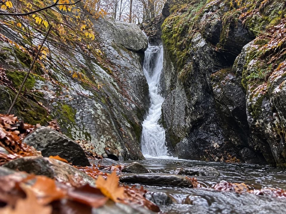 ChallengingCedar Run Falls3.4 mi · 3.5 hr · At the trailheadSteep streamside miles lead to a narrow gorge and natural waterslide.EasyHawksbill Summit via Upper Hawksbill2.1 mi · 1.5 hr · 0.9 mi awayA short climb to Shenandoah’s high point and its stone-walled panorama.
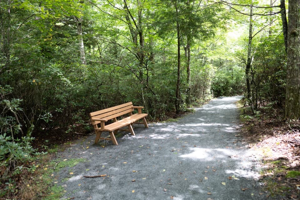 EasyLimberlost Trail1.3 mi · 1.5 hr · 1.7 mi awayAn accessible forest loop with a rare columnar-jointing formation.
 EasyCrescent Rock Overlook via Limberlost3.4 mi · 2 hr · 1.7 mi awayA shady forest climb opens onto a rocky Massanutten view.
 ModerateWhiteoak Falls (Upper)4.6 mi · 3.5 hr · 2.1 mi awayA waterfall overlook with a steep climb back to Skyline Drive.Sight · 0.5 mi awayHawksbill SummitA rocky summit and a full-circle view worth hiking for.
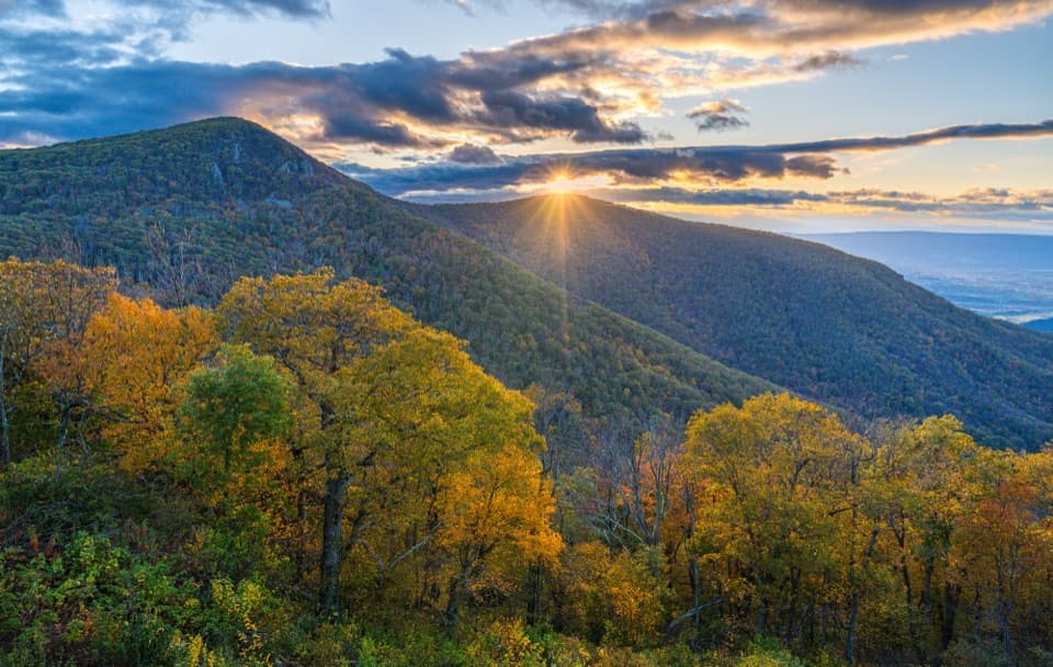 Sight · 0.5 mi awayCrescent Rock OverlookA quick roadside stop for Hawksbill and a rocky west-facing perch.
 Sight · 0.8 mi awayOld Rag View OverlookA three-mile view of Old Rag from Skyline Drive.
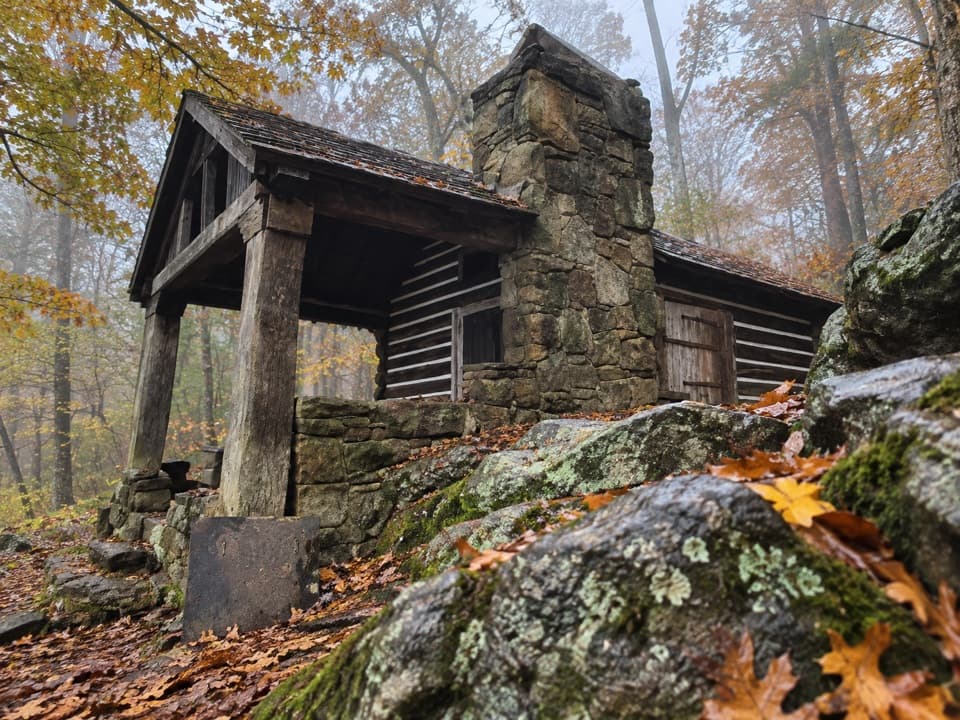 Lodging · 1.2 mi awayRock Spring CabinSpend the night in a 1936 cabin above the Page Valley.
 Scenic pullout · 1.3 mi awayTimber Hollow OverlookA west-facing view with a story from Shenandoah’s creation.
 Sight · 1.3 mi awayUpper Whiteoak FallsA waterfall walk through a bouldery canyon to a rocky viewing ledge.
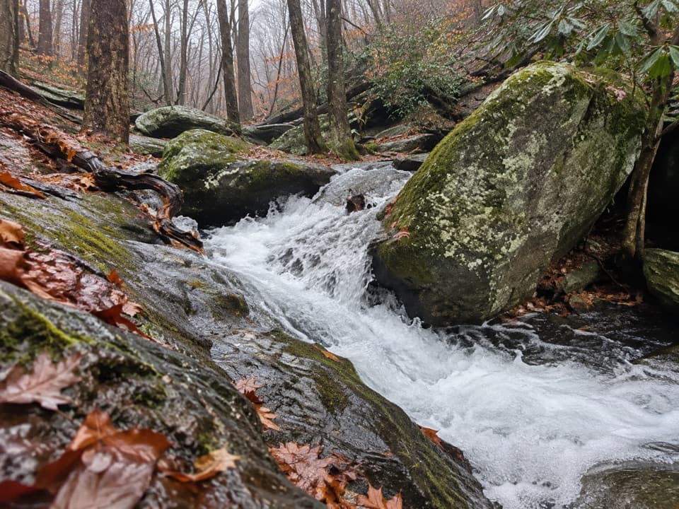 Sight · 1.4 mi awayCedar Run FallsA narrow-gorge waterfall worth a strenuous hike through Cedar Run.
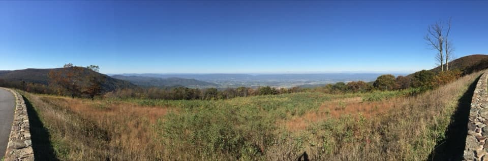 Sight · 1.7 mi awaySpitler Knoll OverlookA broad meadow view over the valley, especially near sunset.
Parkwolf’s Shenandoah ranking
The audio tour guide for the drive, plus offline maps, trails, and wildlife heatmaps for when the signal drops.



