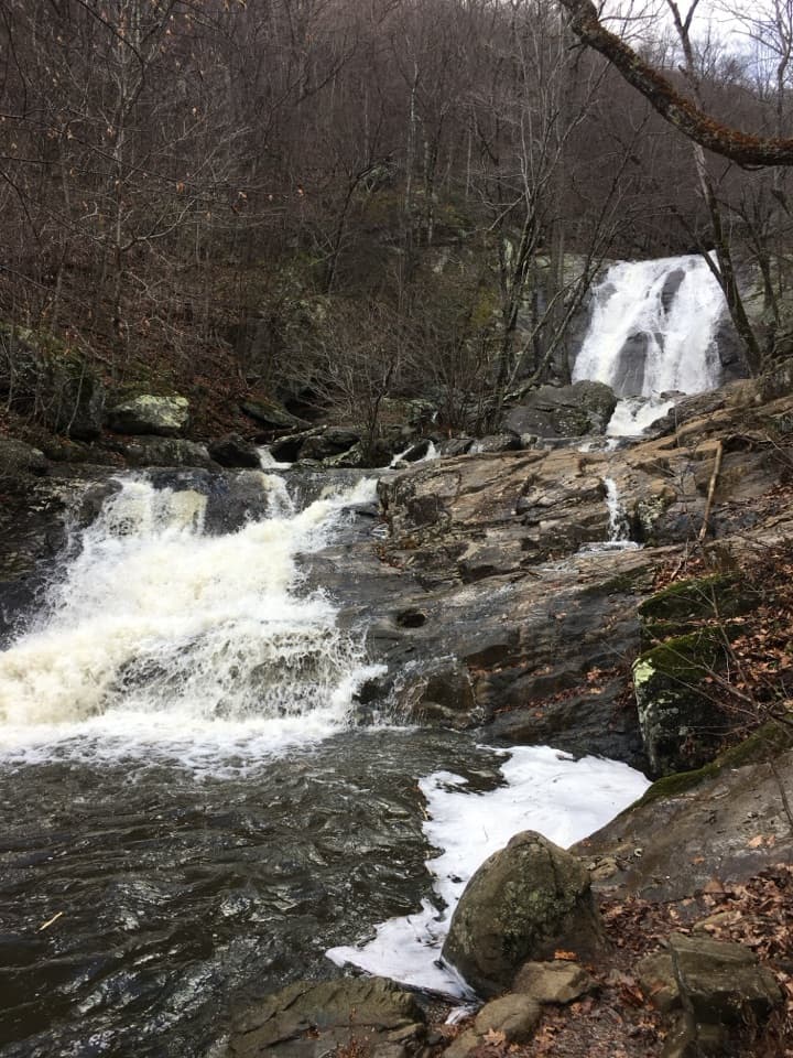
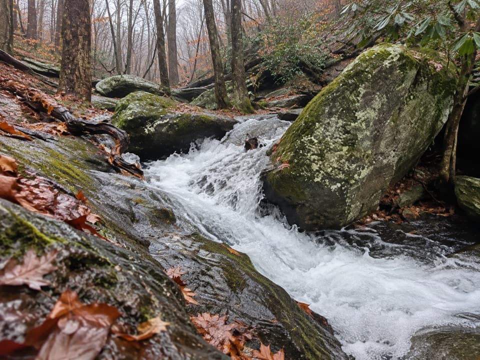
Upper Dark Hollow Trail in Shenandoah National Park

Shenandoah National Park, VA

Upper Dark Hollow Trail

A 4.2-mile out-and-back with a steady 1,000-foot climb.

Length
4.2mi
Time
2.8hr
Elev. change
988ft
Difficulty
Moderate
  • Dogs allowed
  • High point 2,789 ft
Parkwolf audio tour146 stories across Shenandoah’s roads

Overview

About Upper Dark Hollow Trail

Why go

  • A direct connection into the Rapidan trail network
  • A substantial wooded climb on a route open to horses

Heads up

  • About 1,000 feet of climbing in roughly two miles
  • Exact designated parking at the Finks Hollow Lane end is unconfirmed

Map & elevation

The route

Loading the Shenandoah map
Full map
Elevation1,801–2,789 ft
TrailheadFinks Hollow Lane38.49937, -78.37920
Keep this map with you offline in the Parkwolf app

Plan your hike

Before you go

Parking

Finks Hollow Lane is the mapped start, just outside the park. The Rapidan boundary access is from Virginia Route 649, with roadside parking outside a gate, but no dedicated or verified pull-off for this exact trail is identified. Use designated public parking only and verify the legal space before you go.

Safety

The route climbs about 1,000 feet to Rapidan Fire Road. The park warns that longer stretches in this horse-route network can be rough, rocky or narrow and advises against the route in wet or winter conditions; those warnings are not localized to this segment. Cell and GPS service can be unreliable in the Rapidan area.

2 active Shenandoah alerts

  • ClosureOld Rag Trailhead main lot closedThe Old Rag Trailhead main parking lot is closed to vehicles and pedestrians for infrastructure improvements; use the existing overflow lots. - Work is expected to be completed by November 2026.Official details
  • ClosureBackcountry camping and zone closuresBackcountry camping is prohibited on the Appalachian Trail from Lewis Mountain to Big Meadows, and the Naked Creek backcountry zone is closed.Official details
Shenandoah alerts
A park ranger sits on a dash-mounted phone, talking, as Parkwolf’s Tour Guide plays “Army Cutworm Moths: A Grizzly Bear Buffet” on Grand Loop Road below Dunraven Pass in Yellowstone
Parkwolf Tour GuideThe highest, rockiest slopes around here are a summer buffet for grizzly bears.

Shenandoah Tour Guide

Your drive to Upper Dark Hollow Trail, narrated.

Parkwolf is a GPS audio tour guide for Shenandoah National Park. As you drive, it chimes in with what’s ahead: hidden gems, upcoming stops, history, geology, and wildlife, right through your car’s speakers.

See the Shenandoah audio tour

More stories near here in the app

  • Dark Hollow Falls: Down to the Water, Uphill Back
  • Upper Hawksbill: The Gentler Summit Approach
  • Lower Whiteoak Falls: Start at the Boundary
  • Old Rag View Overlook: A Distant Mountain Profile
  • 146 audio storiesacross Shenandoah’s roads, triggered by GPS as you drive
  • Wildlife heatmapsfor Black Bear, Bald Eagle, White-tailed Deer, and 13 more
  • Works offlinemaps, 163 trails, 142 places, and audio download before you lose signal
  • CarPlay readysimple controls built for the drive
★★★★★
“Fantastic app with many points of information… It’s great to just turn on while you’re driving and it gives you an audio tour of the national Park. We love it!!!!”
JMJamesApp Store review
Download Parkwolf on the App StoreGet Parkwolf on Google Play

4.7 from 8,600+ ratings

Trail guide

Hiking Upper Dark Hollow Trail

The routeUpper Dark Hollow is a yellow-blazed trail shared by hikers and horses, running from Finks…

Upper Dark Hollow is a yellow-blazed trail shared by hikers and horses, running from Finks Hollow Lane to Rapidan Fire Road. Walk it as a 4.2-mile out-and-back, retracing the same corridor. The mapped tread is about 2.0 miles one way; an older route map lists 2.2 miles for this segment inside longer horse circuits. This is a through route, not a loop, and it is separate from the Dark Hollow Falls hike.

The trail climbs about 1,000 feet from Finks Hollow Lane to Rapidan Fire Road. Allow 2.5 to 3 hours for the return trip; the uphill is on the way out, with the descent saved for the walk back.

Footing and conditionsThis is a mountain trail, not a smooth nature path.

This is a mountain trail, not a smooth nature path. The surrounding horse-route network is described as a rolling route with long stretches that can be rough, rocky or narrow; those warnings are not pinned to this segment point by point. The park advises against the wider route in wet or winter conditions, so treat slick footing as a reason to turn around.

Start and accessBegin at the Finks Hollow Lane end, just outside the park boundary.

Begin at the Finks Hollow Lane end, just outside the park boundary. The Rapidan area has roadside access from Virginia Route 649, but the exact designated pull-off for this trail is not confirmed. Use designated public parking only and verify the legal place to leave your car before starting; don't block a gate or private drive. Pets are allowed here on a leash no longer than six feet. Cell and GPS service can be unreliable in the Rapidan area.

Wildlife

Wildlife in Shenandoah

All Shenandoah wildlife maps

Sighting maps show where each species has been reported across Shenandoah. Wildlife moves, so no sighting is guaranteed.

Keep exploring

Near Upper Dark Hollow Trail

See it all on the map

Trails that start nearby

Places near the trailhead

Parkwolf’s Shenandoah ranking

Top-rated trails in Shenandoah

All 163 trails
  1. 1Old Rag Summit via Berry HollowChallenging · 5.4 mi
  2. 2Hawksbill LoopModerate · 2.9 mi
  3. 3Marys Rock Summit TrailModerate · 3.7 mi
  4. 4Stony Man HikeEasy · 1.6 mi
  5. 5Cedar Run - Whiteoak CircuitChallenging · 8.1 mi
  6. 6Blackrock Summit LoopEasy · 1 mi

Take Parkwolf to Shenandoah.

The audio tour guide for the drive, plus offline maps, trails, and wildlife heatmaps for when the signal drops.

4.7 from 8,600+ ratings

Download Parkwolf on the App StoreGet Parkwolf on Google Play