Overview
About Uluṟu
Why stop
- The full circuit gives you changing views of one enormous landform.
- Mala Walk reaches caves, rock art and Kaṉtju Gorge without the full loop.
Heads up
- The long base circuit has exposed sections, and summer heat can close tracks.
Map
Where it is

The highest, rockiest slopes around here are a summer buffet for grizzly bears.
Uluru-Kata Tjuta Tour Guide
Your drive to Uluṟu, narrated.
Parkwolf is a GPS audio tour guide for Uluru-Kata Tjuta National Park. As you drive, it chimes in with what’s ahead: hidden gems, upcoming stops, history, geology, and wildlife, right through your car’s speakers.
See the Uluru-Kata Tjuta audio tourRecorded for this place
Uluṟu: Mala Walk and Kaṉtju Gorge“You're approaching Mala carpark at the base of Uluṟu. For a close look without spending the whole morning walking, I'd choose the Mala Walk to Kaṉtju Gorge: two kilometres return, allowing about ninety minutes.”
Plays as you drive up to Uluṟu in the Parkwolf Uluru-Kata Tjuta Tour Guide.
More stories near here in the app
- A Finch Nest Built by Two
- An Emu Dad on Duty
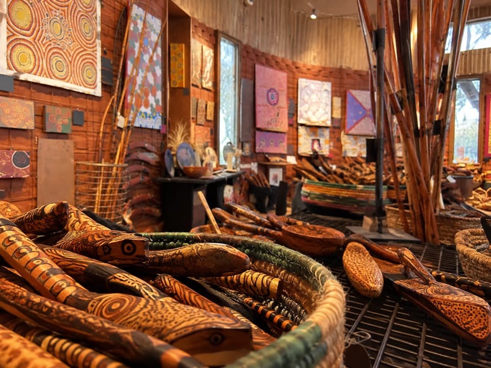
- Cultural Centre: Stories, Art and a Café
- Uluṟu Car Sunset Viewing Area
- 40 audio storiesacross Uluru-Kata Tjuta’s roads, triggered by GPS as you drive
- Wildlife heatmapsfor Dromedary Camel, Black-breasted Kite, Brown Falcon, and 13 more
- Works offlinemaps, 15 trails, 28 places, and audio download before you lose signal
- CarPlay readysimple controls built for the drive
“Fantastic app with many points of information… It’s great to just turn on while you’re driving and it gives you an audio tour of the national Park. We love it!!!!”


Guide
More about Uluṟu
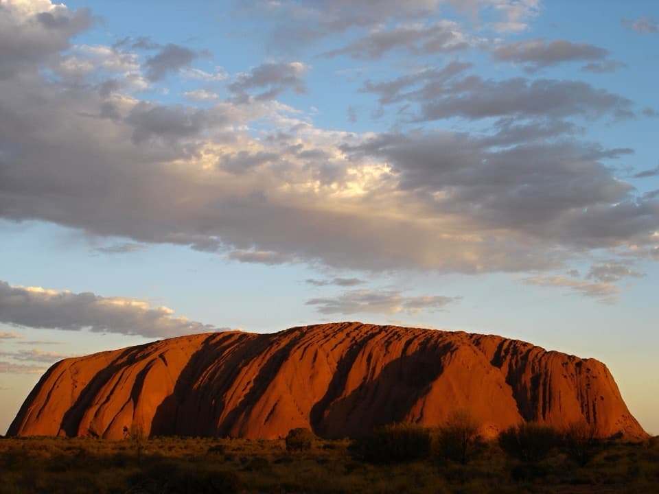
Meet the monolithUluṟu is a 348-metre sandstone monolith rising from the red plains of Central Australia.
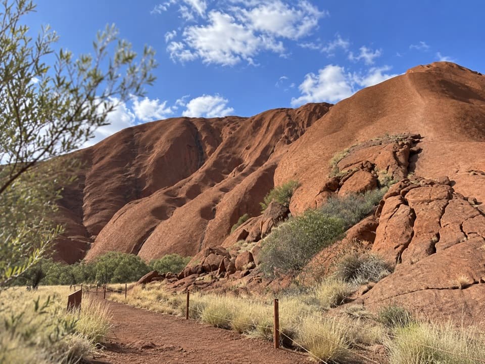
Uluṟu is a 348-metre sandstone monolith rising from the red plains of Central Australia. It is about 9.4 kilometres around, so it is a place to spend time with, not a summit to bag. Climbing has been permanently closed since 2019; explore the rock from its base walks and designated viewing areas. If the weather is manageable, allow about three and a half hours for the full circuit.
Walk a section or do the circuitThe Uluṟu base walk is a 10.6-kilometre loop, graded 3.
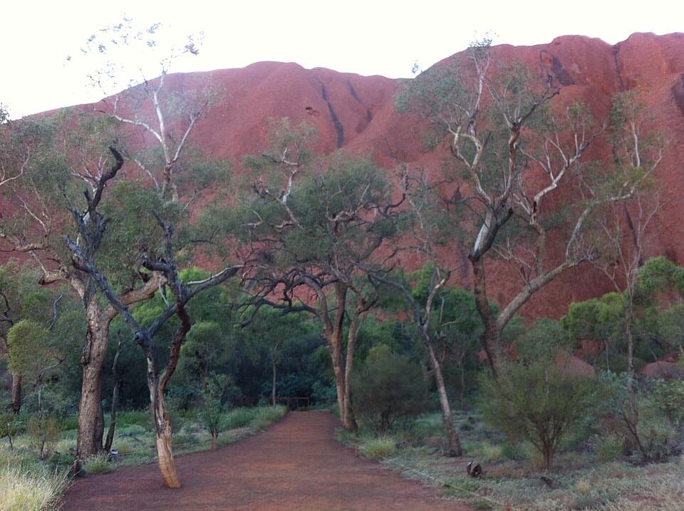
The Uluṟu base walk is a 10.6-kilometre loop, graded 3. Start at Mala Carpark early and, facing the rock, go clockwise. You can also choose a section instead of committing to the whole route. The surroundings change as you go: some stretches are green and sheltered, others feel open and have little shade.
Take the Mala Walk to Kaṉtju GorgeFor a shorter visit, the Mala Walk is a good first choice: 2 kilometres return and about an…
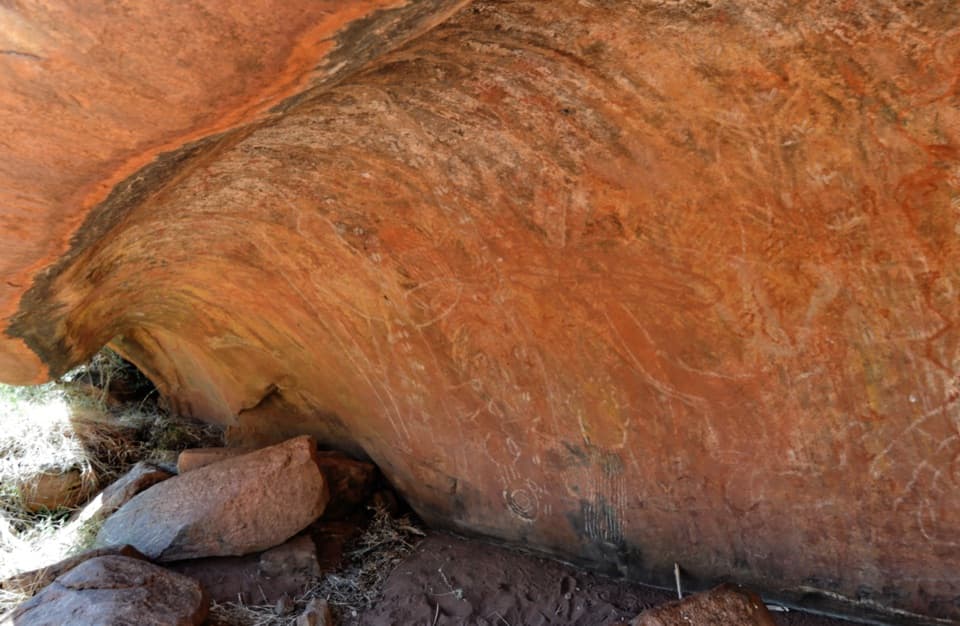
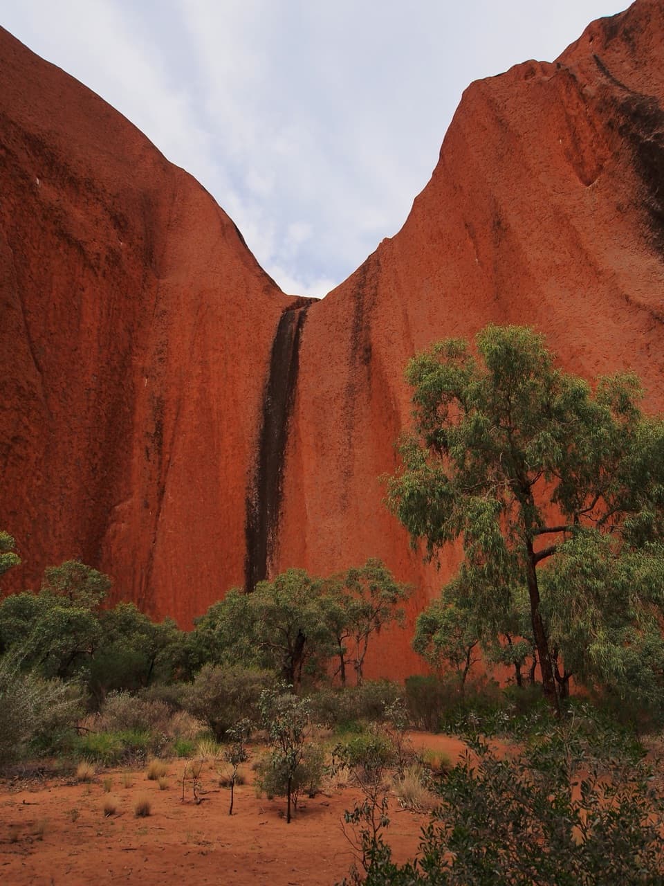
For a shorter visit, the Mala Walk is a good first choice: 2 kilometres return and about an hour and a half. It follows the path from Mala Carpark to Kaṉtju Gorge, past caves where the Mala people camped and prepared food, along with rock art. The gorge has benches beside a waterhole, and water and toilets are listed for the walk.
Read the place with respectFor Aṉangu, Uluṟu is inseparable from Tjukurpa, the traditional law and culture.
For Aṉangu, Uluṟu is inseparable from Tjukurpa, the traditional law and culture. Creation-ancestor stories remain visible in the landscape, and caves along the walk hold rock art. Stay on marked paths and follow restricted-area signs; do not climb onto the rock or boulders. The climb closed permanently in 2019, reflecting Aṉangu's long-standing wishes.
The landscape around the rockThe base route passes acacia woodland and grassed claypans, with bloodwoods, native grasses,…
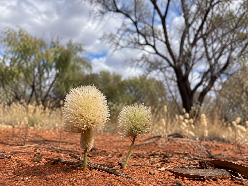
The base route passes acacia woodland and grassed claypans, with bloodwoods, native grasses, waterways and waterholes. It is a more varied walk than the single great wall you see from a distance: some sections feel surprisingly green, while others open onto exposed country. The sandstone itself is about half a billion years old.
Choose a wide viewThe designated car and bus sunset viewing areas and Talinguṟu Nyakunytjaku are the places for a…
The designated car and bus sunset viewing areas and Talinguṟu Nyakunytjaku are the places for a wide view of the whole monolith. Sunrise and sunset light bring out changes in its colour. Photography is restricted in marked cultural areas; for the north-east face, the park asks for wide shots from a distance and asks visitors to leave the details on its upper-left side out of frame.
Plan around the heatSome parts of the base route have little shade, and hot summer afternoons can bring track…
Some parts of the base route have little shade, and hot summer afternoons can bring track closures. On hot days, walk in the cool morning and finish before 11 a.m.; check the current route status before setting out. The full loop is a real commitment in exposed conditions, so a single section can be the better call when it is very hot.
Wildlife
Wildlife in Uluru-Kata Tjuta
 32 sightingsDromedary CamelMost seen around 6 PMSighting map
 14 sightingsBlack-breasted KiteMost seen around 10 AMSighting map
 27 sightingsBrown FalconMost seen around 7 AMSighting map
 11 sightingsWestern Brown SnakeMost seen around 9 AMSighting map
 32 sightingsMain's FrogMost seen around 7 PMSighting map
 17 sightingsRed-backed KingfisherMost seen around 7 AMSighting map
Sighting maps show where each species has been reported across Uluru-Kata Tjuta. Wildlife moves, so no sighting is guaranteed.