Cinnamon Bay Beach in Virgin Islands National Park

#4 of 38 sights in Virgin Islands

Beach · Virgin Islands National Park

Cinnamon Bay Beach

A long north-shore beach with clear water and archaeology beneath it.

Photo: CC BY-SA 2.0
Type
Beach
Nearest trail
0.2 mi
Audio stories
15 nearby
  • Parking
  • Restrooms

Hear the audio tour

Cinnamon Bay Beach and Nature Loop

Overview

About Cinnamon Bay Beach

Why stop

  • Clear shallows and a distinctive underwater heritage story

Heads up

  • Limited parking; snorkeling conditions and sightings vary

Map

Where it is

Loading the Virgin Islands map
Full map
BeachCinnamon Bay Beach18.35552, -64.75317
Keep this map with you offline in the Parkwolf app

Plan your stop

Before you go

1 active Virgin Islands alert

  • ClosureCaneel Bay restricted areas and closed pierAt Caneel Bay, use only designated public areas; other areas and the pier remain closed. - Areas beyond the public areas remain closed because of present safety risks.Official details
Virgin Islands alerts
A park ranger sits on a dash-mounted phone, talking, as Parkwolf’s Tour Guide plays “Army Cutworm Moths: A Grizzly Bear Buffet” on Grand Loop Road below Dunraven Pass in Yellowstone
Parkwolf Tour GuideThe highest, rockiest slopes around here are a summer buffet for grizzly bears.

Virgin Islands Tour Guide

Your drive to Cinnamon Bay Beach, narrated.

Parkwolf is a GPS audio tour guide for Virgin Islands National Park. As you drive, it chimes in with what’s ahead: hidden gems, upcoming stops, history, geology, and wildlife, right through your car’s speakers.

Recorded for this place

Cinnamon Bay Beach and Nature Loop
0:00 / 0:32
“Up ahead is the entrance to Cinnamon Bay, where a long stretch of pale sand makes it easy to settle in for a swim and a shore walk. You don't need a campground reservation to visit the beach.”

Plays as you drive up to Cinnamon Bay Beach in the Parkwolf Virgin Islands Tour Guide.

More stories near here in the app

  • Maho Bay Overlook
  • Maho Bay and Crossroads
  • Reef Bay Trailhead and Petroglyphs
  • L'Esperance Trail to Reef Bay
  • 26 audio storiesacross Virgin Islands’s roads, triggered by GPS as you drive
  • Wildlife heatmapsfor White-tailed Deer, Green Iguana, Brown Pelican, and 13 more
  • Works offlinemaps, 22 trails, 42 places, and audio download before you lose signal
  • CarPlay readysimple controls built for the drive
★★★★★
“Fantastic app with many points of information… It’s great to just turn on while you’re driving and it gives you an audio tour of the national Park. We love it!!!!”
JMJamesApp Store review
Download Parkwolf on the App StoreGet Parkwolf on Google Play

4.7 from 8,600+ ratings

Guide

More about Cinnamon Bay Beach

Make a day of itCinnamon Bay is one of Virgin Islands National Park’s longest beaches, a long stretch of pale…

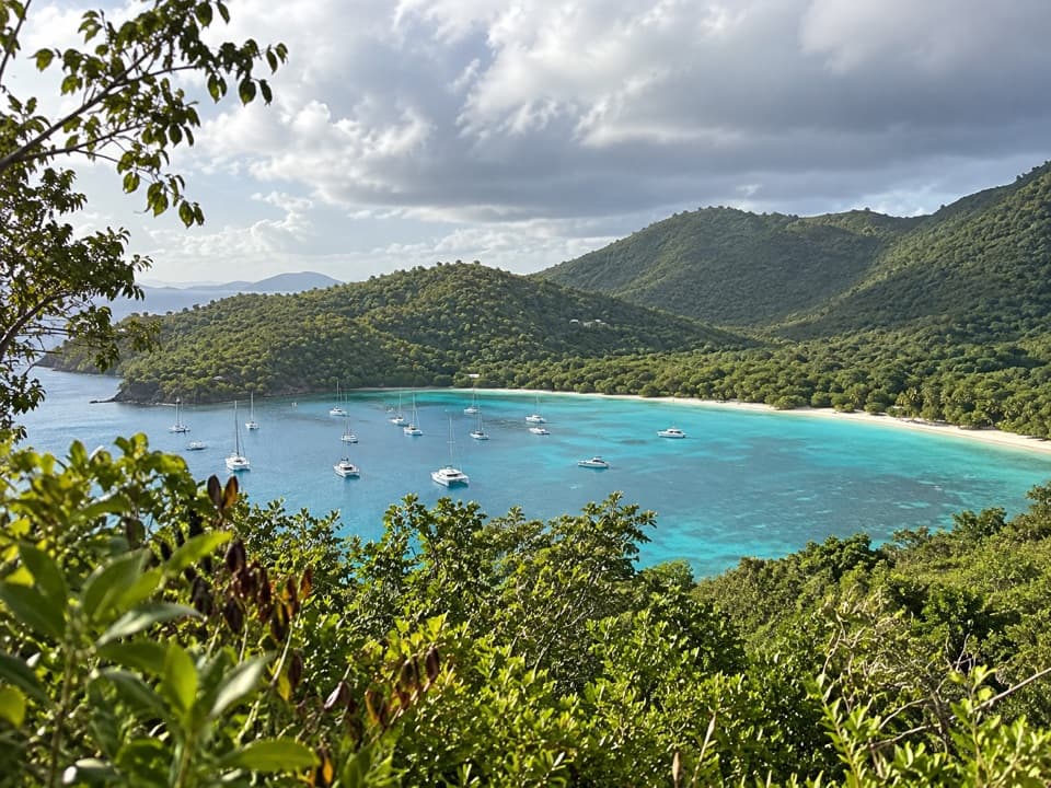
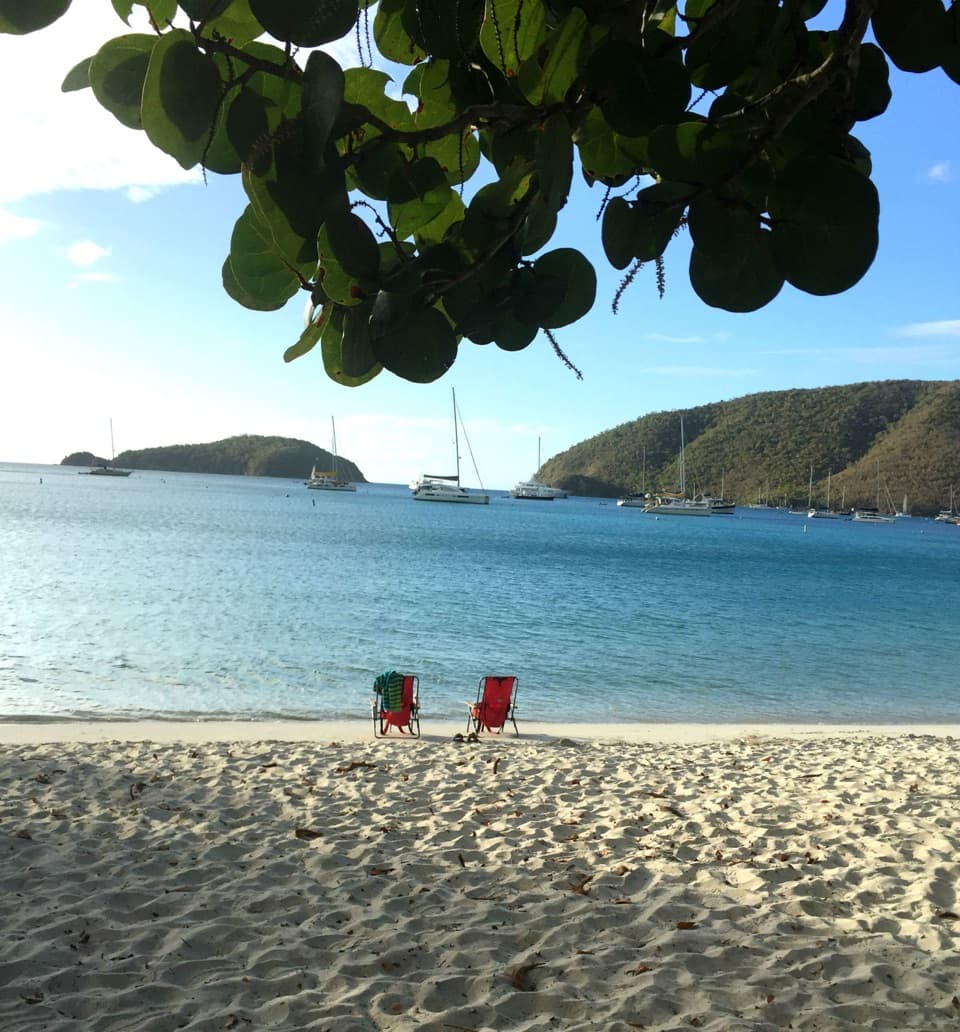
Cinnamon Bay is one of Virgin Islands National Park’s longest beaches, a long stretch of pale sand on St. John’s north shore with clear water, a small cay offshore and patches of shade from lush vegetation. It works as more than a quick photo stop: swim, walk the shore or give the shallows time for a snorkel. The beach is about 4.3 miles from Cruz Bay along North Shore Road, and you can also arrive by boat. Parking in the park is limited, so come early or take a taxi if you’re arriving later. You don’t need a campground reservation to visit the beach.

Look below the surfaceNear Cinnamon Cay, the water hides more than fish.

Near Cinnamon Cay, the water hides more than fish. There’s an underwater fish pen thought to have been made by Taíno people or their ancestors, a submerged historic village and a plane that sank in the 1940s. Those are snorkel finds, not things you can see from the sand; bring a mask if you want to look for them. The Heritage Center and Archaeology Lab nearby have clues for finding the sites. Fish and turtles are sometimes seen, but they’re never guaranteed.

The beach and the ruinsTaíno people settled around Cinnamon Bay long before Danish colonial enslavers established a…

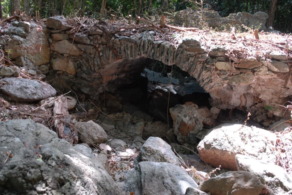
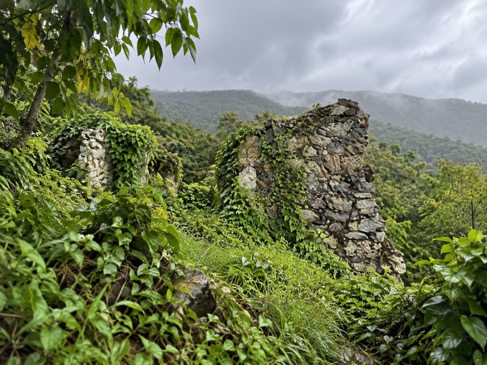
Taíno people settled around Cinnamon Bay long before Danish colonial enslavers established a sugar plantation here and forced enslaved Africans to work it. A nearby half-mile nature loop passes the plantation ruins and interpretive signs, making an easy dry-land follow-up to a swim. The ruins are a separate historic stop from the beach itself.

Walk the shoreAt one end, the long sand gives way to jagged volcanic rocks at America Point.

At one end, the long sand gives way to jagged volcanic rocks at America Point. Dark rock against white sand is the bay’s best natural contrast, with Cinnamon Cay just offshore. For a photo, keep a rock at the edge of the sand in the foreground and the cay beyond it; that shows more of the bay than a tight shot of the water.

Know the last stretchThere’s a paved path from the parking area toward the Heritage Center, then a sandy path down…

There’s a paved path from the parking area toward the Heritage Center, then a sandy path down to the beach. That final section isn’t a firm paved route, so plan for sand if you need a continuous smooth surface. Parking and restrooms serve the beach area. Dogs aren’t allowed on this activity.

Keep snorkeling in perspectiveThe clear shallows make it an inviting place to snorkel, but what you see and how the reef…

The clear shallows make it an inviting place to snorkel, but what you see and how the reef looks can vary. Treat the underwater archaeology and wildlife as a bonus, not a promise; the long beach, history and shoreline walk still make a good visit if snorkeling doesn’t deliver.

Wildlife

Wildlife in Virgin Islands

All Virgin Islands wildlife maps

Sighting maps show where each species has been reported across Virgin Islands. Wildlife moves, so no sighting is guaranteed.

Keep exploring

Near Cinnamon Bay Beach

See it all on the map

Trails nearby

More stops nearby

Parkwolf’s Virgin Islands ranking

Top sights in Virgin Islands

All 42 places
  1. 1Trunk Bay BeachBeach
  2. 2Maho Bay BeachBeach
  3. 3Annaberg Sugar PlantationSight
  4. 5Waterlemon CaySight
  5. 6Reef Bay PetroglyphsSight
  6. 7Trunk Bay OverlookSight

Take Parkwolf to Virgin Islands.

The audio tour guide for the drive, plus offline maps, trails, and wildlife heatmaps for when the signal drops.

4.7 from 8,600+ ratings

Download Parkwolf on the App StoreGet Parkwolf on Google Play