Edelweißlahnerkopf in Berchtesgaden National Park

Berchtesgaden National Park, BY

Edelweißlahnerkopf

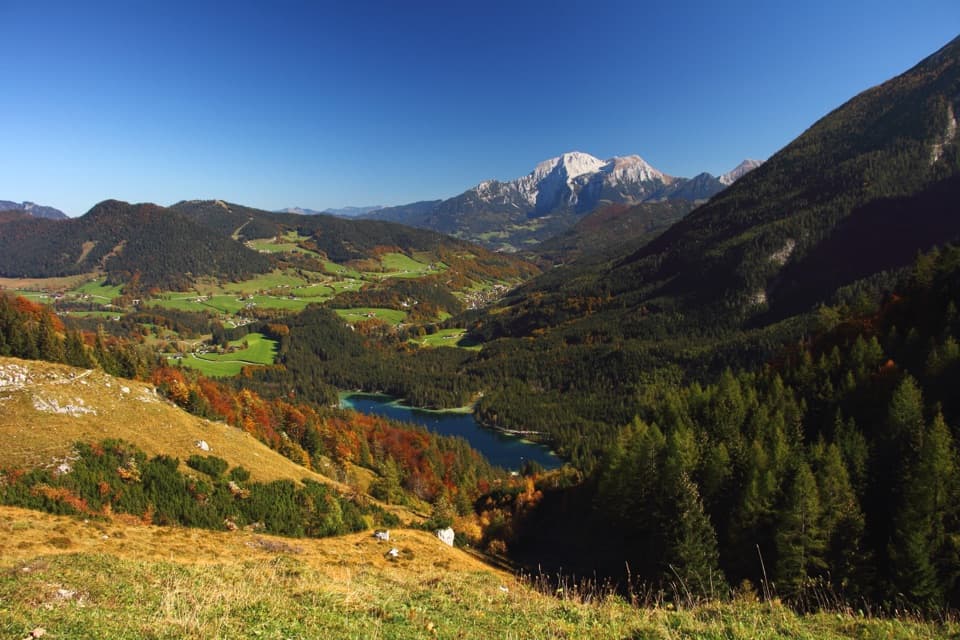
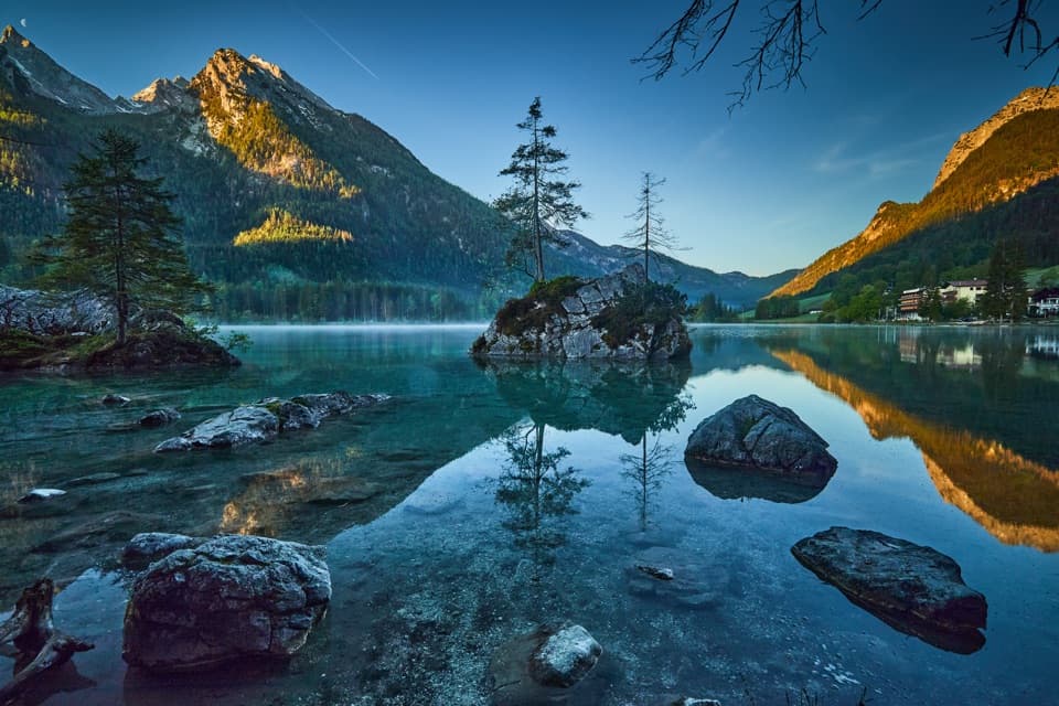
Look down to Hintersee, with Watzmann and Hochkalter beyond

Photo: Wikimedia Commons
Length
7.5km
Time
4.5hr
Elev. change
387m
Difficulty
Moderate
  • Dogs allowed
  • High point 1,953 m
Parkwolf audio tour25 stories across Berchtesgaden’s roads

Overview

About Edelweißlahnerkopf

Why go

  • Wide views down toward Hintersee, with Watzmann and Hochkalter close by.
  • A marked direct summit outing avoids the separate multi-peak ridge circuit.

Heads up

  • Reaching the hut takes a separate 3½–4-hour climb from the valley.
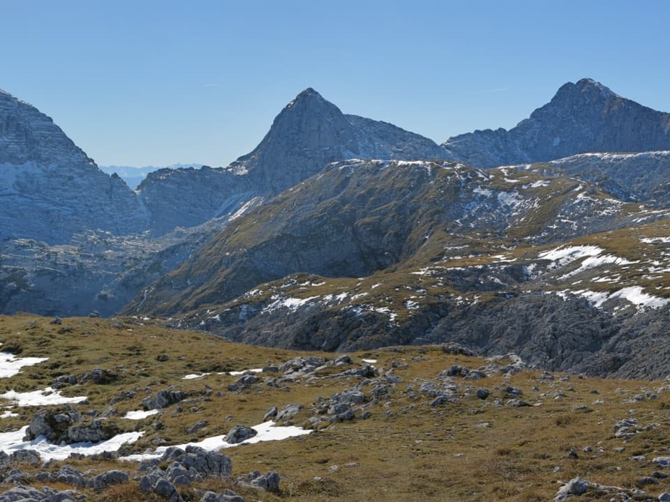
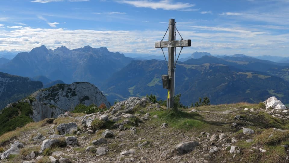
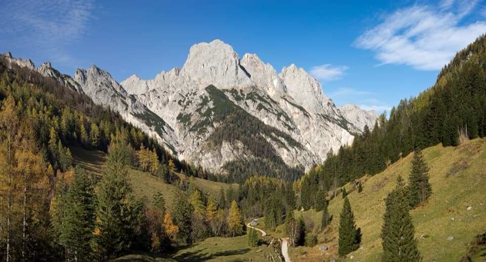
The top looks steeply down toward Hintersee, with Watzmann and Hochkalter close in the panorama. The hut describes the walk as long and partly quiet; allow time to take in the view rather than treating the summit as a quick turn-around. Good visibility matters here, and the hut says good orientation helps.
Parkwolf’s verdictThe view is the payoff

Map & elevation

The route

Loading the Berchtesgaden map
Full map
Elevation1,566–1,953 m
TrailheadNeue Traunsteiner Hütte47.62815, 12.80094
Keep this map with you offline in the Parkwolf app

Plan your hike

Before you go

Parking

For the Schrecksattel approach, park at the Wanderstartplatz beside the Bundeswehr Seilbahntalstation in Unterjettenberg; allow 3½–4 hours uphill to the hut. The summit trail starts there, at Neue Traunsteiner Hütte. No road or public cable car reaches the hut.

Safety

This is a remote, high-alpine route. The hut recommends good visibility and says a good sense of orientation is useful. Dogs must be leashed on the national-park portion.

3 active Berchtesgaden alerts

  • ClosureKlausbachtal trails closed for bridge and flood-protection workAvoid the closed Klausbachtal trail sections; the Klausbach cannot be crossed at the affected bridges. - Trail No.Official details
  • ClosureKönigsbach Waterfall Gumpen area closedDo not enter the area around the “Gumpen” pools at the Königsbach Waterfall on Königssee.Official details
See all 3 alerts
A park ranger sits on a dash-mounted phone, talking, as Parkwolf’s Tour Guide plays “Army Cutworm Moths: A Grizzly Bear Buffet” on Grand Loop Road below Dunraven Pass in Yellowstone
Parkwolf Tour GuideThe highest, rockiest slopes around here are a summer buffet for grizzly bears.

Berchtesgaden Tour Guide

Your drive to Edelweißlahnerkopf, narrated.

Parkwolf is a GPS audio tour guide for Berchtesgaden National Park. As you drive, it chimes in with what’s ahead: hidden gems, upcoming stops, history, geology, and wildlife, right through your car’s speakers.

More stories near here in the app

  • White Fur, Black Ear Tips
  • Klausbachhaus and Golden Eagle Country
  • Hintersee and the Boulder Forest
  • Seeklause: The Climb to Blaueishütte
  • 25 audio storiesacross Berchtesgaden’s roads, triggered by GPS as you drive
  • Wildlife heatmapsfor Bearded Vulture, Golden Eagle, Red Deer, and 13 more
  • Works offlinemaps, 71 trails, 57 places, and audio download before you lose signal
  • CarPlay readysimple controls built for the drive
★★★★★
“Fantastic app with many points of information… It’s great to just turn on while you’re driving and it gives you an audio tour of the national Park. We love it!!!!”
JMJamesApp Store review
Download Parkwolf on the App StoreGet Parkwolf on Google Play

4.7 from 8,600+ ratings

Trail guide

Hiking Edelweißlahnerkopf

A hut-to-summit out-and-backEdelweißlahnerkopf is a 4.

Edelweißlahnerkopf is a 4.65-mile out-and-back from Neue Traunsteiner Hütte to the 1,953 m summit. Follow marked Weg 474 southeast to a saddle, turn left for the final climb, then return the same way. The mapped uphill corridor is 2.33 miles; the listed distance counts the walk back. The summit rises about 390 m above the hut.

The hut’s route page lists 2½ hours but does not say whether that includes the return. Allow about 4–5 hours for the full walk with time at the top. The direct route is graded easy by the hut, but it is still a remote, high-alpine outing.

Keep to the direct summit routeThis is the straightforward hut-to-Edelweißlahnerkopf trip, not the longer ridge circuit over…

This is the straightforward hut-to-Edelweißlahnerkopf trip, not the longer ridge circuit over Schottmalhorn and Prünzlkopf. The marked route reaches the saddle before turning left toward the summit; descend the same way. Do not follow the ridge-loop line if you want this shorter outing.

Reach the hut firstThe summit walk starts at Neue Traunsteiner Hütte on the Reiter Alm, not at a valley parking…

The summit walk starts at Neue Traunsteiner Hütte on the Reiter Alm, not at a valley parking lot. No road reaches the hut, and the cable car is reserved for the military. One established approach starts at the Wanderstartplatz beside the Bundeswehr Seilbahntalstation in Unterjettenberg and climbs via Schrecksattel for 3½–4 hours; count that as a separate leg or stay at the hut. Dining rooms and overnight rooms are at the hut, not along the summit path. Dogs may accompany hikers in the park but must stay leashed.

Wildlife

Wildlife in Berchtesgaden

All Berchtesgaden wildlife maps

Sighting maps show where each species has been reported across Berchtesgaden. Wildlife moves, so no sighting is guaranteed.

Keep exploring

Near Edelweißlahnerkopf

See it all on the map

Trails that start nearby

Places near the trailhead

Parkwolf’s Berchtesgaden ranking

Top-rated trails in Berchtesgaden

All 71 trails
  1. 1Kleine ReibnChallenging · 18.7 km
  2. 2Obersee – Fischunkelalm – RöthbachfallModerate · 8 km
  3. 3Malerwinkel-RundwegEasy · 3.4 km
  4. 4Wimbachklamm-RundwegModerate · 2.1 km
  5. 5Blaueishütte via SchärtenalmChallenging · 10.5 km
  6. 6Gotzenalm via Hochbahn TrailChallenging · 22.8 km

Take Parkwolf to Berchtesgaden.

The audio tour guide for the drive, plus offline maps, trails, and wildlife heatmaps for when the signal drops.

4.7 from 8,600+ ratings

Download Parkwolf on the App StoreGet Parkwolf on Google Play