Rund um den Watzmann via Trischübel in Berchtesgaden National Park

Berchtesgaden National Park, BY

Rund um den Watzmann via Trischübel

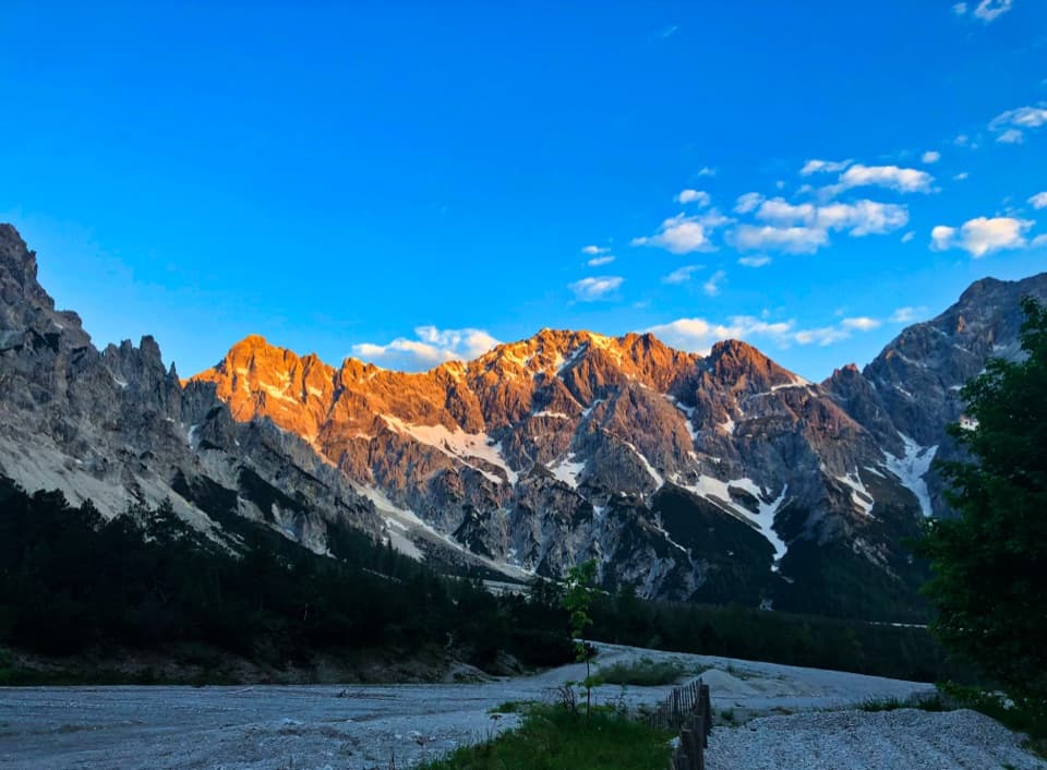
A 20 km crossing from a scree valley to Königssee.

Photo: Wikimedia Commons
Length
19.9km
Time
10hr
Elev. change
1,142m
Difficulty
Challenging
  • Dogs allowed
  • High point 1,744 m
  • #19 of 71 in Berchtesgaden

Hear the audio tour

Wimbachbrücke and the Waterfall Gorge

Overview

About Rund um den Watzmann via Trischübel

Why go

  • The huge Wimbachgries sits between the Watzmann and Hochkalter walls.
  • A true mountain crossing ends at Königssee instead of retracing the approach.

Heads up

  • Ten hours on foot and more than 1,300 m of climbing make this a full-day commitment.
  • The secured climb and exposed Sigeretsteig descent demand very sure footing; the last boat controls the exit.

Map & elevation

The route

Loading the Berchtesgaden map
Full map
Elevation602–1,744 m
TrailheadWimbachbrücke parking area47.60244, 12.92423
Keep this map with you offline in the Parkwolf app

Plan your hike

Before you go

Parking

Start at the Wimbachbrücke parking area beside the National Park information point; a bus stop serves the same access. The route ends at St. Bartholomä, where you need the Königssee boat to leave the lakeshore, so check the timetable before setting out.


Safety

The approach to Trischübel includes an exposed steep pitch with about 25 m of steel cable and ten footholds. The Sigeretsteig descent is steep and exposed and demands very sure footing. Dogs must be leashed in the park, but the secured high-alpine sections are not suitable for them. Missing the last boat at St. Bartholomä leaves the demanding Rinnkendlsteig as the walking route out.

3 active Berchtesgaden alerts

  • ClosureKlausbachtal trails closed for bridge and flood-protection workAvoid the closed Klausbachtal trail sections; the Klausbach cannot be crossed at the affected bridges. - Trail No.Official details
  • ClosureKönigsbach Waterfall Gumpen area closedDo not enter the area around the “Gumpen” pools at the Königsbach Waterfall on Königssee.Official details
See all 3 alerts
A park ranger sits on a dash-mounted phone, talking, as Parkwolf’s Tour Guide plays “Army Cutworm Moths: A Grizzly Bear Buffet” on Grand Loop Road below Dunraven Pass in Yellowstone
Parkwolf Tour GuideThe highest, rockiest slopes around here are a summer buffet for grizzly bears.

Berchtesgaden Tour Guide

Your drive to Rund um den Watzmann via Trischübel, narrated.

Parkwolf is a GPS audio tour guide for Berchtesgaden National Park. As you drive, it chimes in with what’s ahead: hidden gems, upcoming stops, history, geology, and wildlife, right through your car’s speakers.

Recorded for this area

Wimbachbrücke and the Waterfall Gorge
0:00 / 0:38
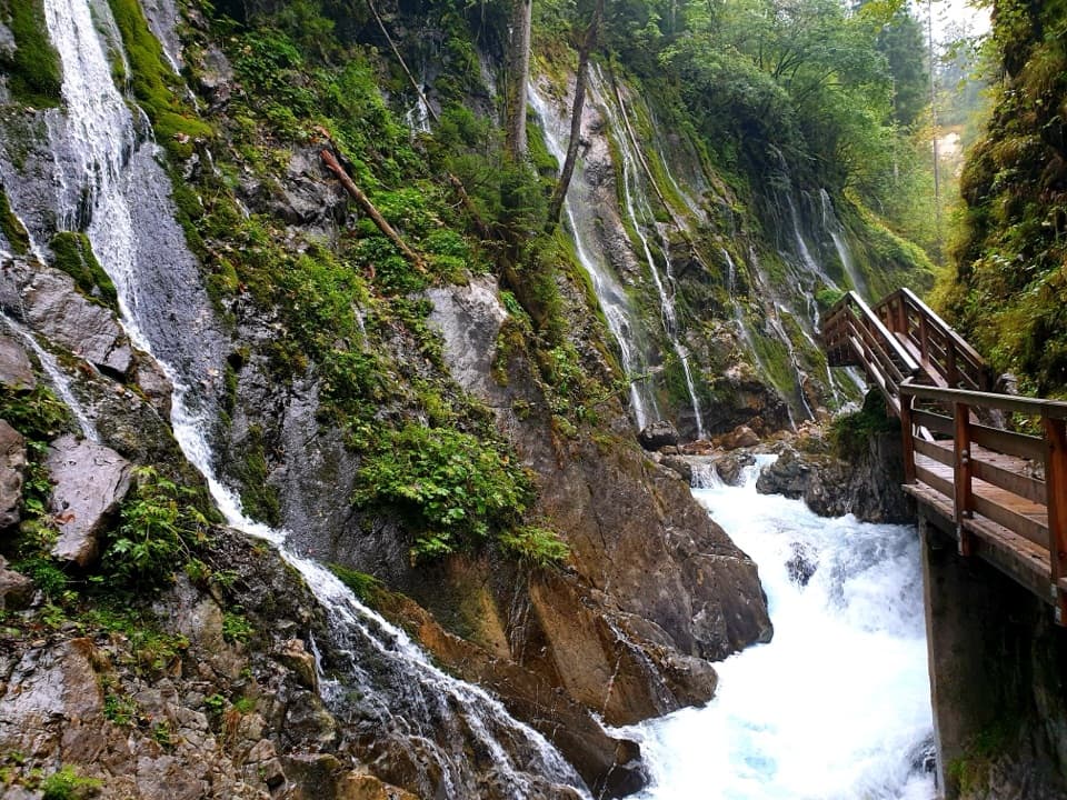
“Wimbachbrücke is coming up, the starting point for Wimbachklamm's waterfall gorge. Allow about an hour for the outing, including the uphill approach and return.”

Plays on the road 0.1 km from the trailhead in the Parkwolf Berchtesgaden Tour Guide.

More stories near here in the app

  • A Marmot’s Winter Fuel
  • Ramsau: A Full Day on Schattseitweg
  • Hammerstiel: Grünstein and a Hut Meal
  • How Trees Hold the Snow
  • 25 audio storiesacross Berchtesgaden’s roads, triggered by GPS as you drive
  • Wildlife heatmapsfor Bearded Vulture, Golden Eagle, Red Deer, and 13 more
  • Works offlinemaps, 71 trails, 57 places, and audio download before you lose signal
  • CarPlay readysimple controls built for the drive
★★★★★
“Fantastic app with many points of information… It’s great to just turn on while you’re driving and it gives you an audio tour of the national Park. We love it!!!!”
JMJamesApp Store review
Download Parkwolf on the App StoreGet Parkwolf on Google Play

4.7 from 8,600+ ratings

Trail guide

Hiking Rund um den Watzmann via Trischübel

A full day across the Watzmann“Rund um den Watzmann” here is a 19.9 km (12.

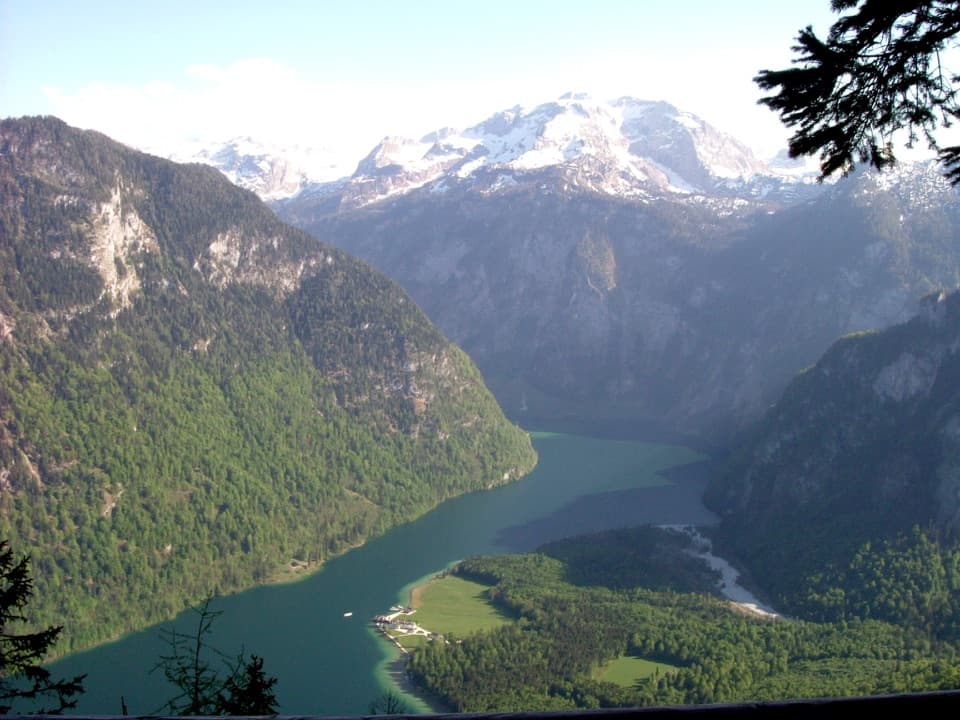
“Rund um den Watzmann” here is a 19.9 km (12.4 mi) point-to-point crossing, not the multi-day circuit around the massif. From Wimbachbrücke it follows the Wimbachgries, crosses Trischübel and drops on the Sigeretsteig to St. Bartholomä. Allow about 10 hours on foot, with roughly 1,302 m of climbing and 1,332 m of descent. The valley approach is long and mostly steady; the pass and the exposed descent demand mountain-hiking experience and very sure footing. Choose it for a full day of changing terrain and a lake finish, not as an easy way to see Königssee.

Plan the finish before setting outStart at the Wimbachbrücke parking area or bus stop.

Start at the Wimbachbrücke parking area or bus stop. This is a true point-to-point hike: there’s no road from St. Bartholomä, so the Königssee boat is the planned exit and is separate from the walking distance. Check the timetable before you start and allow enough time for the descent; miss the final boat and the difficult Rinnkendlsteig is the walking route out. At the first valley fork, the paid Wimbachklamm gorge and the steeper path above it rejoin, so choose whichever suits you.

Walk the WimbachgriesThe long approach follows the pale, coarse Wimbachgries between the steep walls of Watzmann and…

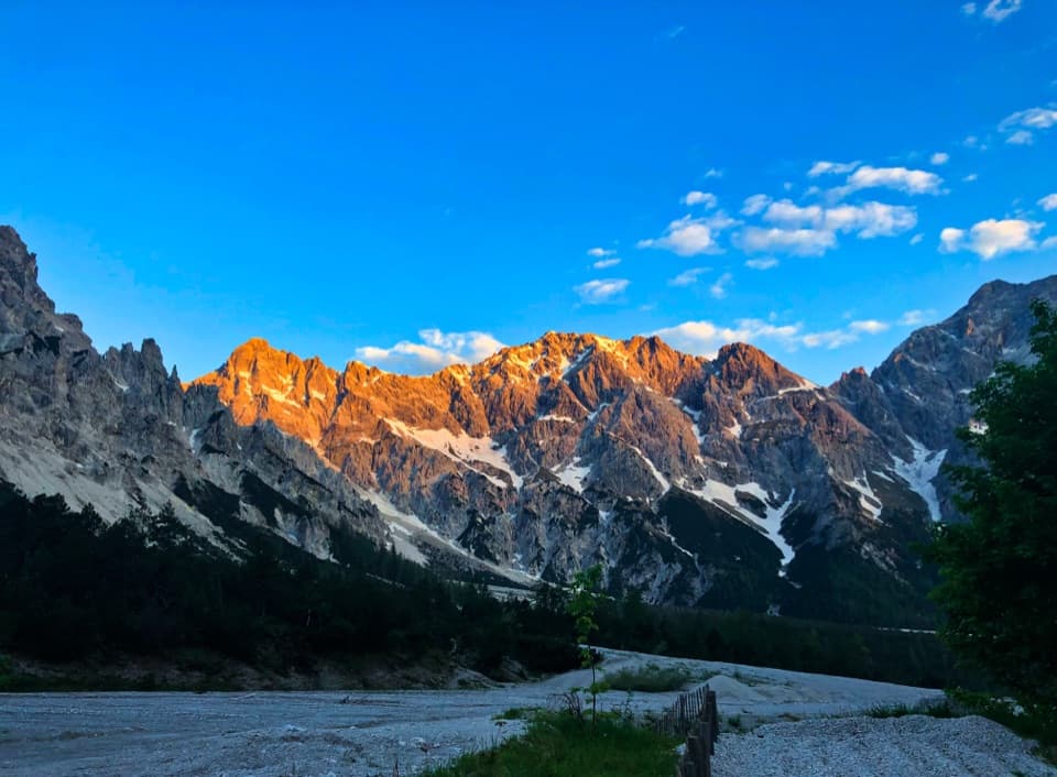
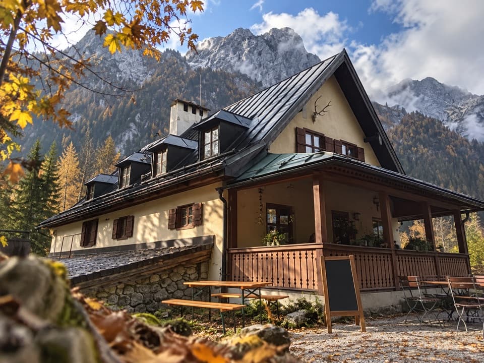
The long approach follows the pale, coarse Wimbachgries between the steep walls of Watzmann and Hochkalter. The path climbs gently for most of this stretch, passing Wimbachschloss before Wimbachgrieshütte at 1,327 m. The hut offers refreshments and overnight accommodation; check its current calendar before relying on it. If you want the valley without the exposed crossing, the hut is a natural turnaround for an out-and-back to Wimbachbrücke. That is a different hike and skips both the pass and the boat. For the defining photo, keep the pale gravel bed in front and both mountain walls in frame so the valley’s scale reads.

A refuge with a long historyWimbachgrieshütte stands on the Griesalm, also called Windachütte, a site recorded from about…

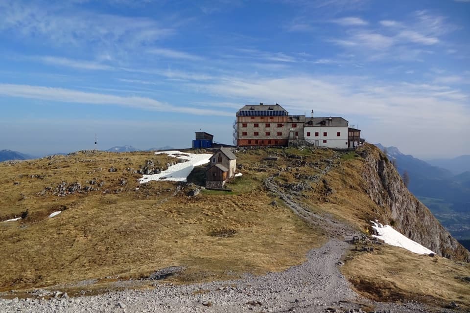
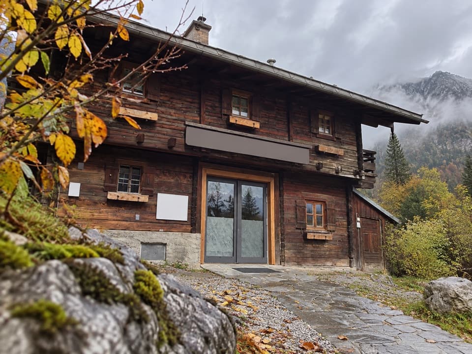
Wimbachgrieshütte stands on the Griesalm, also called Windachütte, a site recorded from about 1546. Nature Friends Munich leased it in 1919 and first built a small mountaineers’ shelter; a larger building followed in 1922–24. It has been a stopping place in the valley for generations, and still makes the sensible break before the high pass.

Climb the current line to TrischübelBeyond the hut, the route climbs into the valley head on the replacement line south of the…

Beyond the hut, the route climbs into the valley head on the replacement line south of the Banngraben rockfall area. The 600 m section gains more than 200 m, and its steep upper pitch has a 25 m steel cable and ten iron footholds. These are exposed steps, not a casual scramble; the security helps, but you still need to be steady on your feet. Hirschwieskopf, at 2,114 m, is an optional viewpoint spur from the pass and isn’t included in the 19.9 km.

Take the descent seriouslyFrom Trischübel, the route drops to Königssee over Sigeretplatte and the Sigeretsteig.

From Trischübel, the route drops to Königssee over Sigeretplatte and the Sigeretsteig. In places the path is cut into steep rock walls, and the exposed sections call for very sure footing. It’s a hard hike; this is where the long valley walk becomes a serious mountain traverse.

The rock behind the valleyThe Wimbachgries is a debris flow, up to 300 m deep, formed as brittle Ramsau dolomite breaks…

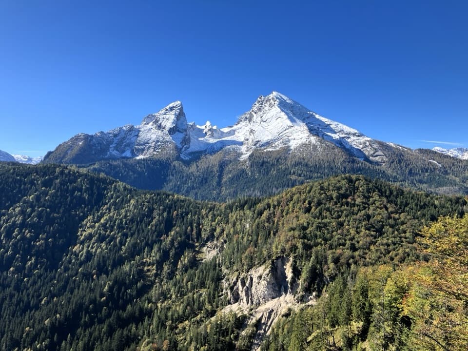
The Wimbachgries is a debris flow, up to 300 m deep, formed as brittle Ramsau dolomite breaks into coarse fragments. Those fragments also built the delta at St. Bartholomä, so the same geology that fills the first valley appears again at the finish. Across Wimbachtal, the Watzmann’s west face exposes rock layers formed from ancient seabed deposits and later folded and lifted as the Alps rose.

Look for the pinesMountain pine grows across the dolomite gravel, with some stands taking on distinctly tree-like…

Mountain pine grows across the dolomite gravel, with some stands taking on distinctly tree-like shapes. It’s an easy detail to miss in a valley this stark, but the dark pine patches show how much life has adapted to the moving scree. Once you reach St. Bartholomä, the church and its lakeshore setting are the payoff; board the boat there rather than adding any unplanned route beyond the trail end.

Wildlife

Wildlife in Berchtesgaden

All Berchtesgaden wildlife maps

Sighting maps show where each species has been reported across Berchtesgaden. Wildlife moves, so no sighting is guaranteed.

Keep exploring

Near Rund um den Watzmann via Trischübel

See it all on the map

Trails that start nearby

Places near the trailhead

Parkwolf’s Berchtesgaden ranking

Top-rated trails in Berchtesgaden

All 71 trails
  1. 1Kleine ReibnChallenging · 18.7 km
  2. 2Obersee – Fischunkelalm – RöthbachfallModerate · 8 km
  3. 3Malerwinkel-RundwegEasy · 3.4 km
  4. 4Wimbachklamm-RundwegModerate · 2.1 km
  5. 5Blaueishütte via SchärtenalmChallenging · 10.5 km
  6. 6Gotzenalm via Hochbahn TrailChallenging · 22.8 km

Take Parkwolf to Berchtesgaden.

The audio tour guide for the drive, plus offline maps, trails, and wildlife heatmaps for when the signal drops.

4.7 from 8,600+ ratings

Download Parkwolf on the App StoreGet Parkwolf on Google Play