Watzmannhaus from Wimbachbrücke in Berchtesgaden National Park

#7 of 71 trails in Berchtesgaden

Berchtesgaden National Park, BY

Watzmannhaus from Wimbachbrücke

A steep 1,270-meter climb to the hut beneath the Watzmann.

Photo: Wikimedia Commons
Length
13.9km
Time
8hr
Elev. change
1,260m
Difficulty
Challenging
  • Dogs allowed
  • High point 1,892 m

Hear the audio tour

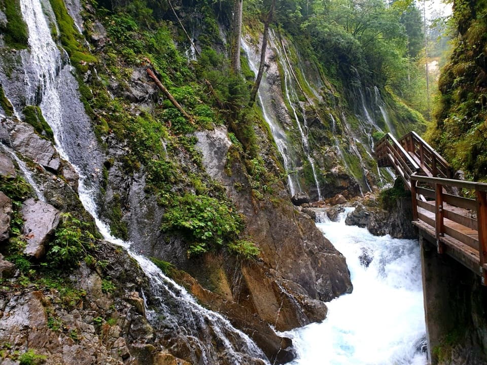
Wimbachbrücke and the Waterfall Gorge

Overview

About Watzmannhaus from Wimbachbrücke

Why go

  • A dramatic hut perch with views over Ramsau and up to the Watzmann.
  • The route shifts from forest and pastures to rocky alpine ground.
  • Seasonal refreshment stops break up the climb.

Heads up

  • About 1,276 m of climbing, much of it steep.
  • The long return repeats the rough, steep path downhill.

Map & elevation

The route

Loading the Berchtesgaden map
Full map
Elevation632–1,892 m
TrailheadParkplatz Wimbachbrücke, Ramsau47.60244, 12.92423
Keep this map with you offline in the Parkwolf app

Plan your hike

Before you go

Parking

Start at Parkplatz Wimbachbrücke in Ramsau, beside the Wimbachbrücke bus stop. Paid parking is available. Bus 846 connects the stop with Berchtesgaden. Follow the Watzmannhaus signs across the bridge; the nearby Wimbachklamm walk is a separate route.

Safety

This is a sustained 1,276 m ascent with a steep, rocky upper third and wooden steps; allow a full day and take care on the long descent. Dogs must be kept on leash in the national park, and the high, uneven route may not suit every dog. Continuing beyond the hut toward Hocheck is a separate, much more demanding alpine route.

3 active Berchtesgaden alerts

  • ClosureKlausbachtal trails closed for bridge and flood-protection workAvoid the closed Klausbachtal trail sections; the Klausbach cannot be crossed at the affected bridges. - Trail No.Official details
  • ClosureKönigsbach Waterfall Gumpen area closedDo not enter the area around the “Gumpen” pools at the Königsbach Waterfall on Königssee.Official details
See all 3 alerts
A park ranger sits on a dash-mounted phone, talking, as Parkwolf’s Tour Guide plays “Army Cutworm Moths: A Grizzly Bear Buffet” on Grand Loop Road below Dunraven Pass in Yellowstone
Parkwolf Tour GuideThe highest, rockiest slopes around here are a summer buffet for grizzly bears.

Berchtesgaden Tour Guide

Your drive to Watzmannhaus from Wimbachbrücke, narrated.

Parkwolf is a GPS audio tour guide for Berchtesgaden National Park. As you drive, it chimes in with what’s ahead: hidden gems, upcoming stops, history, geology, and wildlife, right through your car’s speakers.

Recorded for this trailhead

Wimbachbrücke and the Waterfall Gorge
0:00 / 0:38
“Wimbachbrücke is coming up, the starting point for Wimbachklamm's waterfall gorge. Allow about an hour for the outing, including the uphill approach and return.”

Plays as you drive up to this trailhead in the Parkwolf Berchtesgaden Tour Guide.

More stories near here in the app

  • A Marmot’s Winter Fuel
  • Ramsau: A Full Day on Schattseitweg
  • Hammerstiel: Grünstein and a Hut Meal
  • How Trees Hold the Snow
  • 25 audio storiesacross Berchtesgaden’s roads, triggered by GPS as you drive
  • Wildlife heatmapsfor Bearded Vulture, Golden Eagle, Red Deer, and 13 more
  • Works offlinemaps, 71 trails, 57 places, and audio download before you lose signal
  • CarPlay readysimple controls built for the drive
★★★★★
“Fantastic app with many points of information… It’s great to just turn on while you’re driving and it gives you an audio tour of the national Park. We love it!!!!”
JMJamesApp Store review
Download Parkwolf on the App StoreGet Parkwolf on Google Play

4.7 from 8,600+ ratings

Trail guide

Hiking Watzmannhaus from Wimbachbrücke

A full-day climb to the hutWatzmannhaus from Wimbachbrücke is a strenuous out-and-back to the 1,930 m hut on Falzköpfl,…

Watzmannhaus from Wimbachbrücke is a strenuous out-and-back to the 1,930 m hut on Falzköpfl, the shoulder below Hocheck on the Watzmann. It is about 13.9 km (8.6 miles) round trip, with roughly 1,276 m of climbing. The mapped line follows the 6.9 km ascent once; return by the same route. Allow seven to nine hours with breaks—about four hours to climb, then a long descent. Choose it if you are comfortable with a continuous mountain ascent and want the hut and its wide views; this is not a quick walk or casual lunch stop.

From Wimbachbrücke to StubenalmStart at Parkplatz Wimbachbrücke in Ramsau, cross the bridge and follow the Watzmannhaus signs…

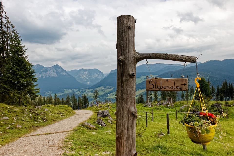
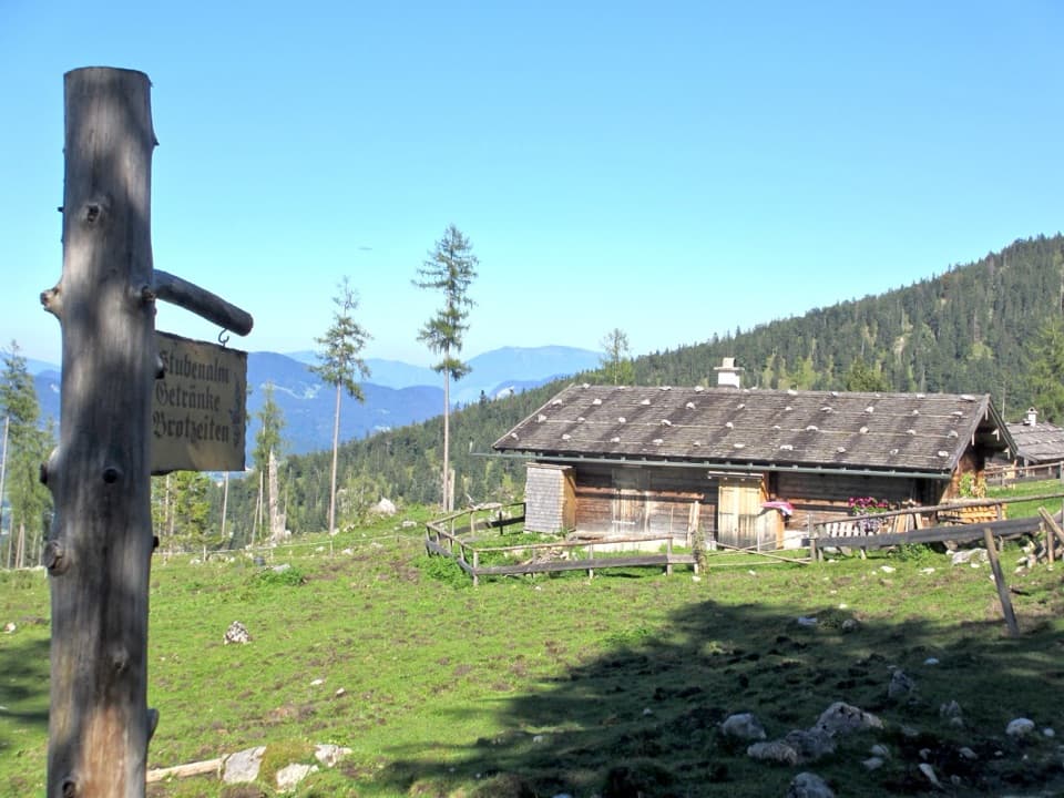
Start at Parkplatz Wimbachbrücke in Ramsau, cross the bridge and follow the Watzmannhaus signs to the right. After about 500 m you reach a forest road; turn right again after another 200 m. The lower climb is steep and wooded, with switchbacks and a couple of clearings that open views across the valley. Stubenalm’s grassy meadows make the first natural rest stop, and its seasonal refreshment stop can be a welcome bonus. The nearby Wimbachklamm is a separate walk, so keep to the Watzmannhaus route at the junctions.

Pastures, then a rougher climbBeyond Stubenalm the path returns to forest, passes the hut’s material cableway and crosses the…

Beyond Stubenalm the path returns to forest, passes the hut’s material cableway and crosses the meadows at Mitterkaseralm. The national park’s forest climate station is a useful landmark: after it, the broad track narrows into a steeper, rockier mountain path. Above the trees, the route reaches Falzalm. Take the signed right fork for Watzmannhaus, then climb through dwarf pine over rough rock and sections of built wooden steps. It is not a summit scramble, but the slope keeps going and the uneven footing makes the descent tiring too.

The hut and the viewAt about 1,930 m, Watzmannhaus sits on a high shoulder with the Watzmann rising above it and…

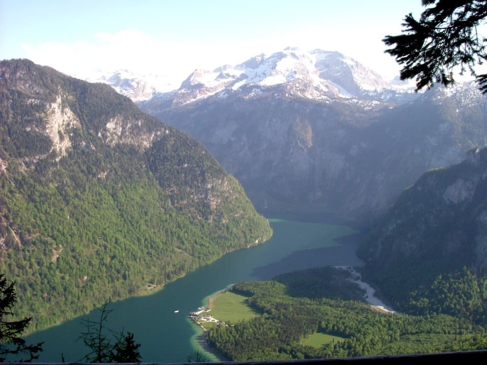
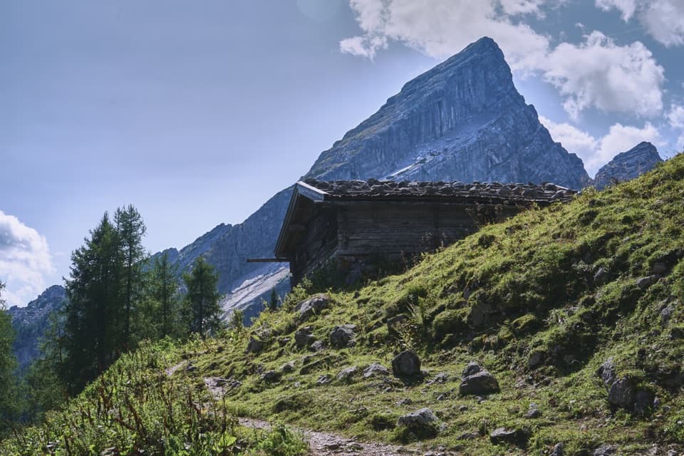
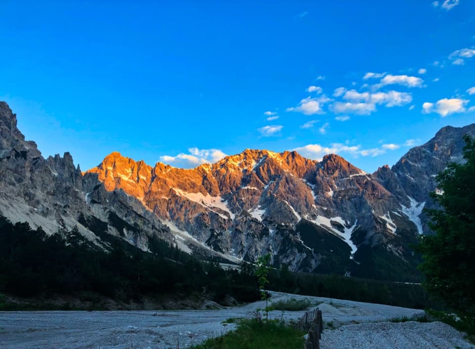
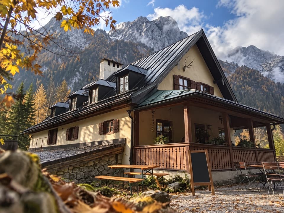
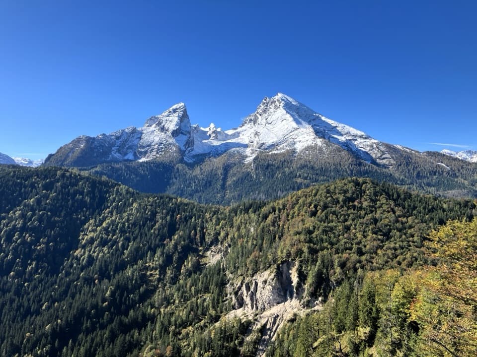
At about 1,930 m, Watzmannhaus sits on a high shoulder with the Watzmann rising above it and the Ramsau and Berchtesgaden valleys far below. Falzalm is the best place to frame the mountain above the open grass; from the hut, include the rocky shoulder in the foreground to show how high the perch is. Stubenalm and Mitterkaseralm are seasonal refreshment stops, and the hut serves food and offers beds while staffed. Its season is weather dependent, so check service and reserve if you are counting on a meal or overnight stay. Going on from the hut toward Hocheck is a different, much more alpine undertaking that needs mountain experience, excellent fitness and suitable equipment.

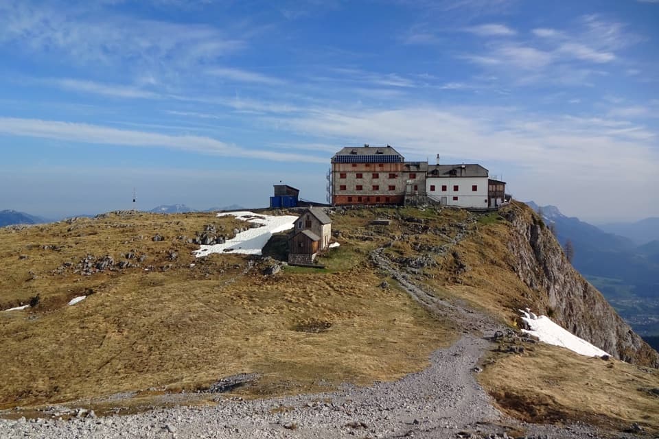
A hut built for the WatzmannThe hut opened in 1888 after the Munich Alpine Club section funded a project that its…

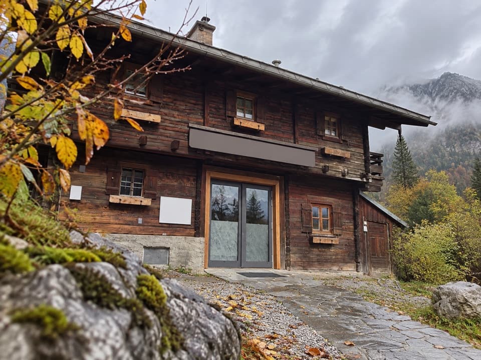
The hut opened in 1888 after the Munich Alpine Club section funded a project that its Berchtesgaden counterpart could not afford. Its first keeper was Johann Grill, known as the Kederbacher, who looked after it until 1905. A major rebuilding between 1908 and 1911 gave it much of its present appearance. It remains both a rewarding destination in its own right and a base for the much harder Watzmann peaks.

Rock and wildlife on the way upThe pale rock underfoot belongs to the limestone and dolomite layers that formed from ancient…

The pale rock underfoot belongs to the limestone and dolomite layers that formed from ancient Tethys seafloor deposits about 200 million years ago, then were folded and pushed upward. The change from forest to open alpine pasture makes that geology easier to see near Falzalm. Chamois and ibex may appear on the slopes, but sightings are never guaranteed. Dogs are allowed in the national park on leash; this sustained climb and rocky upper section suit only dogs accustomed to mountain terrain.

Wildlife

Wildlife in Berchtesgaden

All Berchtesgaden wildlife maps

Sighting maps show where each species has been reported across Berchtesgaden. Wildlife moves, so no sighting is guaranteed.

Keep exploring

Near Watzmannhaus from Wimbachbrücke

See it all on the map

Trails that start nearby

Places near the trailhead

Parkwolf’s Berchtesgaden ranking

Top-rated trails in Berchtesgaden

All 71 trails
  1. 1Kleine ReibnChallenging · 18.7 km
  2. 2Obersee – Fischunkelalm – RöthbachfallModerate · 8 km
  3. 3Malerwinkel-RundwegEasy · 3.4 km
  4. 4Wimbachklamm-RundwegModerate · 2.1 km
  5. 5Blaueishütte via SchärtenalmChallenging · 10.5 km
  6. 6Gotzenalm via Hochbahn TrailChallenging · 22.8 km

Take Parkwolf to Berchtesgaden.

The audio tour guide for the drive, plus offline maps, trails, and wildlife heatmaps for when the signal drops.

4.7 from 8,600+ ratings

Download Parkwolf on the App StoreGet Parkwolf on Google Play