Linville Falls Plunge Basin Trail

Short, steep drop to intimate, thundering views of Linville Falls

LENGTH
1.7 mi
TIME
45 min
DIFFICULTY
Moderate
DOGS
Allowed
Linville Falls Plunge Basin Trail, Blue Ridge Parkway
Image credit: Parkwolf

Pros & cons

PROS

  • Quieter than the main rim-overlook trails, especially on weekdays
  • Two distinct below-rim viewpoints in a short outing (overlook and basin)

CONS

  • Return climb is steep and feels tougher than the mileage
  • Early junctions can be confusing if you don’t watch the signs
PARKING

Park at the Linville Falls Visitor Center on the Blue Ridge Parkway (MP 316.4). Large lot at the visitor area; restrooms typically available in season. The Plunge Basin Trail starts just left of the breezeway. [nps.gov](https://www.nps.gov/blri/planyourvisit/linville-falls-trails.htm) [brptrails.com](https://www.brptrails.com/brp3164.htm) [hikewnc.info](https://www.hikewnc.info/besthikes/linville-falls/plunge-basin) [romanticasheville.com](https://www.romanticasheville.com/linville_falls.htm)

CAUTION

Steep, rocky, and stepped trail with cliff exposure; very slick when wet or icy. The climb out is strenuous. Watch children and leashed dogs near drop-offs. In winter, verify Parkway access or use back parking lots if open. [nps.gov](https://www.nps.gov/blri/planyourvisit/linville-falls-trails.htm) [ashevilletrails.com](https://ashevilletrails.com/linville-gorge/linville-falls-plunge-basin-trail/) [ncwaterfalls.com](http://www.ncwaterfalls.com/lin1.htm)

Why this hike

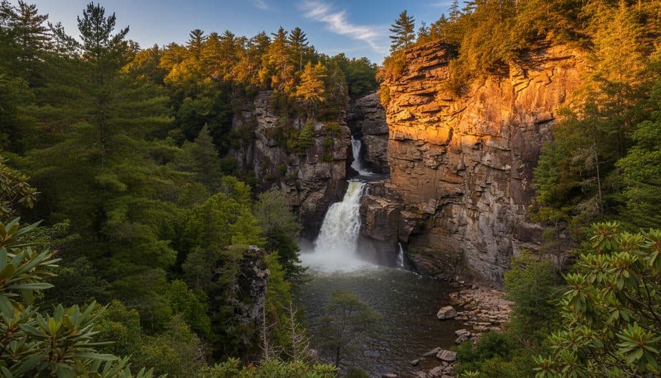
If you want Linville Falls up close—with the roar in your chest and spray in the air—this is the route. The Plunge Basin Trail dives below the rim into the dramatic Linville Gorge, sometimes called the “Grand Canyon of the Southern Appalachians,” to showcase a 90-foot waterfall amid towering cliffs and evergreen thickets. It’s short, steep, and stunning, and generally quieter than the popular rim overlooks. Expect a workout on the way back out. [romanticasheville.com](https://www.romanticasheville.com/linville_falls.htm) [ashevilletrails.com](https://ashevilletrails.com/linville-gorge/linville-falls-plunge-basin-trail/)

Route options and distance

Start at the Linville Falls Visitor Center on the Blue Ridge Parkway (MP 316.4). About 0.2 mile in, you hit a signed fork:

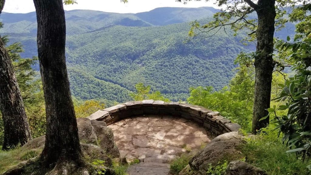
  • Right to Plunge Basin Overlook: roughly 1.0 mile round trip, with steps and steep sections to a dramatic overlook across the gorge (bonus views of the Chimneys).
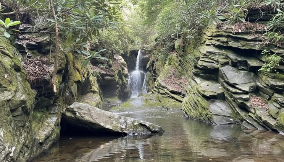
  • Left down to the river/gorge floor at the base of the falls: about 1.4 miles round trip, steeper and rockier, ending at the water’s edge for that intimate, below-the-falls perspective.

Do both spurs and you’re looking at approximately 1.7 miles total, round trip, from the visitor center. [nps.gov](https://www.nps.gov/blri/planyourvisit/linville-falls-trails.htm) [brptrails.com](https://www.brptrails.com/brp3164.htm) [musingsofarover.com](https://www.musingsofarover.com/linville-falls-hiking/)

What you’ll see

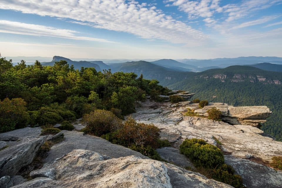
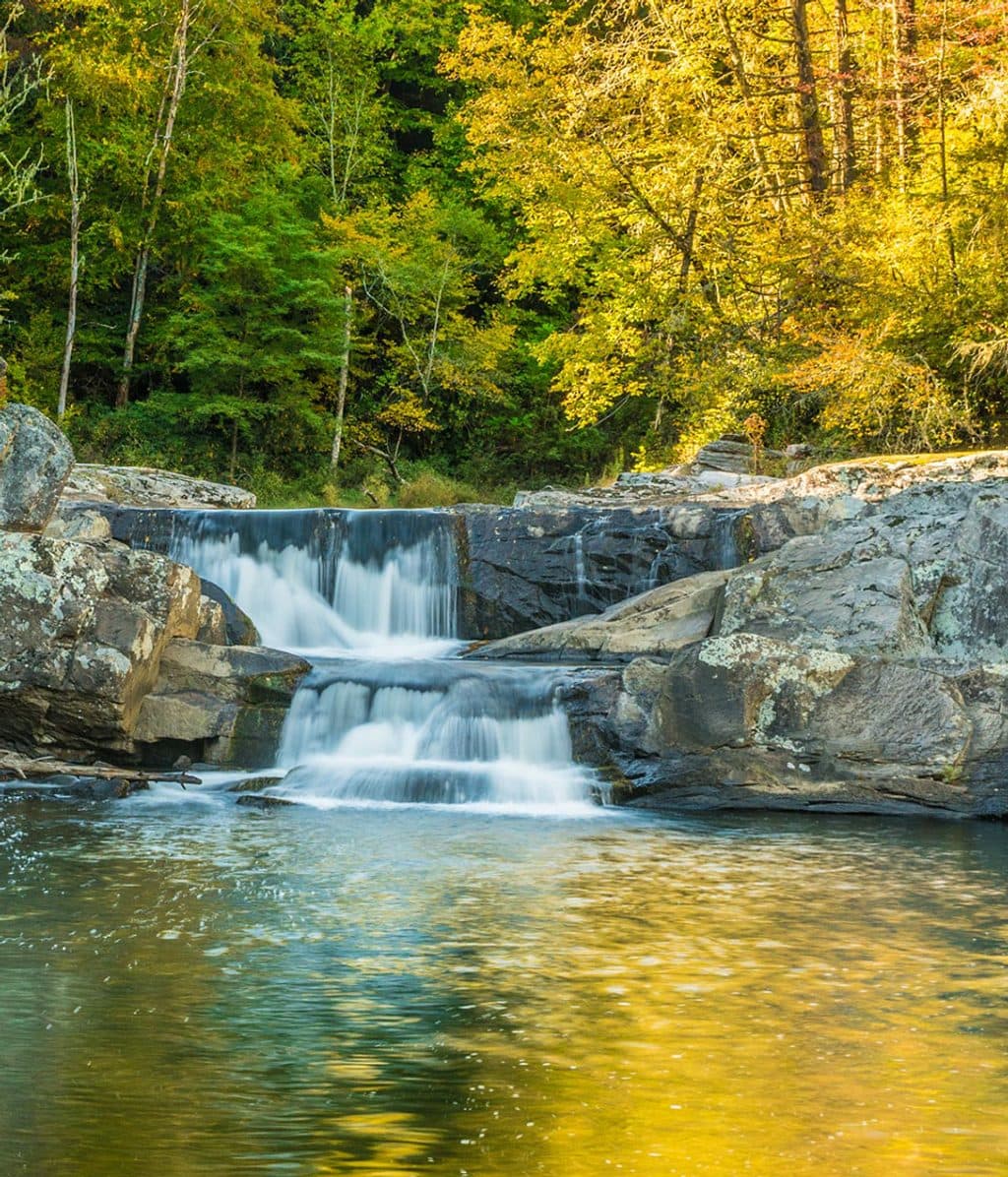
The approach tunnels through hemlock and rhododendron, with seasonal wildflowers and a constant sense of dropping into a gorge. From the overlook, the falls plunge into a deep, rock-walled pool with the Chimneys rising beyond; down at river level, the thunder and spray are the main event. It’s one of the Parkway’s most intimate waterfall views. [nps.gov](https://www.nps.gov/blri/planyourvisit/linville-falls-trails.htm) [ashevilletrails.com](https://ashevilletrails.com/linville-gorge/linville-falls-plunge-basin-trail/)

Difficulty and footing

Don’t let the mileage fool you. The National Park Service rates both the overlook and gorge-floor options as strenuous. Expect steep grades, uneven rock, steps, and some cliffy feel. It’s “anything but easy” despite being short, and the climb back to the visitor center is a leg-burner. Young children may need help on steeper sections. Wear real hiking shoes—this route can be slick after rain. [nps.gov](https://www.nps.gov/blri/planyourvisit/linville-falls-trails.htm) [ashevilletrails.com](https://ashevilletrails.com/linville-gorge/linville-falls-plunge-basin-trail/) [hikewnc.info](https://www.hikewnc.info/besthikes/linville-falls/plunge-basin) [ncwaterfalls.com](http://www.ncwaterfalls.com/lin1.htm)

Best time to hike

Year-round works if conditions are safe. Spring and summer bring lush greens and blooms; fall lights up the gorge with color; winter offers stark views—just mind ice and check Parkway access. Even when the Parkway is closed, winter access via back parking lots can make this hike possible. For fewer people and softer light, go early or on weekdays; this trail sees fewer crowds than the upper-falls overlook loop. Restrooms and visitor info are typically available May–October. [ncwaterfalls.com](http://www.ncwaterfalls.com/lin1.htm) [ashevilletrails.com](https://ashevilletrails.com/linville-gorge/linville-falls-plunge-basin-trail/) [romanticasheville.com](https://www.romanticasheville.com/linville_falls.htm)

Tips

  • Decide at the fork: right for sweeping, cliff-framed views; left for the spray at river level.
  • Follow signs closely near the start so you don’t wander toward other short spurs by mistake.
  • Bring water and a snack; the return climb punches above its mileage.
  • Leashed dogs are allowed; keep them close near drop-offs. [nps.gov](https://www.nps.gov/blri/planyourvisit/linville-falls-trails.htm) [brptrails.com](https://www.brptrails.com/brp3164.htm) [ashevilletrails.com](https://ashevilletrails.com/linville-gorge/linville-falls-plunge-basin-trail/)

Elevation

1.7 mi · 45 min
Start · 982 mHigh point · 1039 mEnd · 997 m

Near Linville Falls Plunge Basin Trail

All places →All trails →

More about Linville Falls Plunge Basin Trail

PARKWOLF TOUR GUIDE

Like a tour guide in your car.

Bring Blue Ridge Parkway trail research into the car, with offline maps and stories that play as you drive.
Download Parkwolf on the App StoreGet Parkwolf on Google Play
The Parkwolf tour guide sitting on a phone mounted in a car
Get the Audio Tour Guide for your drive through Blue Ridge ParkwayOpen Parkwolf