Jonas Pass Trail in Jasper National Park

Jasper National Park, AB

Jonas Pass Trail

A demanding 54 km alpine traverse from Nigel Creek over Jonas Pass to Poboktan Creek

Length
53.9km
Time
1day
Elev. change
910m
Difficulty
Challenging
  • No dogs
  • High point 2,452 m
  • #25 of 91 in Jasper

Hear the audio tour

Sea Creatures in the Rockies

Overview

About Jonas Pass Trail

Why go

  • Sustained alpine walking with panoramic views from Jonas Shoulder
  • A quieter, remote alternative to Jasper’s headline hikes
  • Official backcountry campgrounds break the long traverse into manageable stages

Heads up

  • One-way route requires a shuttle or other transport plan
  • Long exposed sections can be difficult in wind, rain, or lingering snow
  • Backcountry permits, campground reservations, and careful navigation are required
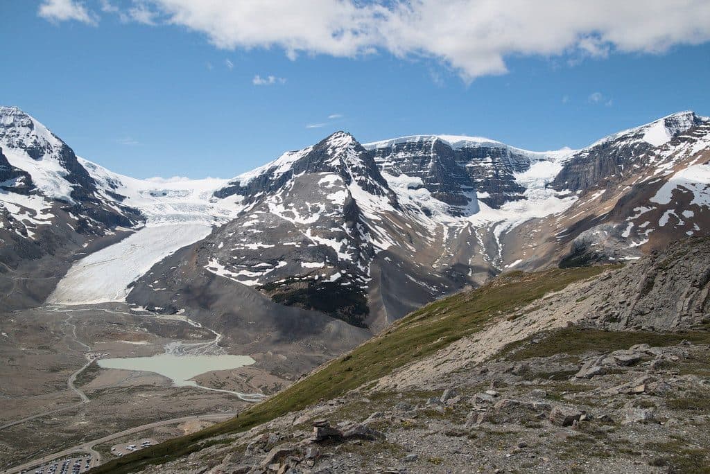
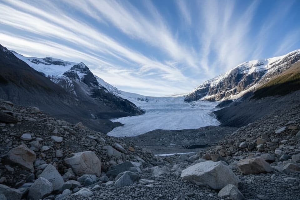
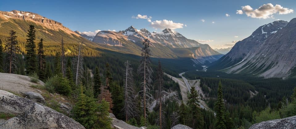
Jonas Pass Trail is a 54 km (about 33.5 mile) point-to-point backcountry traverse through the high country of Jasper National Park. It links the Nigel Creek trailhead on the Icefields Parkway with the Poboktan Creek trailhead, passing broad alpine meadows, glacial valleys, waterfalls, and the panoramas from Jonas Shoulder. Marmots, mountain goats, and other Rockies wildlife are possible, so travel with normal backcountry bear awareness.
Parkwolf’s verdictWhy hike it

Map & elevation

The route

Loading the Jasper map
Full map
Elevation1,542–2,452 m
TrailheadNigel Creek Trailhead (Nigel/Brazeau)52.18653, -117.06941
Keep this map with you offline in the Parkwolf app

Plan your hike

Before you go

Parking

Park at the Nigel Creek (Nigel/Brazeau) trailhead on the Icefields Parkway for the south-to-north route, or arrange the reverse itinerary from the Poboktan Creek trailhead. End-to-end hikers need a shuttle, second vehicle, or other transport between trailheads.

Best time to go

Passes can remain snow-covered into July; late July through September is the usual window described by Parks Canada. Carry layers and reliable navigation for exposed alpine weather, and check Parks Canada trail, road, and access information before departure.

Safety

High, exposed alpine route with rapid weather changes, lingering snow on passes, rocky or muddy tread, and small stream crossings. A Parks Canada backcountry permit and campground reservations are required. Fires are allowed only in designated pits and not at Jonas Cutoff; dogs are prohibited on Jonas Pass and Poboktan Creek trails, horses on Jonas Pass, and the route is seasonally closed for caribou from November 1 to May 15.

8 active Jasper alerts

  • ClosureWildfire-impacted areas and facilities closedStay out of closed wildfire-impacted areas and facilities in Jasper National Park; closures protect public safety after the 2024 wildfire and remain in effect while recovery and safety work continues.Official details
  • Closure93A (Wabasso Road) no through travel during roadworkFrom mid-October to early November 2026, plan for 93A (Wabasso Road) to be accessible from the south entrance only; no through travel is expected during roadwork.Official details
See all 8 alerts
A park ranger sits on a dash-mounted phone, talking, as Parkwolf’s Tour Guide plays “Army Cutworm Moths: A Grizzly Bear Buffet” on Grand Loop Road below Dunraven Pass in Yellowstone
Parkwolf Tour GuideThe highest, rockiest slopes around here are a summer buffet for grizzly bears.

Jasper Tour Guide

Your drive to Jonas Pass Trail, narrated.

Parkwolf is a GPS audio tour guide for Jasper National Park. As you drive, it chimes in with what’s ahead: hidden gems, upcoming stops, history, geology, and wildlife, right through your car’s speakers.

See the Jasper audio tour

Recorded for this area

Sea Creatures in the Rockies
Listen
“It’s hard to imagine, but all these mountains were once the floor of a warm, tropical sea. Because of that, the rocks here are full of fossils. You don't have to be a geologist to find them, either.”

Plays on the road 1.1 km from the trailhead in the Parkwolf Jasper Tour Guide.

More stories near here in the app

  • Reading the Avalanche Paths
  • Sunwapta Pass: The Border Between Parks
  • The Tree That Needs a Bird to Plant It
  • Wilcox Creek Campground: Views and Trails
  • 157 audio storiesacross Jasper’s roads, triggered by GPS as you drive
  • Wildlife heatmapsfor Grizzly Bear, Caribou, Gray Wolf, and 13 more
  • Works offlinemaps, 91 trails, 129 places, and audio download before you lose signal
  • CarPlay readysimple controls built for the drive
★★★★★
“Fantastic app with many points of information… It’s great to just turn on while you’re driving and it gives you an audio tour of the national Park. We love it!!!!”
JMJamesApp Store review
Download Parkwolf on the App StoreGet Parkwolf on Google Play

4.7 from 8,600+ ratings

Trail guide

Hiking Jonas Pass Trail

Route, length & directionThe stored route follows the maintained Parks Canada corridor south to north: trail 130 from…

The stored route follows the maintained Parks Canada corridor south to north: trail 130 from Nigel Creek over Nigel Pass to Four Point campground, trail 131 over Jonas Pass and up Jonas Shoulder to Jonas Cutoff, then trail 132 down Poboktan Creek to the highway. Parks Canada lists the sections as 13.9 km to Four Point, 18.9 km to Jonas Cutoff, 9.3 km to Waterfalls, 4.5 km to Poboktan, and 7.5 km to the Poboktan Creek trailhead, or about 54 km one way. Nigel Pass is about 2,195 m, Jonas Pass about 2,320 m, and Jonas Shoulder about 2,470 m.

Trail experienceThis is sustained, remote alpine travel usually done as a 3–4 day backpacking trip.

This is sustained, remote alpine travel usually done as a 3–4 day backpacking trip. The route is maintained but low priority, with exposed passes, rocky or muddy tread, lingering snow, and small stream crossings. The ascent to Jonas Shoulder is the most strenuous section; the route then drops through the Poboktan valley toward the highway.

Logistics & permitsThis is not a loop.

This is not a loop. Arrange a shuttle, second vehicle, or other transport for the roughly 44 km between the two trailheads. Overnight travel requires a Parks Canada backcountry camping permit and reservations at designated campgrounds such as Four Point, Jonas Cutoff, Waterfalls, and Poboktan. Fires are limited to designated pits, with no fire at Jonas Cutoff. Dogs are not permitted on Jonas Pass or Poboktan Creek trails, and horses are not permitted on Jonas Pass.

Worth it?For experienced backpackers, the long traverse rewards the effort with open alpine scenery,…

For experienced backpackers, the long traverse rewards the effort with open alpine scenery, quiet camps, and a strong sense of wilderness. It is a demanding point-to-point trip, not a casual day hike, and requires advance logistics and self-sufficiency.

Wildlife

Wildlife in Jasper

All Jasper wildlife maps

Sighting maps show where each species has been reported across Jasper. Wildlife moves, so no sighting is guaranteed.

Keep exploring

Near Jonas Pass Trail

See it all on the map

Trails that start nearby

Places near the trailhead

Parkwolf’s Jasper ranking

Top-rated trails in Jasper

All 91 trails
  1. 1Skyline TrailChallenging · 44.1 km
  2. 2Maligne CanyonModerate · 3.7 km
  3. 3Cavell MeadowsModerate · 8.4 km
  4. 4Sulphur SkylineChallenging · 8.9 km
  5. 5Athabasca Falls LoopEasy · 0.8 km
  6. 6Indian RidgeChallenging · 8.9 km

Take Parkwolf to Jasper.

The audio tour guide for the drive, plus offline maps, trails, and wildlife heatmaps for when the signal drops.

4.7 from 8,600+ ratings

Download Parkwolf on the App StoreGet Parkwolf on Google Play