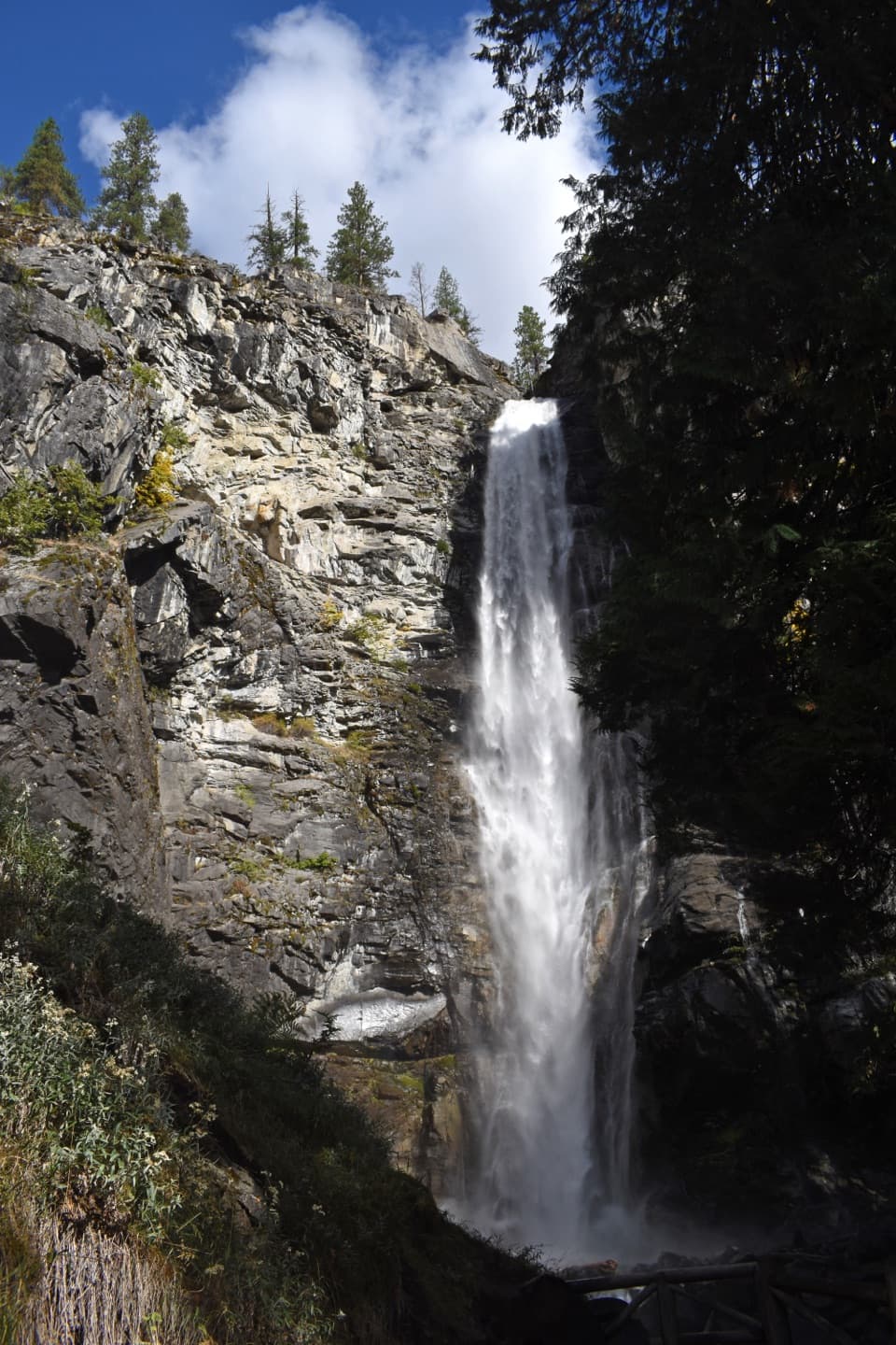
Agnes Gorge Trail in North Cascades National Park

North Cascades National Park, WA

Agnes Gorge Trail

An easy forest walk to a narrow gorge and waterfall.

Photo: National Park Service
Length
5mi
Time
3hr
Elev. change
395ft
Difficulty
Easy
  • No dogs
  • High point 2,051 ft
  • #18 of 88 in North Cascades

Hear the audio tour

High Bridge: River Gorge and Ranger Station

Overview

About Agnes Gorge Trail

Why go

  • A mostly level walk ends above a waterfall gorge with remnants of an old bridge.
  • Open hillside views of Agnes Mountain and Chickamin Glacier.

Heads up

  • The creek crossing can be difficult during spring runoff or high water.
  • Stehekin access requires a shuttle ride to High Bridge.

Map & elevation

The route

Loading the North Cascades map
Full map
Elevation1,656–2,051 ft
TrailheadAgnes Gorge Trailhead, Stehekin Valley Road near High Bridge48.38080, -120.84027
Keep this map with you offline in the Parkwolf app

Plan your hike

Before you go

Parking

From Stehekin, take the shuttle to High Bridge. The signed Agnes Gorge trailhead is the second left after crossing the Stehekin River; the first is Agnes Creek/Pacific Crest Trail. A few informal spaces are described south of High Bridge, but no formal trailhead lot or capacity is confirmed.

Safety

One short stretch has a steep drop beside the tread. The creek crossing can be difficult in spring or high water. Pets and bicycles are prohibited.

7 active North Cascades alerts

  • ClosureWildfire closures and Stehekin fire advisoryMentions this trailWildfire-related closures remain in effect; stay out of all closed trails, camps, and areas.Official details
  • ClosureStehekin Valley Road closed after landslidesMentions Stehekin Valley Road, referenced in this guideStehekin Valley Road is closed because landslides damaged it; additional precipitation and flood-related hazards persist.Official details
See all 7 alerts
A park ranger sits on a dash-mounted phone, talking, as Parkwolf’s Tour Guide plays “Army Cutworm Moths: A Grizzly Bear Buffet” on Grand Loop Road below Dunraven Pass in Yellowstone
Parkwolf Tour GuideThe highest, rockiest slopes around here are a summer buffet for grizzly bears.

North Cascades Tour Guide

Your drive to Agnes Gorge Trail, narrated.

Parkwolf is a GPS audio tour guide for North Cascades National Park. As you drive, it chimes in with what’s ahead: hidden gems, upcoming stops, history, geology, and wildlife, right through your car’s speakers.

See the North Cascades audio tour

Recorded for this trailhead

High Bridge: River Gorge and Ranger Station
0:00 / 0:35
“High Bridge is coming up, with the Stehekin River rushing through a rocky gorge below. Stop for the river view even if you’re not heading out on a hike.”

Plays as you drive up to this trailhead in the Parkwolf North Cascades Tour Guide.

More stories near here in the app

  • The Prospector Behind Howard Lake
  • A Pine's Thick Skin
  • Stehekin Valley Ranch and the Cookhouse
  • The Landscape Under Lake Chelan
  • 83 audio storiesacross North Cascades’s roads, triggered by GPS as you drive
  • Wildlife heatmapsfor Mountain Goat, Black Bear, Mule Deer, and 10 more
  • Works offlinemaps, 88 trails, 76 places, and audio download before you lose signal
  • CarPlay readysimple controls built for the drive
★★★★★
“Fantastic app with many points of information… It’s great to just turn on while you’re driving and it gives you an audio tour of the national Park. We love it!!!!”
JMJamesApp Store review
Download Parkwolf on the App StoreGet Parkwolf on Google Play

4.7 from 8,600+ ratings

Trail guide

Hiking Agnes Gorge Trail

What this hike isAgnes Gorge Trail is a 5-mile out-and-back from the second signed trailhead past High Bridge to…

Agnes Gorge Trail is a 5-mile out-and-back from the second signed trailhead past High Bridge to a waterfall gorge on Agnes Creek. The route gains about 500 feet and is mostly level, with forest, open hillside and a creek crossing. Allow about three hours with a stop at the gorge. It’s a good half-day choice if you want a relaxed walk with mountain views and a clear destination, without a long climb.

Start at the right trailheadFrom Stehekin Landing, take the Stehekin Shuttle to High Bridge.

From Stehekin Landing, take the Stehekin Shuttle to High Bridge. Cross the Stehekin River just above the bridge, then continue a short way on Stehekin Valley Road to the second signed trailhead on the left. The first trailhead is Agnes Creek/Pacific Crest Trail, a different route; there’s no bridge connecting the two. Starting at the Agnes Gorge sign keeps this record’s distance to the gorge and back.

Forest, aspens and open slopesThe trail moves through varied forest, then follows open hillside with occasional views toward…

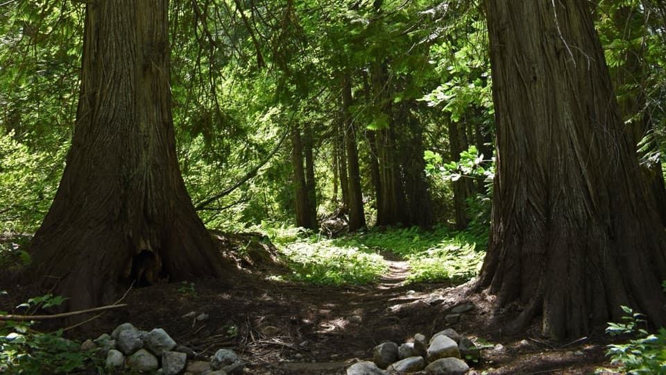
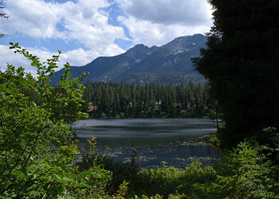
The trail moves through varied forest, then follows open hillside with occasional views toward the gorge. Around a mile in, a small aspen grove stands out among ponderosa pine and Douglas-fir. Look at the thin aspen bark for bear claw marks. The path is generally easy, though one short section has a steep drop beside it.

Agnes Mountain and the flowersAt roughly 1.5 miles, a rustic sign marks the entry into Glacier Peak Wilderness.

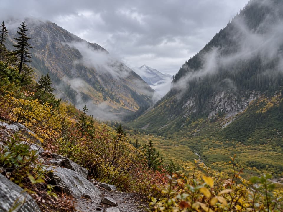
At roughly 1.5 miles, a rustic sign marks the entry into Glacier Peak Wilderness. Soon the hillside opens toward Agnes Mountain, with Chickamin Glacier peeking over its shoulder. Early and mid-summer bring tiger lilies, chocolate lilies, lupine, paintbrush and wild rose. Huckleberries can fruit on the slopes in fall.

The gorge at the endThe maintained trail ends above a narrow gorge, with a cascading waterfall and rushing water…

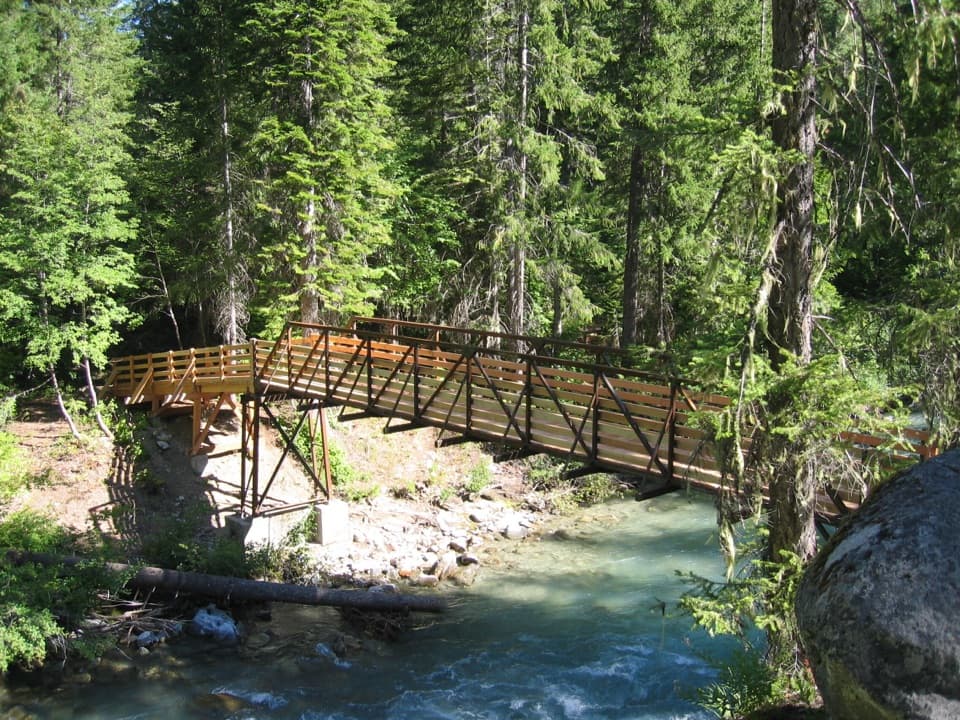
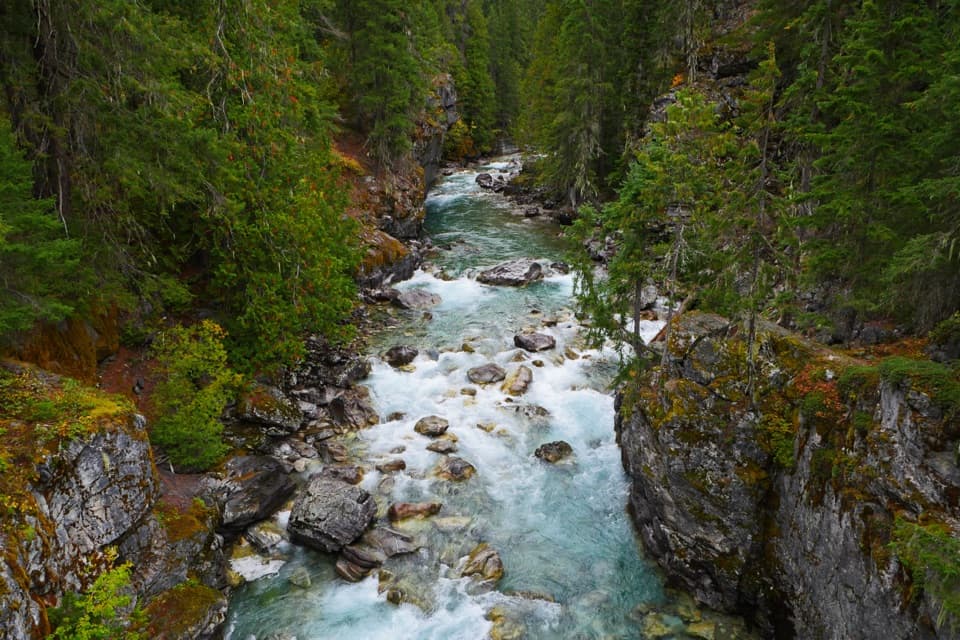
The maintained trail ends above a narrow gorge, with a cascading waterfall and rushing water below. A suspension bridge once crossed here; it’s gone, but metal pieces and the concrete anchors remain. Give yourself time to sit by the overlook before retracing the same trail. For a photo, include some of the cliff wall and water together so the narrow gorge reads clearly.

Crossings and rulesA creek crossing can be tricky in spring or high water, so be ready for wet feet.

A creek crossing can be tricky in spring or high water, so be ready for wet feet. Reports place it at different points along the walk. Pets and bicycles aren’t allowed.

Wildlife

Wildlife in North Cascades

All North Cascades wildlife maps

Sighting maps show where each species has been reported across North Cascades. Wildlife moves, so no sighting is guaranteed.

Keep exploring

Near Agnes Gorge Trail

See it all on the map

Trails that start nearby

Places near the trailhead

Parkwolf’s North Cascades ranking

Top-rated trails in North Cascades

All 88 trails
  1. 1Sahale Arm TrailChallenging · 11.8 mi
  2. 2Cascade Pass TrailModerate · 7.4 mi
  3. 3Heather–Maple Pass LoopChallenging · 7.2 mi
  4. 4Hidden Lake TrailChallenging · 9 mi
  5. 5Copper Ridge / Chilliwack River LoopChallenging · 33.5 mi
  6. 6Thunder Knob TrailModerate · 3.8 mi

Take Parkwolf to North Cascades.

The audio tour guide for the drive, plus offline maps, trails, and wildlife heatmaps for when the signal drops.

4.7 from 8,600+ ratings

Download Parkwolf on the App StoreGet Parkwolf on Google Play