Purple Pass / Boulder Creek Loop in North Cascades National Park

North Cascades National Park, WA

Purple Pass / Boulder Creek Loop

A hard climb to Purple Pass, then a long Boulder Creek descent.

Photo: National Park Service
Length
22.4mi
Time
18hr
Elev. change
5,860ft
Difficulty
Challenging
  • Loop
  • Dogs allowed
  • High point 6,952 ft

Hear the audio tour

Stehekin Landing and Golden West

Overview

About Purple Pass / Boulder Creek Loop

Why go

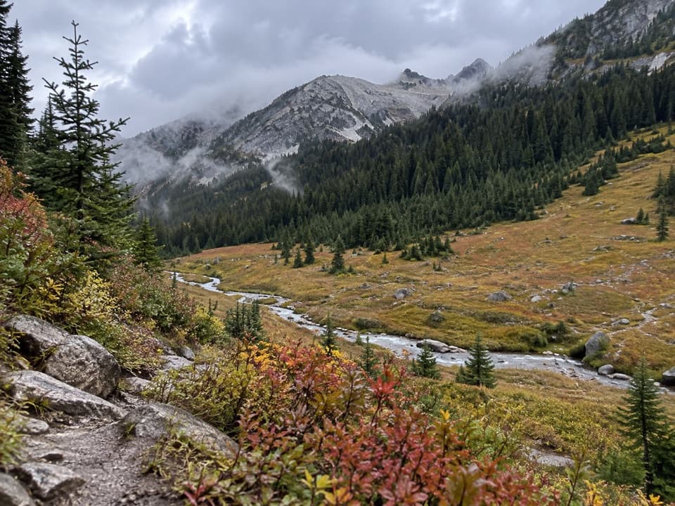
  • Purple Pass and Juanita Lake reward the climb with high-country Lake Chelan views and autumn larches.
  • One circuit links an alpine basin, fire-regrowth slopes and the forested Stehekin valley.

Heads up

  • The early climb is steep, hot and exposed, with a long gap between reliable water.
  • A long descent and valley-road finish make this a substantial backpack rather than a casual loop.

Map & elevation

The route

Loading the North Cascades map
Full map
Elevation1,093–6,952 ft
TrailheadGolden West Visitor Center / Stehekin Landing48.30836, -120.65639
Keep this map with you offline in the Parkwolf app

Plan your hike

Before you go

Parking

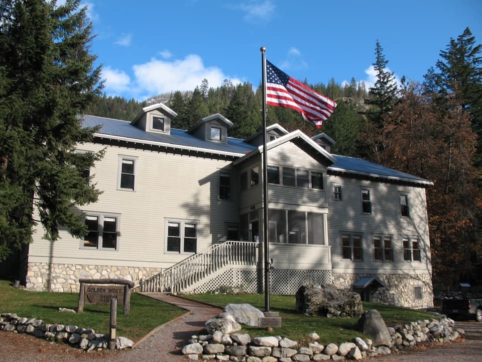
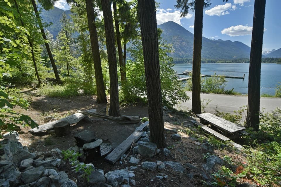
Begin behind Golden West Visitor Center, a short walk from Stehekin Landing’s passenger ferry dock. Stehekin has no road access from outside the valley; visitors arrive by ferry, private boat, floatplane or on foot. A seasonal valley shuttle serves trailheads.

Safety

Purple Creek gains about 5,800 feet in 7.4 miles with substantial sun exposure. Reliable water is limited to the creek crossing about two miles in, then not until Juanita Lake beyond the pass; treat water. Snow can linger near the lake into early July. Overnight camping requires a limited permit.

7 active North Cascades alerts

  • InfoLimited services at Stehekin Landing after flood damageMentions Stehekin Landing, referenced in this guideSome services at Stehekin Landing remain limited after the December 2025 flood damaged the wastewater treatment plant and other basic infrastructure.Official details
  • ClosureWildfire closures and Stehekin fire advisoryWildfire-related closures remain in effect; stay out of all closed trails, camps, and areas.Official details
See all 7 alerts
A park ranger sits on a dash-mounted phone, talking, as Parkwolf’s Tour Guide plays “Army Cutworm Moths: A Grizzly Bear Buffet” on Grand Loop Road below Dunraven Pass in Yellowstone
Parkwolf Tour GuideThe highest, rockiest slopes around here are a summer buffet for grizzly bears.

North Cascades Tour Guide

Your drive to Purple Pass / Boulder Creek Loop, narrated.

Parkwolf is a GPS audio tour guide for North Cascades National Park. As you drive, it chimes in with what’s ahead: hidden gems, upcoming stops, history, geology, and wildlife, right through your car’s speakers.

See the North Cascades audio tour

Recorded for this trailhead

Stehekin Landing and Golden West
0:00 / 0:31
“You're approaching Stehekin Landing, the boat gateway at the head of Lake Chelan. Make this a waterfront break, with a short uphill walk to Golden West Visitor Center.”

Plays as you drive up to this trailhead in the Parkwolf North Cascades Tour Guide.

More stories near here in the app

  • The Garden: Stehekin's Farm Stand
  • Stehekin Pastry Company: Cinnamon Rolls and Coffee
  • Rainbow Loop: A Traverse with Lake Views
  • Buckner Orchard: Heirloom Apples and a Working Ditch
  • 83 audio storiesacross North Cascades’s roads, triggered by GPS as you drive
  • Wildlife heatmapsfor Mountain Goat, Black Bear, Mule Deer, and 10 more
  • Works offlinemaps, 88 trails, 76 places, and audio download before you lose signal
  • CarPlay readysimple controls built for the drive
★★★★★
“Fantastic app with many points of information… It’s great to just turn on while you’re driving and it gives you an audio tour of the national Park. We love it!!!!”
JMJamesApp Store review
Download Parkwolf on the App StoreGet Parkwolf on Google Play

4.7 from 8,600+ ratings

Trail guide

Hiking Purple Pass / Boulder Creek Loop

The complete circuitThis demanding 22.

This demanding 22.4-mile loop starts behind Golden West Visitor Center, climbs Imus and Purple Creek to Purple Pass, descends Boulder Creek, then follows the lower Rainbow Loop to the valley road and 2.6 miles back to Stehekin Landing. The published itinerary gives 19.8 miles from the visitor center to the lower Rainbow trailhead; adding the road return closes the walking circuit. Expect about 18 hours of hiking, usually spread over two or three days.

Climb, exposure and waterThe climb to 6,900-foot Purple Pass is about 7.4 miles with 5,800 feet of gain.

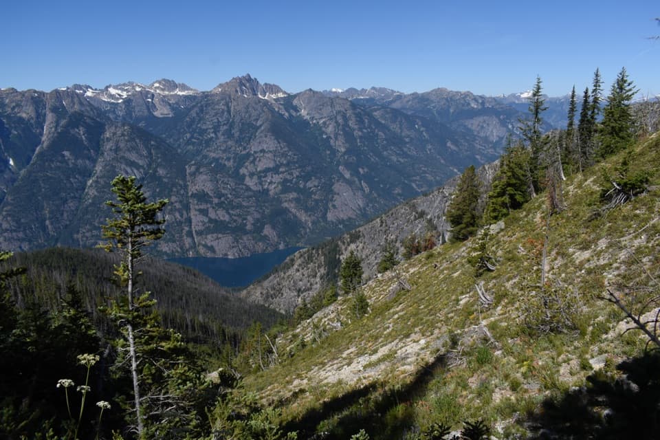
The climb to 6,900-foot Purple Pass is about 7.4 miles with 5,800 feet of gain. Much of Purple Creek is sun-exposed. The only reliable water before Juanita Lake is the Purple Creek crossing about two miles up; the next reliable source is beyond the pass at the lake. Treat water before drinking. Snow can linger around Juanita Lake into early July and make route-finding difficult. A marked spur after the pass adds about half a mile each way to 7,350-foot Boulder Butte, a former lookout site with wide views toward Lake Chelan, Cascade Pass and Mount Goode; the spur is not included in the mapped route.

Overnight permits and lake rulesAn overnight backcountry permit is required, and permits are limited, so plan the trip before…

An overnight backcountry permit is required, and permits are limited, so plan the trip before arriving. Juanita Lake has backcountry camps; fires and grazing are prohibited within a quarter mile of the lake. The party limit is 12 people, including stock. Keep pets leashed on the route.

Fire recovery and glacial landformsThe lower Purple Creek drainage still shows the 2006 Flick Creek Fire's patchwork of black…

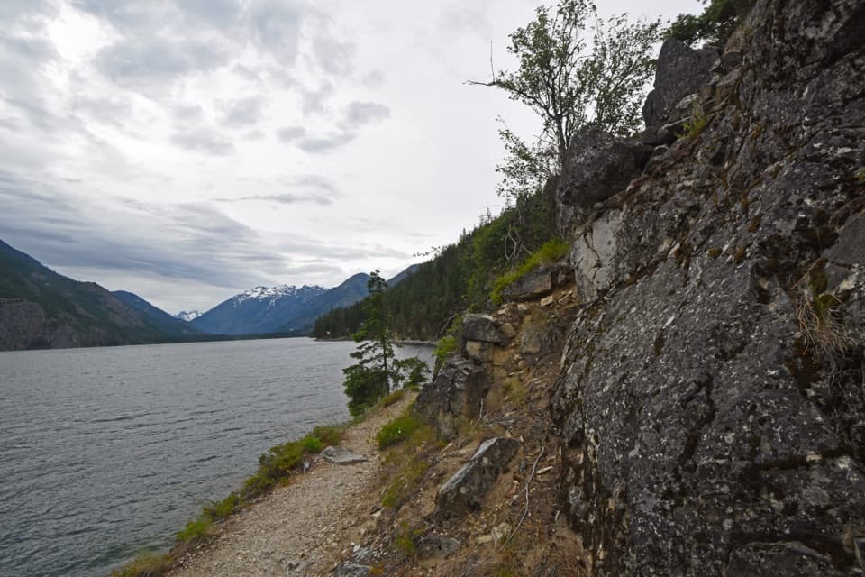
The lower Purple Creek drainage still shows the 2006 Flick Creek Fire's patchwork of black snags, new growth and fireweed. Near Juanita Lake, larches turn gold in autumn. The lower Rainbow trail climbs across sandy deposits and a bedrock bench left by glacial carving and later river erosion; look for small ant-lion pits in the sand.

Reaching the trailheadStehekin has no road connection to the outside.

Stehekin has no road connection to the outside. Reach the Landing by passenger ferry, private boat, floatplane or on foot; the visitor center is a short walk from the ferry landing, and the Purple Creek approach begins behind it. The lower Rainbow trailhead is 2.6 miles up-valley from the Landing, and the seasonal shuttle serves trailheads along the valley road.

Wildlife

Wildlife in North Cascades

All North Cascades wildlife maps

Sighting maps show where each species has been reported across North Cascades. Wildlife moves, so no sighting is guaranteed.

Keep exploring

Near Purple Pass / Boulder Creek Loop

See it all on the map

Trails that start nearby

Places near the trailhead

Parkwolf’s North Cascades ranking

Top-rated trails in North Cascades

All 88 trails
  1. 1Sahale Arm TrailChallenging · 11.8 mi
  2. 2Cascade Pass TrailModerate · 7.4 mi
  3. 3Heather–Maple Pass LoopChallenging · 7.2 mi
  4. 4Hidden Lake TrailChallenging · 9 mi
  5. 5Copper Ridge / Chilliwack River LoopChallenging · 33.5 mi
  6. 6Thunder Knob TrailModerate · 3.8 mi

Take Parkwolf to North Cascades.

The audio tour guide for the drive, plus offline maps, trails, and wildlife heatmaps for when the signal drops.

4.7 from 8,600+ ratings

Download Parkwolf on the App StoreGet Parkwolf on Google Play