Overview
About Red Cedar Flat Picnic Area
Why stop
- Easy pull-in with short loop walks and birdwatching nearby.
Heads up
- Very basic stop; table availability is uncertain.
Map
Where it is

The highest, rockiest slopes around here are a summer buffet for grizzly bears.
Royal Tour Guide
Your drive to Red Cedar Flat Picnic Area, narrated.
Parkwolf is a GPS audio tour guide for Royal National Park. As you drive, it chimes in with what’s ahead: hidden gems, upcoming stops, history, geology, and wildlife, right through your car’s speakers.
See the Royal audio tourRecorded for this area
Why It’s a Cabbage-Tree Palm“Cabbage-tree palms are native to eastern Australia. On a forest walk, look for big, fan-shaped leaves above a tall trunk with rings left by old leaf bases.”
Plays on the road 0.5 km from Red Cedar Flat Picnic Area in the Parkwolf Royal Tour Guide.
More stories near here in the app
- The Beach Shacks' Working-Class Roots
- The Banksia's Seed Bank
- Inside a Waratah Bloom
- Garawarra Farm and Figure Eight Pools
- 43 audio storiesacross Royal’s roads, triggered by GPS as you drive
- Wildlife heatmapsfor Humpback Whale, White-bellied Sea-Eagle, Koala, and 13 more
- Works offlinemaps, 69 trails, 58 places, and audio download before you lose signal
- CarPlay readysimple controls built for the drive
“Fantastic app with many points of information… It’s great to just turn on while you’re driving and it gives you an audio tour of the national Park. We love it!!!!”


Guide
More about Red Cedar Flat Picnic Area
A handy roadside pauseRed Cedar Flat is a small grassy picnic clearing on Lady Wakehurst Drive near Otford, in the…
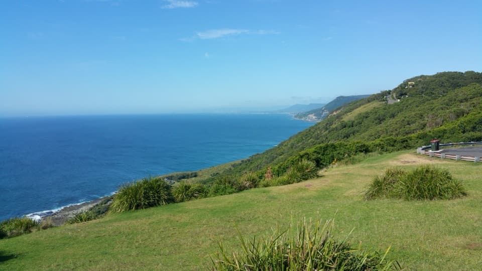
Red Cedar Flat is a small grassy picnic clearing on Lady Wakehurst Drive near Otford, in the southern part of Royal National Park. It’s a useful place to stop for lunch or a breather on a park drive, with a couple of short loop walks nearby. I’d use it as a convenient pause along the way rather than make a long detour just for the picnic setup.
Plan for a simple setupParking is easy, but table availability is uncertain.
Parking is easy, but table availability is uncertain. Bring a picnic rug or folding chair if you need a guaranteed seat. Toilets and potable water weren’t confirmed at the clearing, so don’t depend on either. It works well as a quick bite or gear check before a road ride or walk.
A little birdwatchingBirdwatching is one of the reasons to stop, and the trees around the clearing give you…
Birdwatching is one of the reasons to stop, and the trees around the clearing give you something to scan while you take a break. Bring binoculars if you want to make that part of the visit; no particular species or season is established here.
Wildlife
Wildlife in Royal
 56 sightingsHumpback WhaleMost seen around 11 AMSighting map
 70 sightingsWhite-bellied Sea-EagleMost seen around 9 AMSighting map
 12 sightingsKoalaMost seen around 6 PMSighting map
 34 sightingsJavan RusaMost seen around 6 PMSighting map
 70 sightingsShort-beaked EchidnaMost seen around 5 PMSighting map
 11 sightingsRed FoxMost seen around 5 PMSighting map
Sighting maps show where each species has been reported across Royal. Wildlife moves, so no sighting is guaranteed.