Los Tagorores to Colada de Pahoehoe Accessible Trail in Teide National Park

Teide National Park, TF

Los Tagorores to Colada de Pahoehoe Accessible Trail

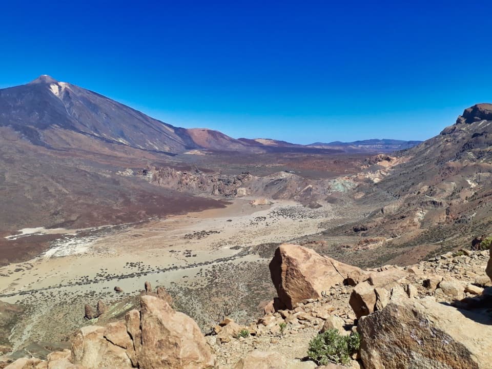
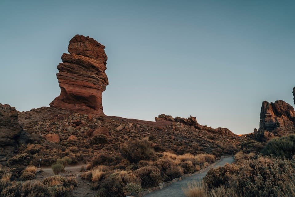
A short accessible path beside the Roques, with Teide in view.

Length
0.8km
Time
25min
Elev. change
20m
Difficulty
Easy
  • High point 2,158 m
  • #16 of 62 in Teide

Hear the audio tour

Roques de García and La Ruleta

Overview

About Los Tagorores to Colada de Pahoehoe Accessible Trail

Why go

  • Officially designated accessible, with a low-difficulty 770 m route
  • Roque Cinchado, Teide and the caldera wall share one short walk

Heads up

  • It is a line, not a loop; a stand-alone visit means retracing the route

Map & elevation

The route

Loading the Teide map
Full map
Elevation2,138–2,158 m
TrailheadLos Tagorores28.22450, -16.63047
Keep this map with you offline in the Parkwolf app

Plan your hike

Before you go

Parking

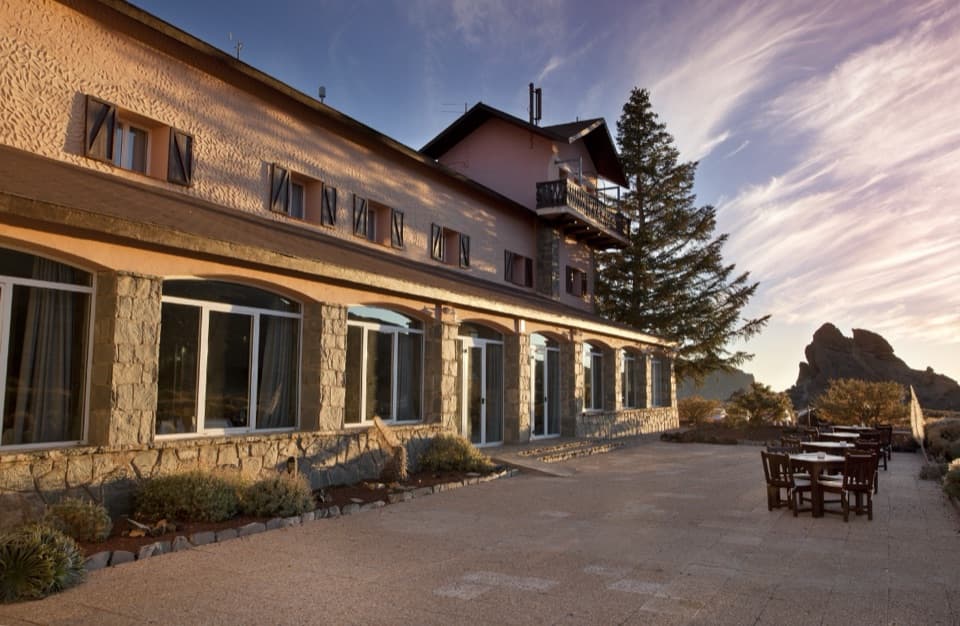
Use the La Ruleta access off TF-21 around km 46, then take the separate 180 m SA PMR 01 connector to Los Tagorores, the PMR 02 start. Two marked spaces are reserved for authorized vehicles; buses 342 and 348 serve Parador del Teide stop 7684.

Safety

The route is officially designated accessible, but published details do not specify grades by stretch or exact surface conditions; confirm suitability for your mobility aid if needed. The pet rule could not be verified; check with the park before bringing a dog.

3 active Teide alerts

  • CautionActive wildfire risk and preventive measuresTenerife ON currently lists wildfire risk and preventive wildfire measures; check the live restrictions before visiting Teide National Park.Official details
  • CautionNo smoking in Teide National ParkSmoking is prohibited throughout Teide National Park as a preventive measure against forest fires.Official details
See all 3 alerts
A park ranger sits on a dash-mounted phone, talking, as Parkwolf’s Tour Guide plays “Army Cutworm Moths: A Grizzly Bear Buffet” on Grand Loop Road below Dunraven Pass in Yellowstone
Parkwolf Tour GuideThe highest, rockiest slopes around here are a summer buffet for grizzly bears.

Teide Tour Guide

Your drive to Los Tagorores to Colada de Pahoehoe Accessible Trail, narrated.

Parkwolf is a GPS audio tour guide for Teide National Park. As you drive, it chimes in with what’s ahead: hidden gems, upcoming stops, history, geology, and wildlife, right through your car’s speakers.

Recorded for this trailhead

Roques de García and La Ruleta
0:00 / 0:36
“Roques de García is coming up, with volcanic towers standing against Teide. Keep this one on your shortlist, even for a short stop: the platforms at La Ruleta give you the view without doing the full hike.”

Plays as you drive up to this trailhead in the Parkwolf Teide Tour Guide.

More stories near here in the app

  • Cañada Blanca and the Parador
  • Los Azulejos: The Colored Rocks
  • Llano de Ucanca and La Catedral
  • The Tajinaste’s One Big Bloom
  • 39 audio storiesacross Teide’s roads, triggered by GPS as you drive
  • Wildlife heatmapsfor Short-finned Pilot Whale, Tenerife Lizard, West Canary Skink, and 10 more
  • Works offlinemaps, 62 trails, 49 places, and audio download before you lose signal
  • CarPlay readysimple controls built for the drive
★★★★★
“Fantastic app with many points of information… It’s great to just turn on while you’re driving and it gives you an audio tour of the national Park. We love it!!!!”
JMJamesApp Store review
Download Parkwolf on the App StoreGet Parkwolf on Google Play

4.7 from 8,600+ ratings

Trail guide

Hiking Los Tagorores to Colada de Pahoehoe Accessible Trail

The short accessible lineSA PMR 02 is a 770 m (0.

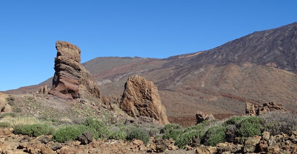
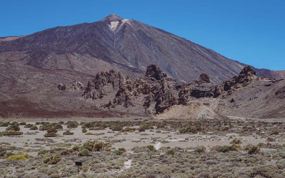
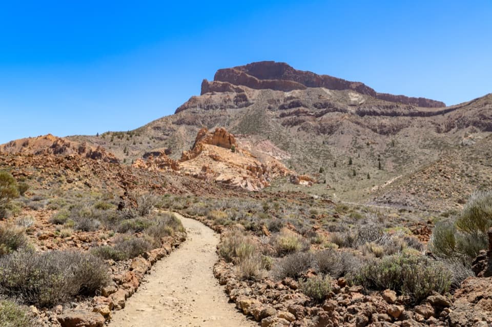
SA PMR 02 is a 770 m (0.48 mi) point-to-point path from Los Tagorores to the PNT 03 connection toward Colada de Pahoehoe. It runs beside the Roques de García and passes Roque Cinchado, with Teide and the Las Cañadas caldera wall in view. The route is officially designated accessible and low difficulty; its listed 25-minute time does not say whether a return is included.

Get there and backLa Ruleta is reached from TF-21 around km 46.

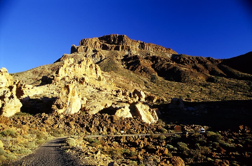
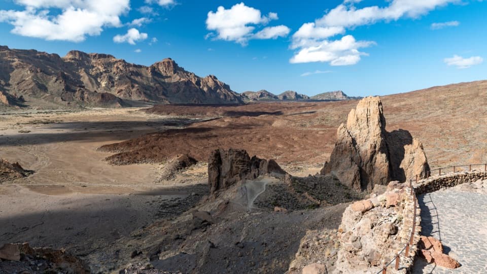
La Ruleta is reached from TF-21 around km 46. From its paved viewpoint, the separate 180 m SA PMR 01 connector reaches Los Tagorores; that connector is not part of PMR 02’s 770 m. This isn’t a loop. Unless you continue on PNT 03, turn around and retrace PMR 02. Walking this segment out and back is about 1.54 km (0.96 mi); starting and ending at La Ruleta makes the whole walk about 1.9 km (1.18 mi), counting the connector in both directions. The PNT 03 circuit is 3.47 km, but only its accessible first section overlaps this route; the rest is not accessible to visitors with reduced mobility.

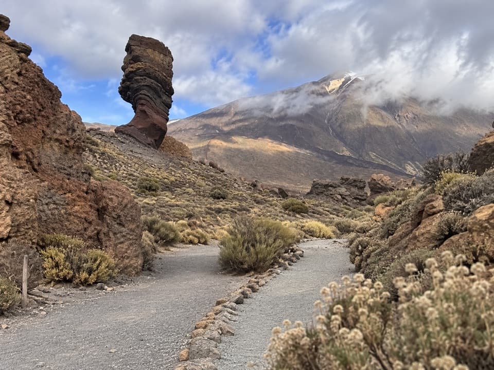
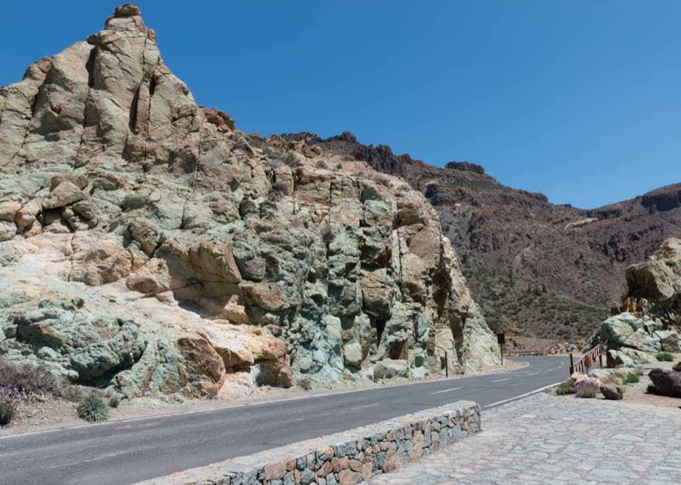
Walk beside the RoquesThe path follows the rock alignment into the Cañada Blanca area.

The path follows the rock alignment into the Cañada Blanca area. Roque Cinchado is the unmistakable landmark; Teide and the caldera wall sit behind the rocks, with Guajara rising behind the Parador. For a photo, frame the narrow pillar against Teide so the size and shape of the formations read together.

Check the access detailsThe route is officially designated accessible, but the published description doesn’t give…

The route is officially designated accessible, but the published description doesn’t give grades by stretch or precise surface details. Confirm it suits your mobility aid if those specifics matter. Two marked spaces at the La Ruleta access are reserved for authorized vehicles; buses 342 and 348 serve Parador del Teide stop 7684. I couldn’t verify a pet rule for this route, so check before bringing a dog.

Wildlife

Wildlife in Teide

All Teide wildlife maps

Sighting maps show where each species has been reported across Teide. Wildlife moves, so no sighting is guaranteed.

Keep exploring

Near Los Tagorores to Colada de Pahoehoe Accessible Trail

See it all on the map

Trails that start nearby

Places near the trailhead

Parkwolf’s Teide ranking

Top-rated trails in Teide

All 62 trails
  1. 1Telesforo Bravo Trail (PNT 10)Challenging · 1.4 km
  2. 2PNT 03 Roques de García LoopModerate · 3.5 km
  3. 3Alto de Guajara Summit LoopChallenging · 11.1 km
  4. 4Mirador de Pico Viejo Trail (PNT 12)Moderate · 1.5 km
  5. 5PNT 07 Montaña Blanca–La Rambleta TrailChallenging · 8.3 km
  6. 6Sámara Loop TrailModerate · 4.6 km

Take Parkwolf to Teide.

The audio tour guide for the drive, plus offline maps, trails, and wildlife heatmaps for when the signal drops.

4.7 from 8,600+ ratings

Download Parkwolf on the App StoreGet Parkwolf on Google Play