Camp Creek Hike in Zion National Park

Zion National Park, UT

Camp Creek Hike

A rough canyon walk to twin stone portals and pitted red walls

Length
8.5mi
Time
5.5hr
Elev. change
1,670ft
Difficulty
Challenging
  • No dogs
  • High point 7,106 ft
Parkwolf audio tour45 stories across Zion’s roads

Overview

About Camp Creek Hike

Why go

  • Paired stone portals and pitted red canyon walls
  • Remote creek travel with a distinct change from brushy valley to narrows

Heads up

  • Private-property access is not confirmed
  • Brushy, unmaintained creek travel makes route finding slow

Map & elevation

The route

Loading the Zion map
Full map
Elevation5,436–7,106 ft
TrailheadCamp Creek access road below the water tank (reported point)37.50428, -113.19690
Keep this map with you offline in the Parkwolf app

Plan your hike

Before you go

Parking

No public parking location could be confirmed. Route accounts place the start on a dirt road below a water tank near Kanarraville, but directions have changed and the approach crosses private property. Confirm current permission and a legal place to park with the landowner before driving in.

Safety

Current permission to cross private property is unverified. Beyond the approach path, the route is unmaintained and hard to follow through brush and creekbed; crossings may be wet, and canyon weather can create flash-flood danger. Turn around before the sustained scrambling above the pothole section.

3 active Zion alerts

  • CautionToxic cyanobacteria in Zion waterwaysDo not drink Zion in-stream water, submerge your head, or touch or ingest algae mats; cyanobacteria can produce harmful toxins.Official details
  • ClosureWatchman Trail closed for repairsWatchman Trail is closed pending repairs; do not enter the trail and choose another hike. Check current park conditions before setting out.Official details
See all 3 alerts
A park ranger sits on a dash-mounted phone, talking, as Parkwolf’s Tour Guide plays “Army Cutworm Moths: A Grizzly Bear Buffet” on Grand Loop Road below Dunraven Pass in Yellowstone
Parkwolf Tour GuideThe highest, rockiest slopes around here are a summer buffet for grizzly bears.

Zion Tour Guide

Your drive to Camp Creek Hike, narrated.

Parkwolf is a GPS audio tour guide for Zion National Park. As you drive, it chimes in with what’s ahead: hidden gems, upcoming stops, history, geology, and wildlife, right through your car’s speakers.

See the Zion audio tour

More stories near here in the app

  • Taylor Creek and Double Arch Alcove
  • A Songbird Underwater
  • South Fork of Taylor Creek
  • Lee Pass and Kolob Arch
  • 45 audio storiesacross Zion’s roads, triggered by GPS as you drive
  • Wildlife heatmapsfor California Condor, Bighorn Sheep, Mountain Lion, and 13 more
  • Works offlinemaps, 54 trails, 36 places, and audio download before you lose signal
  • CarPlay readysimple controls built for the drive
★★★★★
“Fantastic app with many points of information… It’s great to just turn on while you’re driving and it gives you an audio tour of the national Park. We love it!!!!”
JMJamesApp Store review
Download Parkwolf on the App StoreGet Parkwolf on Google Play

4.7 from 8,600+ ratings

Trail guide

Hiking Camp Creek Hike

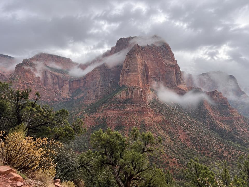
The routeCamp Creek is an unmaintained out-and-back hike into Zion’s remote northwestern Kolob country.

Camp Creek is an unmaintained out-and-back hike into Zion’s remote northwestern Kolob country. The commonly described outing is roughly 8.5 miles round trip and takes about 4–6 hours. It follows an old approach path to the creek, then continues through brush and the creek corridor to paired stone pillars, narrowing red walls and an upper pothole section. The line here represents the shorter turnaround before sustained scrambling farther up canyon. The approach crosses private property; current permission and directions have not been confirmed, so verify access before setting out.

From the gate to the creekThe reported start is on a dirt road below a water tank near Kanarraville.

The reported start is on a dirt road below a water tank near Kanarraville. Beyond the Zion boundary gate, a faint path climbs through trees to a high point with a view east across Camp Creek Valley, then drops to the creek. Note where the path leaves the creek on the way in; it is easy to miss on the return. There is no maintained tread through much of the drainage.

Through the canyonThe lower valley is brushy, with route finding along or in the creek and a few crossings that…

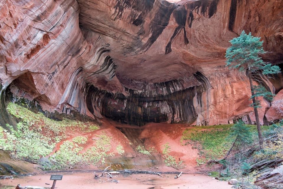
The lower valley is brushy, with route finding along or in the creek and a few crossings that can wet your boots. Two large stone pillars, known as the Two Portals, mark a change: the walls draw closer, the creekbed becomes drier, and the red rock is more exposed. Look for pitted sandstone and small seep-formed holes in the walls. The corridor continues toward slickrock narrows and potholes.

Where to turn backThe upper potholes and obstacles make a practical endpoint for this outing.

The upper potholes and obstacles make a practical endpoint for this outing. Beyond them, the route becomes sustained scrambling over boulders and fallen trees; that harder continuation is not included in the distance here. There is no single standardized turnaround, so allow extra time for slow creek travel and turn around before the terrain exceeds your skills.

Before you goThe current public status of the private-property approach is unclear, and the access point has…

The current public status of the private-property approach is unclear, and the access point has reportedly changed. Confirm landowner permission and legal parking before using the reported start; do not assume the dirt road or gate is open to hikers. This is a rough, unmarked canyon route where brush, water and flash-flood conditions can make progress hazardous. Check Zion’s current conditions and weather before entering. Pets are not allowed on this route in the park; Pa’rus Trail is Zion’s only pet-permitted trail.

Wildlife

Wildlife in Zion

All Zion wildlife maps

Sighting maps show where each species has been reported across Zion. Wildlife moves, so no sighting is guaranteed.

Keep exploring

Near Camp Creek Hike

See it all on the map

Trails that start nearby

Places near the trailhead

Parkwolf’s Zion ranking

Top-rated trails in Zion

All 54 trails
  1. 1Angels Landing TrailChallenging · 4.2 mi
  2. 2The Narrows from the Bottom UpChallenging · 9.4 mi
  3. 3Canyon Overlook TrailModerate · 1 mi
  4. 4East Mesa Trail to Observation PointModerate · 6.8 mi
  5. 5Left Fork (Subway) Bottom-UpChallenging · 9 mi
  6. 6West Rim Trail (Top-Down)Challenging · 14.6 mi

Take Parkwolf to Zion.

The audio tour guide for the drive, plus offline maps, trails, and wildlife heatmaps for when the signal drops.

4.7 from 8,600+ ratings

Download Parkwolf on the App StoreGet Parkwolf on Google Play