Parking
Start at Lee Pass Trailhead on Kolob Canyons Road. It is a roadside trailhead with several parking spaces.

Zion National Park, UT
An 18-mile out-and-back to Bear Trap Canyon Falls in red sandstone.
Overview
Map & elevation
Plan your hike

The highest, rockiest slopes around here are a summer buffet for grizzly bears.
Zion Tour Guide
Parkwolf is a GPS audio tour guide for Zion National Park. As you drive, it chimes in with what’s ahead: hidden gems, upcoming stops, history, geology, and wildlife, right through your car’s speakers.
See the Zion audio tourRecorded for this trailhead
Lee Pass and Kolob Arch“Lee Pass Trailhead is ahead, the starting point for a long canyon walk to Kolob Arch. Plan on a strenuous fourteen-mile round trip taking seven to nine hours, with red cliffs and La Verkin Creek along the way.”
Plays as you drive up to this trailhead in the Parkwolf Zion Tour Guide.
More stories near here in the app
“Fantastic app with many points of information… It’s great to just turn on while you’re driving and it gives you an audio tour of the national Park. We love it!!!!”


Trail guide
La Verkin Creek Trail to Bear Trap Canyon Falls is an approximately 18-mile out-and-back from Lee Pass to a pool beneath a waterfall in a narrow red-rock canyon. The direct route follows the trail through Timber Creek country to La Verkin Creek, then continues to the mouth of Bear Trap Canyon and up the creek. Set aside about 10 to 12 hours. The measured route is 18.1 miles round trip; one published estimate is 17.6, so treat it as about 18 miles. This is for hikers ready for a remote, all-day walk, not a quick waterfall stop.
The first miles drop from Lee Pass toward Timber Creek, with open views across the Kolob Finger Canyons. The path enters a mostly dry wash, then leaves it around mile 3 and bends around Gregory Butte on the descent to La Verkin Creek. The return to Lee Pass means climbing back roughly 1,000 feet from the lower creek country. It is a long climb after an even longer walk; save energy for it.
La Verkin Creek brings a change to sandy banks and creek-side walking. Deep sand can make steady progress slow, and the route crosses water several times. Continue beyond the Hop Valley junction toward Bear Trap Canyon. The optional Kolob Arch spur is near this section and adds a little over half a mile each way to the arch viewpoint; it is not part of the falls route or the mileage above. Tread gets fainter and brushier as you approach the canyon.
At the canyon mouth, leave the named trail and follow the stream upstream for about half a mile to the falls. The final narrows are framed by thin-layered red-orange Navajo sandstone, with sand and pebbles, slick gray mud, and driftwood at the water's edge. The walk ends at a pool beneath the cascade; the waterfall blocks the way farther up. If the water is low and the footing is safe, frame the falls with the vertical walls to show how narrow the canyon is.
Lee Pass Trailhead is a roadside access on Kolob Canyons Road with several parking spaces. There is no food service along the route, so bring a full day's food. Carry water and treatment gear; natural water needs purification. Spring through fall is the usual hiking season, while snow can linger into early spring. Several creek crossings can become difficult during or after heavy rain, and narrow canyons in Zion can flash flood at any time. Check the forecast and park flood potential, and do not enter the canyon when storms threaten. Overnight stays require a wilderness permit and a designated campsite. Pets are not allowed on this trail.
Wildlife
 291 sightingsCalifornia CondorMost seen around 11 AMSighting map
 350 sightingsBighorn SheepMost seen around 7 AMSighting map
 22 sightingsMountain LionMost seen around 7 PMSighting map
 1,326 sightingsMule DeerMost seen around 6 AMSighting map
 23 sightingsGolden EagleMost seen around 10 AMSighting map
 15 sightingsPeregrine FalconMost seen around 7 AMSighting map
Sighting maps show where each species has been reported across Zion. Wildlife moves, so no sighting is guaranteed.
Keep exploring
 ChallengingLa Verkin Creek Trail to Kolob Arch14 mi · 8 hr · At the trailheadA long creek walk earns a distant view of Kolob Arch.
 ChallengingTrans-Zion Trek37 mi · 1 day · At the trailheadA backcountry crossing from Kolob's creek canyons to Zion Canyon.
 ModerateSouth Fork of Taylor Creek Trail3 mi · 3 hr · 0.4 mi awayA sandy canyon path beneath Kolob’s high red walls.
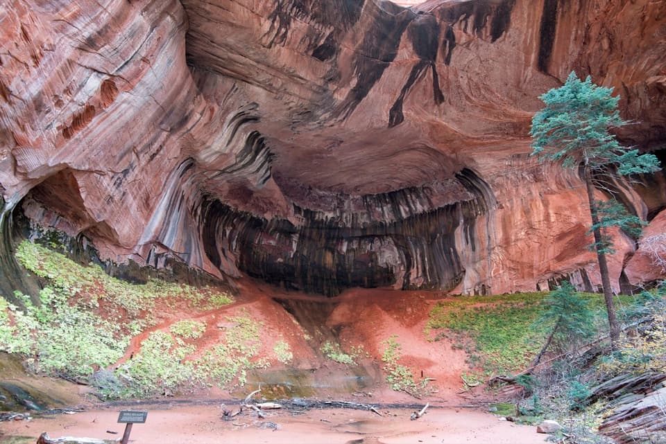 ModerateTaylor Creek Trail5.2 mi · 3.5 hr · 0.8 mi awayTwo homestead cabins lead to a shaded sandstone alcove.
 ModerateNorth Fork of Taylor Creek5.5 mi · 4 hr · 0.8 mi awayA quiet canyon walk, an easy to miss fork and small arch.
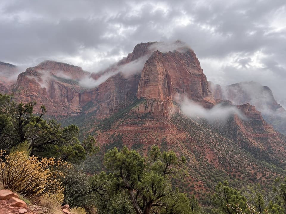 EasyTimber Creek Overlook Trail1.2 mi · 45 min · 1.3 mi awayShort ridge, red cliffs, and a long look toward Pine Valley.
 ChallengingCamp Creek Hike8.5 mi · 5.5 hr · 3.6 mi awayA rough canyon walk to twin stone portals and pitted red walls
 ModerateConnector Trail5.1 mi · 2.5 hr · 8.8 mi awayOpen meadows and slickrock connect two Kolob trailheads.
 Sight · 0.8 mi awayLarson CabinA 1931 log cabin marks a homestead that never quite took hold.
 Sight · 1.3 mi awayKolob Canyons ViewpointA five-mile drive earns a sweeping view of red finger canyons.
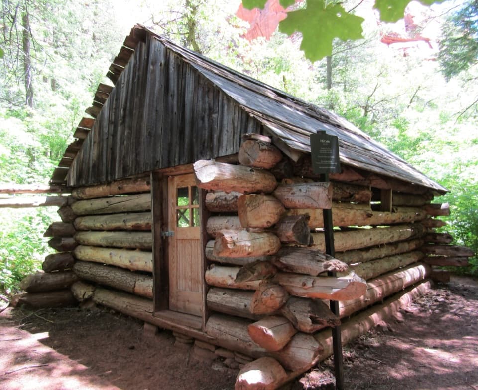 Sight · 1.3 mi awayFife CabinA small 1930s homestead gives the creek hike a human story.Sight · 1.6 mi awayDouble Arch AlcoveA streaked sandstone alcove caps a creek-crossing hike.
 Sight · 1.8 mi awayTimber Creek OverlookA rocky ridge walk to Kolob’s wide southern horizon.
 Visitor center · 1.9 mi awayKolob Canyons Visitor CenterYour required pass stop before Kolob's five-mile scenic road.
 Sight · 3 mi awayKolob ArchA full-day canyon hike to an arch you see from afar.
 Campground · 9.9 mi awayLava Point CampgroundSix tent sites on Zion's high, remote Kolob Terrace.
Parkwolf’s Zion ranking

The audio tour guide for the drive, plus offline maps, trails, and wildlife heatmaps for when the signal drops.




