Parking
Lee Pass Trailhead on Kolob Canyons Road. Parking is limited, with no water or restroom at the trailhead. Fill bottles and use the restroom at Kolob Canyons Visitor Center before heading farther in.

Zion National Park, UT
A long creek walk earns a distant view of Kolob Arch.
Overview
Map & elevation
Plan your hike

The highest, rockiest slopes around here are a summer buffet for grizzly bears.
Zion Tour Guide
Parkwolf is a GPS audio tour guide for Zion National Park. As you drive, it chimes in with what’s ahead: hidden gems, upcoming stops, history, geology, and wildlife, right through your car’s speakers.
See the Zion audio tourRecorded for this trailhead
Lee Pass and Kolob Arch“Lee Pass Trailhead is ahead, the starting point for a long canyon walk to Kolob Arch. Plan on a strenuous fourteen-mile round trip taking seven to nine hours, with red cliffs and La Verkin Creek along the way.”
Plays as you drive up to this trailhead in the Parkwolf Zion Tour Guide.
More stories near here in the app
“Fantastic app with many points of information… It’s great to just turn on while you’re driving and it gives you an audio tour of the national Park. We love it!!!!”


Trail guide
This is a 14-mile round trip from Lee Pass to the Kolob Arch viewpoint, following La Verkin Creek Trail and its short spur. Plan on 7–9 hours for a full day. The canyon walk and creek corridor are as much of the payoff as the arch. You see Kolob Arch high on a cliff from across the canyon, not from underneath it.
The trail drops quickly from Lee Pass, opening views of the red-and-cream Kolob Finger Canyons before it reaches the mostly dry Timber Creek wash. You cross that drainage several times. Around three miles in, the route leaves Timber Creek, skirts Gregory Butte and turns toward La Verkin Creek. The grade eases in places, but sandy and rocky stretches still slow the walk. At the creek, a small slickrock chute is a good place to pause before continuing along the sandy banks.
The Kolob Arch spur branches from the creek trail near the seven-mile point. It is a little over half a mile each way and rougher than the main route, with a bit of scrambling near the viewpoint. The arch spans 287 feet and is 75 feet thick, but it sits high across the canyon and can be partly screened by trees. Go for the whole canyon day as well as the landmark; the arch is a distant finish, not a close-up walk-through.
Return the same way. The early descent from Lee Pass becomes the final uphill climb, after a long day on uneven sand and rock. The arch spur is part of the 14-mile round trip, so leave time for the return climb rather than turning around at the creek.
Lee Pass has limited parking and no water or restroom. Fill bottles and use the restroom at Kolob Canyons Visitor Center before driving to the trailhead, then carry enough water for the whole day; do not count on the creek as a drinking-water stop. Summer heat can be punishing, while snow can linger into early spring. Pets are prohibited on Kolob Canyons trails. Overnight trips need a wilderness permit and must use designated campsites. Wilderness groups are limited to 12 people sharing an affiliation.
Wildlife
 291 sightingsCalifornia CondorMost seen around 11 AMSighting map
 350 sightingsBighorn SheepMost seen around 7 AMSighting map
 22 sightingsMountain LionMost seen around 7 PMSighting map
 1,326 sightingsMule DeerMost seen around 6 AMSighting map
 23 sightingsGolden EagleMost seen around 10 AMSighting map
 15 sightingsPeregrine FalconMost seen around 7 AMSighting map
Sighting maps show where each species has been reported across Zion. Wildlife moves, so no sighting is guaranteed.
Keep exploring
 ChallengingTrans-Zion Trek37 mi · 1 day · At the trailheadA backcountry crossing from Kolob's creek canyons to Zion Canyon.
 ChallengingLa Verkin Creek Trail to Bear Trap Canyon Falls18.1 mi · 11 hr · At the trailheadAn 18-mile out-and-back to Bear Trap Canyon Falls in red sandstone.
 ModerateSouth Fork of Taylor Creek Trail3 mi · 3 hr · 0.4 mi awayA sandy canyon path beneath Kolob’s high red walls.
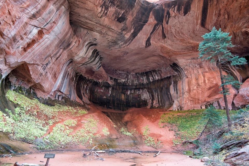 ModerateTaylor Creek Trail5.2 mi · 3.5 hr · 0.8 mi awayTwo homestead cabins lead to a shaded sandstone alcove.
 ModerateNorth Fork of Taylor Creek5.5 mi · 4 hr · 0.8 mi awayA quiet canyon walk, an easy to miss fork and small arch.
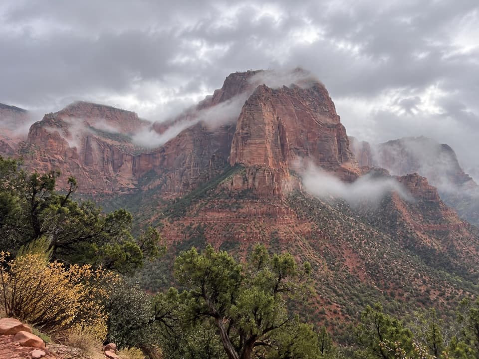 EasyTimber Creek Overlook Trail1.2 mi · 45 min · 1.3 mi awayShort ridge, red cliffs, and a long look toward Pine Valley.
 ChallengingCamp Creek Hike8.5 mi · 5.5 hr · 3.6 mi awayA rough canyon walk to twin stone portals and pitted red walls
 ModerateConnector Trail5.1 mi · 2.5 hr · 8.8 mi awayOpen meadows and slickrock connect two Kolob trailheads.
 Sight · 0.8 mi awayLarson CabinA 1931 log cabin marks a homestead that never quite took hold.
 Sight · 1.3 mi awayKolob Canyons ViewpointA five-mile drive earns a sweeping view of red finger canyons.
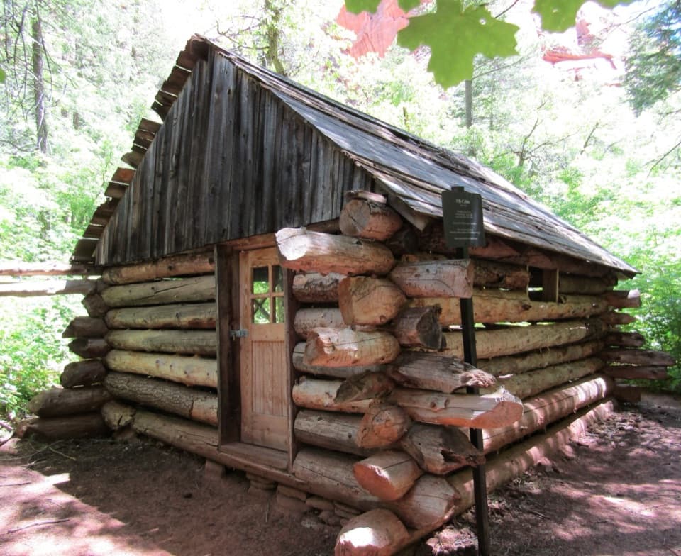 Sight · 1.3 mi awayFife CabinA small 1930s homestead gives the creek hike a human story.Sight · 1.6 mi awayDouble Arch AlcoveA streaked sandstone alcove caps a creek-crossing hike.
 Sight · 1.8 mi awayTimber Creek OverlookA rocky ridge walk to Kolob’s wide southern horizon.
 Visitor center · 1.9 mi awayKolob Canyons Visitor CenterYour required pass stop before Kolob's five-mile scenic road.
 Sight · 3 mi awayKolob ArchA full-day canyon hike to an arch you see from afar.
 Campground · 9.9 mi awayLava Point CampgroundSix tent sites on Zion's high, remote Kolob Terrace.
Parkwolf’s Zion ranking

The audio tour guide for the drive, plus offline maps, trails, and wildlife heatmaps for when the signal drops.




