Parking
Taylor Creek Trailhead on Kolob Canyons Road, about 2.1 miles from the Kolob Canyons entrance. Pit toilets are at the trailhead; water filling is at Kolob Canyons Visitor Center. Parking capacity and fees were not verified.

Zion National Park, UT
A quiet canyon walk, an easy to miss fork and small arch.
Overview
North Fork of Taylor Creek is a 5.5-mile out-and-back that follows the established Taylor Creek path to Larson Cabin, then leaves the maintained route for an informal creekbed walk. Allow 3 to 5 hours. It suits hikers who like exploring a quiet side canyon and don't need a signed trail the whole way. The climb is gradual, but loose gravel, thick brush and a few boulder scrambles make the route more demanding than the mileage alone suggests.
 Parkwolf’s verdictIs this the hike for you?
Map & elevation
Plan your hike

The highest, rockiest slopes around here are a summer buffet for grizzly bears.
Zion Tour Guide
Parkwolf is a GPS audio tour guide for Zion National Park. As you drive, it chimes in with what’s ahead: hidden gems, upcoming stops, history, geology, and wildlife, right through your car’s speakers.
See the Zion audio tourRecorded for this trailhead
Taylor Creek and Double Arch Alcove“You're coming up on Taylor Creek Trailhead, the start of the walk to Double Arch Alcove.”
Plays as you drive up to this trailhead in the Parkwolf Zion Tour Guide.
More stories near here in the app
“Fantastic app with many points of information… It’s great to just turn on while you’re driving and it gives you an audio tour of the national Park. We love it!!!!”


Trail guide
From Taylor Creek Trailhead, follow the main path down to the creek and continue for roughly a mile to Larson Cabin. The North Fork comes in from the north just beyond the cabin, and the turn is easy to miss. Larson's old homestead is the landmark to watch for. Keep going into the North Fork; the main route continues along the Middle Fork toward Double Arch Alcove, a different hike.
Follow the creekbed north, then east around Tucupit Point. The water fades and the canyon floor opens into gravel, with stretches of thick vegetation. Near the upper canyon, red sandstone rises around a pitted alcove wall and a natural arch. There isn't a marked endpoint: the mapped route ends near this upper wall, while the on-the-ground turnaround depends on brush and boulders. The 5.5-mile figure is for the mapped out-and-back; turning earlier changes your distance.
Use the shared Taylor Creek Trailhead on Kolob Canyons Road; pit toilets are there, and the visitor center has water filling. No on-route water service was found. Pets aren't allowed on Kolob Canyons trails, and Zion's wilderness group limit is 12 people. This is an unmaintained creekbed beyond the cabin, not a signed trail. Flash floods can race through narrow canyons from storms miles away, even when skies above are clear; avoid the drainage whenever storms threaten.
Wildlife
 291 sightingsCalifornia CondorMost seen around 11 AMSighting map
 350 sightingsBighorn SheepMost seen around 7 AMSighting map
 22 sightingsMountain LionMost seen around 7 PMSighting map
 1,326 sightingsMule DeerMost seen around 6 AMSighting map
 23 sightingsGolden EagleMost seen around 10 AMSighting map
 15 sightingsPeregrine FalconMost seen around 7 AMSighting map
Sighting maps show where each species has been reported across Zion. Wildlife moves, so no sighting is guaranteed.
Keep exploring
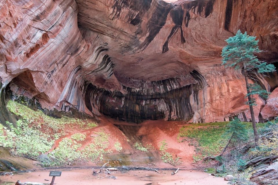 ModerateTaylor Creek Trail5.2 mi · 3.5 hr · At the trailheadTwo homestead cabins lead to a shaded sandstone alcove.
 ChallengingLa Verkin Creek Trail to Kolob Arch14 mi · 8 hr · 0.8 mi awayA long creek walk earns a distant view of Kolob Arch.
 ChallengingTrans-Zion Trek37 mi · 1 day · 0.8 mi awayA backcountry crossing from Kolob's creek canyons to Zion Canyon.
 ChallengingLa Verkin Creek Trail to Bear Trap Canyon Falls18.1 mi · 11 hr · 0.8 mi awayAn 18-mile out-and-back to Bear Trap Canyon Falls in red sandstone.
 ModerateSouth Fork of Taylor Creek Trail3 mi · 3 hr · 0.9 mi awayA sandy canyon path beneath Kolob’s high red walls.
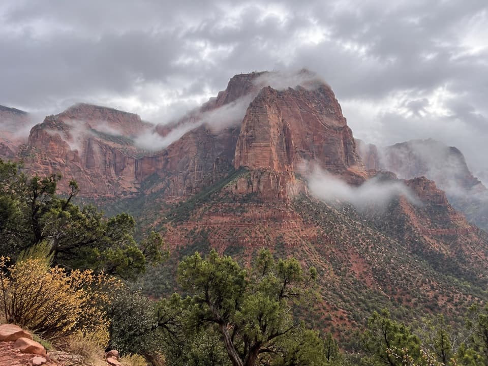 EasyTimber Creek Overlook Trail1.2 mi · 45 min · 1.8 mi awayShort ridge, red cliffs, and a long look toward Pine Valley.
 ChallengingCamp Creek Hike8.5 mi · 5.5 hr · 2.9 mi awayA rough canyon walk to twin stone portals and pitted red walls
 ModerateConnector Trail5.1 mi · 2.5 hr · 9.6 mi awayOpen meadows and slickrock connect two Kolob trailheads.
 Sight · 0.8 mi awayLarson CabinA 1931 log cabin marks a homestead that never quite took hold.
 Visitor center · 1.5 mi awayKolob Canyons Visitor CenterYour required pass stop before Kolob's five-mile scenic road.
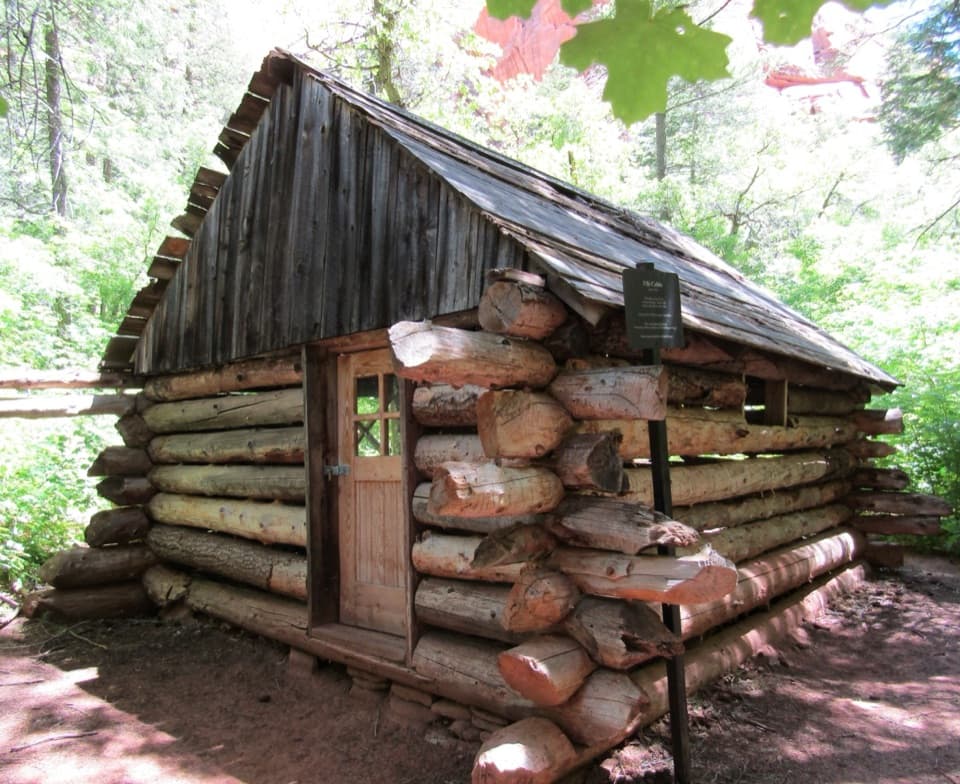 Sight · 1.7 mi awayFife CabinA small 1930s homestead gives the creek hike a human story.
 Sight · 1.9 mi awayKolob Canyons ViewpointA five-mile drive earns a sweeping view of red finger canyons.Sight · 2.1 mi awayDouble Arch AlcoveA streaked sandstone alcove caps a creek-crossing hike.
 Sight · 2.4 mi awayTimber Creek OverlookA rocky ridge walk to Kolob’s wide southern horizon.
 Sight · 3.8 mi awayKolob ArchA full-day canyon hike to an arch you see from afar.
Parkwolf’s Zion ranking
The audio tour guide for the drive, plus offline maps, trails, and wildlife heatmaps for when the signal drops.




