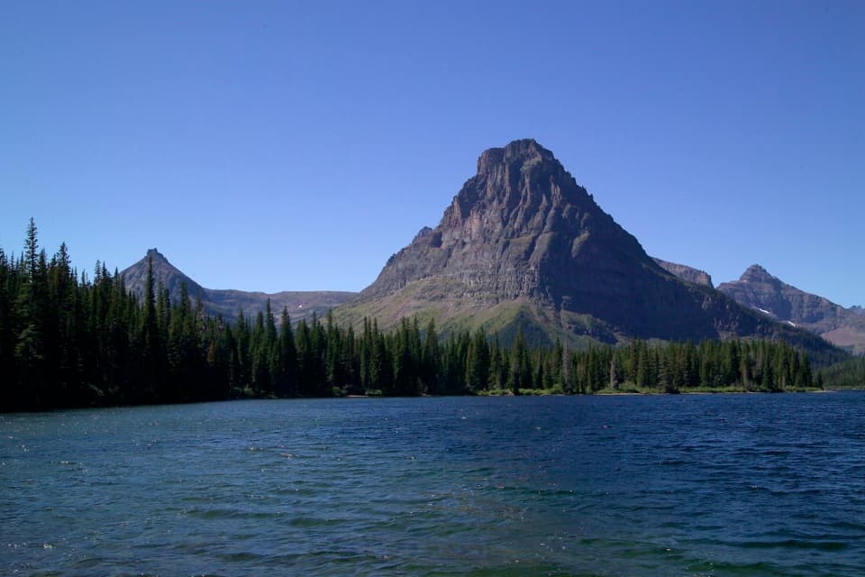
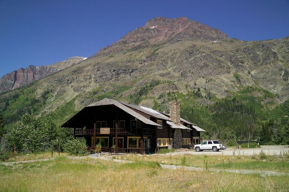
Ole Creek Trail in Glacier National Park

Glacier National Park, MT

Ole Creek Trail

Cross Firebrand Pass into Ole Creek's remote mountain valley.

Photo: Wikimedia Commons
Length
25mi
Time
16hr
Elev. change
2,828ft
Difficulty
Challenging
  • No dogs
  • High point 6,598 ft

Hear the audio tour

Lubec Trailhead and Firebrand Pass

Overview

About Ole Creek Trail

Why go

  • The Firebrand Pass panorama looks deep into the Ole Creek valley.
  • A true through-hike links alpine pass, lake and remote creek country.

Heads up

  • The 25-mile one-way route needs a shuttle or staged vehicle.
  • Loose scree and an unbridged creek ford add difficult footing.

Map & elevation

The route

Loading the Glacier map
Full map
Elevation3,770–6,598 ft
TrailheadLubec Trailhead, US Highway 2 mile marker 20348.37173, -113.27941
Keep this map with you offline in the Parkwolf app

Plan your hike

Before you go

Parking

Use the roadside pullout along US Highway 2 near mile marker 203, about six miles south of East Glacier. The signed Lubec access is across the railroad tracks; cross carefully. Arrange a shuttle or second vehicle at Walton Ranger Station for the one-way finish.

Safety

The unbridged Ole Creek ford near mile 13.4 can be swift and cold early in the season, and loose scree makes the descent below Firebrand Pass unstable underfoot. Seasonal bridges are removed from park trails by late September; check the current trail report before depending on a crossing.

1 active Glacier alert

  • ClosureTwo Medicine Campground closed for 2026 constructionTwo Medicine Campground is closed throughout 2026 because of construction in the Two Medicine developed area.Official details
Glacier alerts
A park ranger sits on a dash-mounted phone, talking, as Parkwolf’s Tour Guide plays “Army Cutworm Moths: A Grizzly Bear Buffet” on Grand Loop Road below Dunraven Pass in Yellowstone
Parkwolf Tour GuideThe highest, rockiest slopes around here are a summer buffet for grizzly bears.

Glacier Tour Guide

Your drive to Ole Creek Trail, narrated.

Parkwolf is a GPS audio tour guide for Glacier National Park. As you drive, it chimes in with what’s ahead: hidden gems, upcoming stops, history, geology, and wildlife, right through your car’s speakers.

See the Glacier audio tour

Recorded for this trailhead

Lubec Trailhead and Firebrand Pass
0:00 / 0:25
“Up ahead is Lubec Trailhead, the start of a strenuous hike to Firebrand Pass and views down the remote Ole Creek valley. Allow six to eight hours for about ten miles round trip and two thousand feet of climbing.”

Plays as you drive up to this trailhead in the Parkwolf Glacier Tour Guide.

More stories near here in the app

  • Why Ice Can Look Blue
  • What a Flicking Tongue Finds
  • How Much Water Is in the Snow?
  • A Bear's Pregnancy on Pause
  • 204 audio storiesacross Glacier’s roads, triggered by GPS as you drive
  • Wildlife heatmapsfor Grizzly Bear, Wolverine, Mountain Goat, and 13 more
  • Works offlinemaps, 157 trails, 91 places, and audio download before you lose signal
  • CarPlay readysimple controls built for the drive
★★★★★
“Our first time to glacier and we used the audio portion for Going to the Sun Road. Wonderful information with perfect advice of what to see and do along the road.”
PaisleyParkFanApp Store review
Download Parkwolf on the App StoreGet Parkwolf on Google Play

4.7 from 8,600+ ratings

Trail guide

Hiking Ole Creek Trail

The full traverseFrom Lubec Trailhead to Walton Ranger Station, this is a roughly 25-mile one-way backcountry…

From Lubec Trailhead to Walton Ranger Station, this is a roughly 25-mile one-way backcountry traverse over Firebrand Pass and down the Ole Creek valley. Allow about 16 hours for the trip; for most hikers, an overnight plan is more realistic than a single push. The listed itinerary gives 25 miles, while the mapped trail line measures about 22.9, so plan around the longer figure and check the current park map for the exact mileage. You need a shuttle or a second vehicle at Walton.

Climbing to Firebrand PassLubec is on US Highway 2 near mile marker 203, with the signed trail access across the railroad…

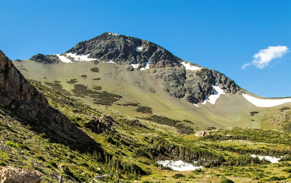
Lubec is on US Highway 2 near mile marker 203, with the signed trail access across the railroad tracks. The route starts through open meadows and aspen along Coonsa Creek, then passes through forest. At the Autumn Creek junction around mile 1.5, stay on the northbound branch; later, take the meadow junction toward Firebrand Pass. The climb reaches the pass at about 4.8 miles, with roughly 2,210 feet of gain. The descent into Ole Creek is steep and covered in loose scree.

Into Ole Creek valleyFirebrand Pass opens a long view south down Ole Creek and across the mountains between the Ole…

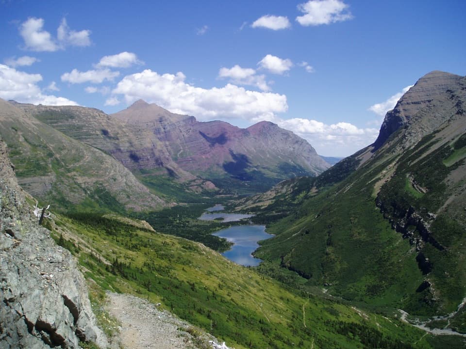
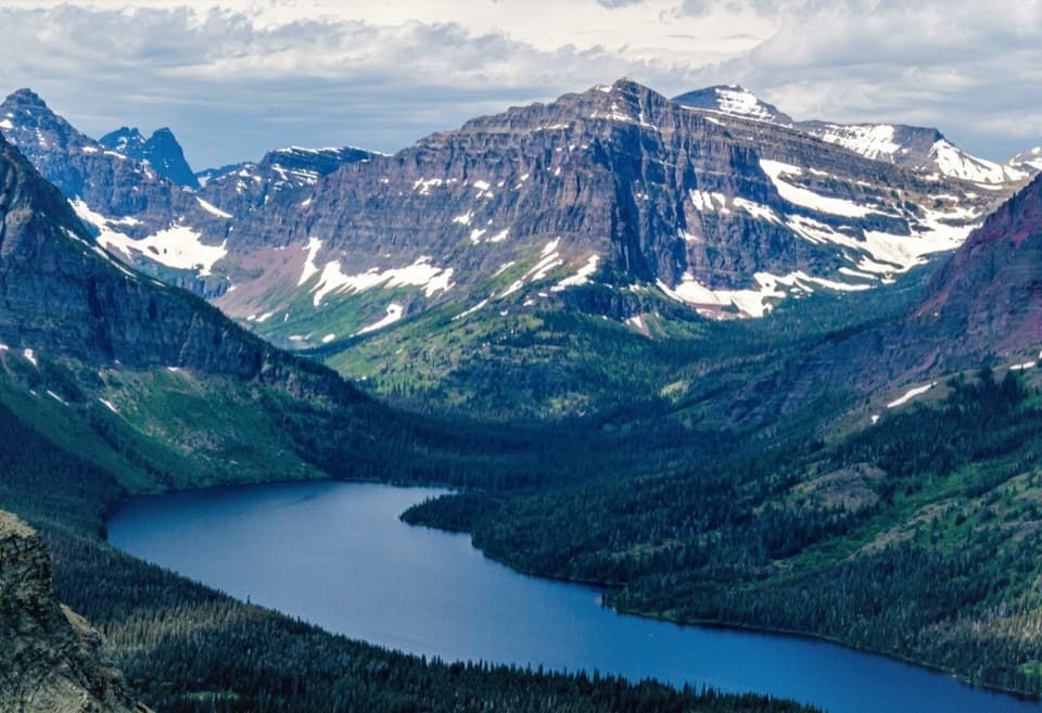
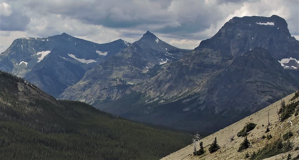
Firebrand Pass opens a long view south down Ole Creek and across the mountains between the Ole and Park Creek valleys. It is the route's defining panorama and the best place to frame a photograph looking down the valley. Below the pass, the trail spends much of its length in lodgepole forest, with occasional views toward Mount Despair and Peak 8888. Ole Lake and its backcountry campground are about 8.4 miles from Lubec; mosquitoes can be heavy there in summer.

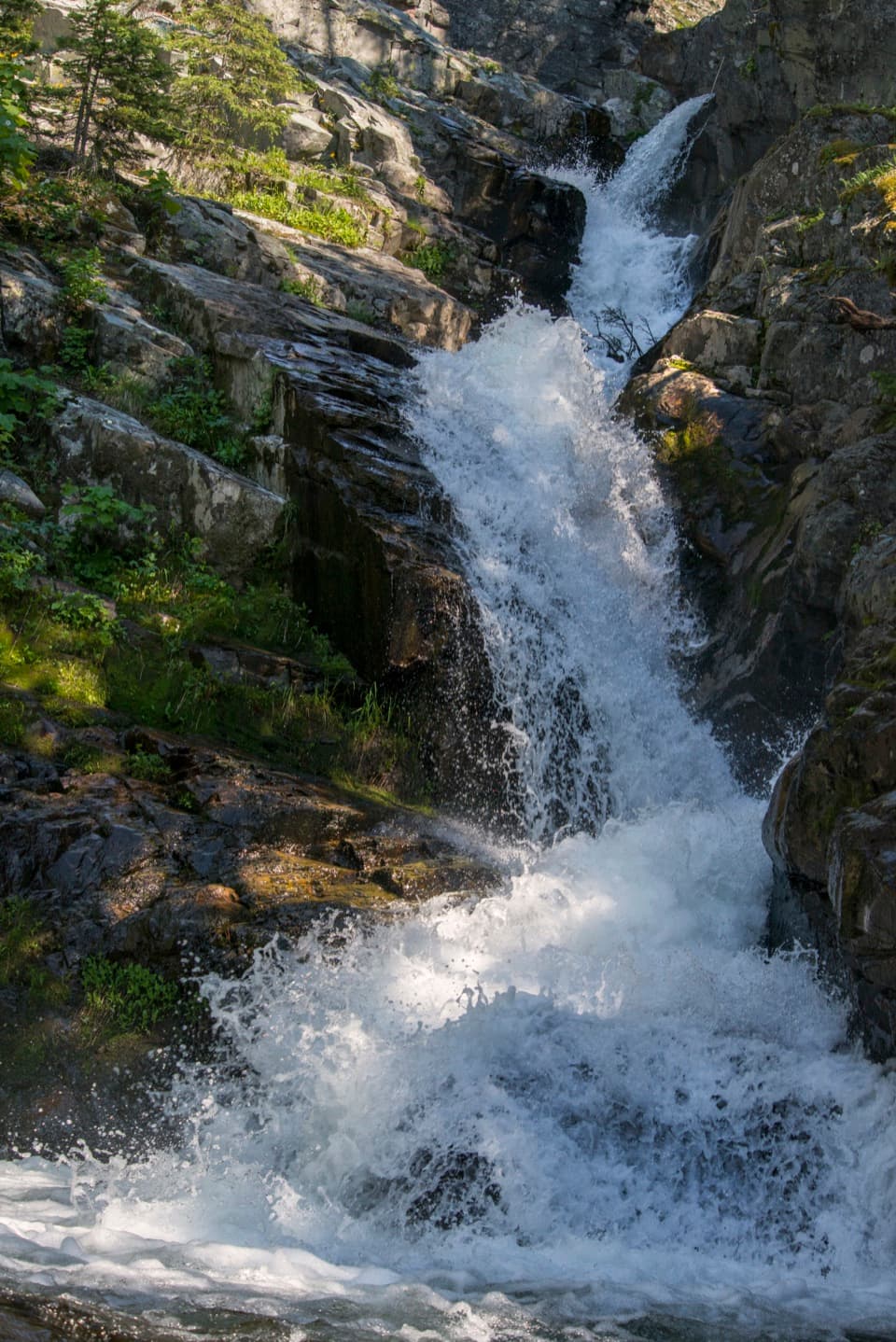
An unbridged Ole Creek ford comes around mile 13.4 and can be swift and cold early in the season. Ole Creek Campground and the Fielding Coal Creek junction are near mile 17.8. At the next junction toward Fielding and Coal Creek, continue straight to stay on the through route.

Reaching WaltonAround mile 23.9, turn left at the Boundary Trail junction toward Walton Ranger Station.

Around mile 23.9, turn left at the Boundary Trail junction toward Walton Ranger Station. The route crosses Ole Creek on a suspension bridge, then has about 1.1 miles left to the finish. Seasonal bridges on park trails are removed by late September, so check current trail status before relying on a crossing late in the season. Overnight backcountry camping requires a wilderness permit, and pets are not permitted on park trails.

Firebrand PassThe pass name recalls the 1910 fires, when burning branches blown over the pass inspired the…

The pass name recalls the 1910 fires, when burning branches blown over the pass inspired the term “firebrand”; about 120,000 acres burned in Glacier that year. If you want a shorter hike, Firebrand Pass is a 4.8-mile one-way climb from Lubec; turning around there makes a 9.6-mile out-and-back with about 2,210 feet of gain, rather than the full Ole Creek traverse.

Wildlife

Wildlife in Glacier

All Glacier wildlife maps

Sighting maps show where each species has been reported across Glacier. Wildlife moves, so no sighting is guaranteed.

Keep exploring

Near Ole Creek Trail

See it all on the map

Trails that start nearby

Places near the trailhead

Parkwolf’s Glacier ranking

Top-rated trails in Glacier

All 157 trails
  1. 1Highline TrailChallenging · 11.8 mi
  2. 2Grinnell Glacier TrailChallenging · 10 mi
  3. 3Iceberg Lake TrailModerate · 9.6 mi
  4. 4Hidden Lake Overlook TrailModerate · 2.6 mi
  5. 5Avalanche Lake TrailModerate · 5 mi
  6. 6Trail of the CedarsEasy · 0.9 mi

Take Parkwolf to Glacier.

The audio tour guide for the drive, plus offline maps, trails, and wildlife heatmaps for when the signal drops.

4.7 from 8,600+ ratings

Download Parkwolf on the App StoreGet Parkwolf on Google Play