Parking
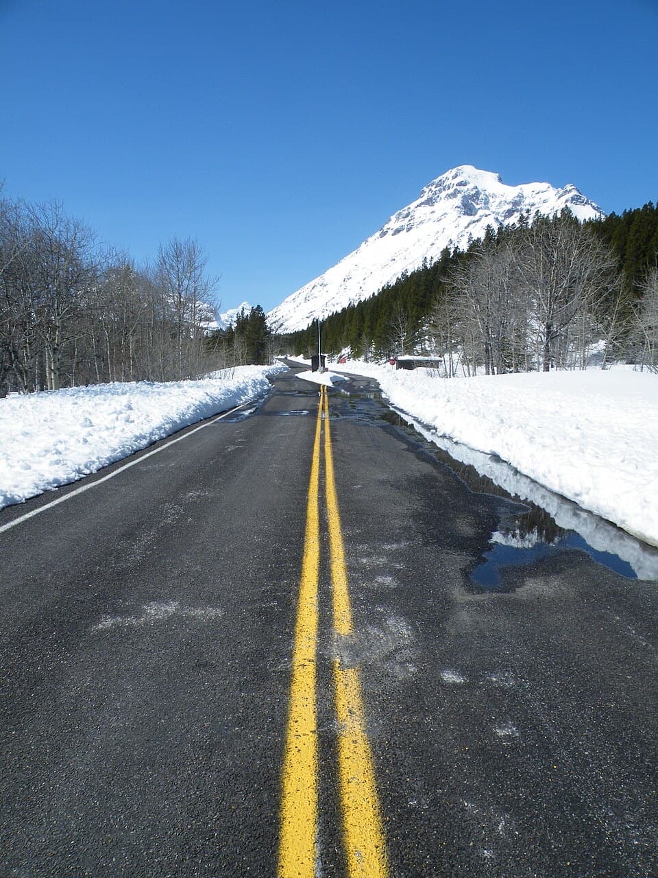
Use the Scenic Point Trailhead parking area on Two Medicine Road, about 0.3 miles east of the Two Medicine Ranger Station. The road closes to vehicles in winter.
#13 of 157 trails in Glacier
Glacier National Park, MT
Climb through weathered pines to a ledge above lakes and plains.
Overview
Map & elevation
Plan your hike

The highest, rockiest slopes around here are a summer buffet for grizzly bears.
Glacier Tour Guide
Parkwolf is a GPS audio tour guide for Glacier National Park. As you drive, it chimes in with what’s ahead: hidden gems, upcoming stops, history, geology, and wildlife, right through your car’s speakers.
See the Glacier audio tourRecorded for this trailhead
Scenic Point and Appistoki Falls“You're approaching Scenic Point parking, the starting point for Appistoki Falls and the much longer Scenic Point hike.”
Plays as you drive up to this trailhead in the Parkwolf Glacier Tour Guide.
More stories near here in the app
“Our first time to glacier and we used the audio portion for Going to the Sun Road. Wonderful information with perfect advice of what to see and do along the road.”


Trail guide
Scenic Point is a 7.6-mile out-and-back, 3.8 miles each way from the roadside Scenic Point Trailhead. Allow about 5½ hours for the mostly exposed climb, which gains roughly 2,259 feet. This is a hard half-day hike for a wide view, not a quick overlook or a casual lakeshore walk. Two Medicine Road closes to vehicles in winter, so the usual drive-up trailhead isn't available then; the park's winter access starts at the road gate.
At about 0.6 mile, a short side path leaves for Appistoki Falls. Stay on the Mt Henry route for Scenic Point. The broad saddle around 3.1 miles is sometimes mistaken for the destination, but the named viewpoint is farther along the ridge. Near 3.8 miles, take the unmarked left spur uphill to the ledge. Mt Henry Trail continues southeast toward East Glacier, so this is the turn that makes the shorter Scenic Point out-and-back.
The route starts through scrub and trees, bending around Appistoki Creek before the falls junction. Past it, switchbacks gain the east side of the valley. After about a mile, the last trees give way to talus and open meadow. The grade steepens on a cliff band near 1.6 miles; around 2 miles, weather-shaped whitebark pines stand above the switchbacks. Appistoki Peak and Mount Henry come into view as you climb, and the Two Medicine basin opens wider behind you.
The main switchbacks top out around 2.6 miles. From there the trail climbs southeast to the saddle, then traverses the ridge and crosses toward its eastern side. You can see the trail continuing past the Scenic Point turnoff, which helps explain why the mapped Mt Henry corridor is longer than this hike.
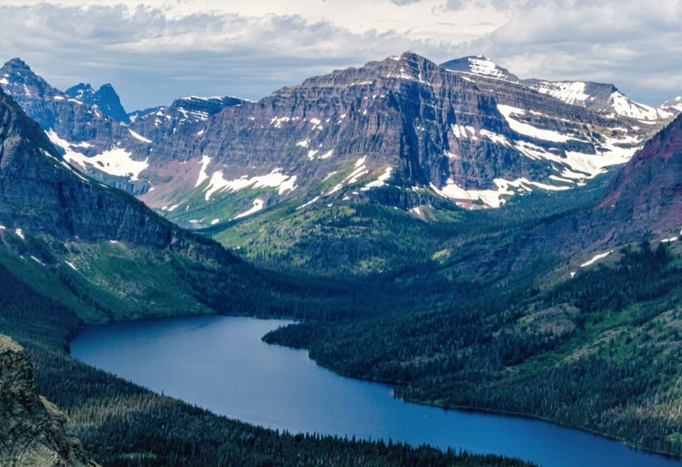
At the end, the rocky ledge looks west over Lower, Two Medicine and Upper Two Medicine lakes and their surrounding peaks. Turn east for Browning and the open plains; on clear days the view reaches toward East Glacier and the Bob Marshall Wilderness. The climb itself can make the stronger lake photograph: higher up, the water sits below the dark valley slopes with the peaks behind it. At the ledge, take in the plains as well as the lakes. Wind can be strong enough to shorten a stop.
The bleached whitebark pine skeletons are part of what makes the open slope feel so stark. These trees died from white pine blister rust or mountain pine beetles. They appear near the upper switchbacks, where the bare trunks stand against the valley and the peaks instead of blending into a forest.
The Mt Henry trail began as a 1913 connection between Glacier Park Lodge and Two Medicine Chalets, built by Great Northern Railway contractors. Scenic Point later had a locomotive bell: the Glacier Park Hotel Company installed it in 1929 after a request inspired by the custom of ringing bells on mountain passes. It was removed in fall 1943 for a wartime scrap-metal drive. There is no bell at the ledge now.
Wildlife
 404 sightingsGrizzly BearMost seen around 6 AMSighting map
 11 sightingsWolverineMost seen around 8 PMSighting map
 1,173 sightingsMountain GoatMost seen around 6 AMSighting map
 1,000 sightingsBighorn SheepMost seen around 6 AMSighting map
 395 sightingsMooseMost seen around 6 AMSighting map
 506 sightingsBlack BearMost seen around 8 PMSighting map
Sighting maps show where each species has been reported across Glacier. Wildlife moves, so no sighting is guaranteed.
Keep exploring
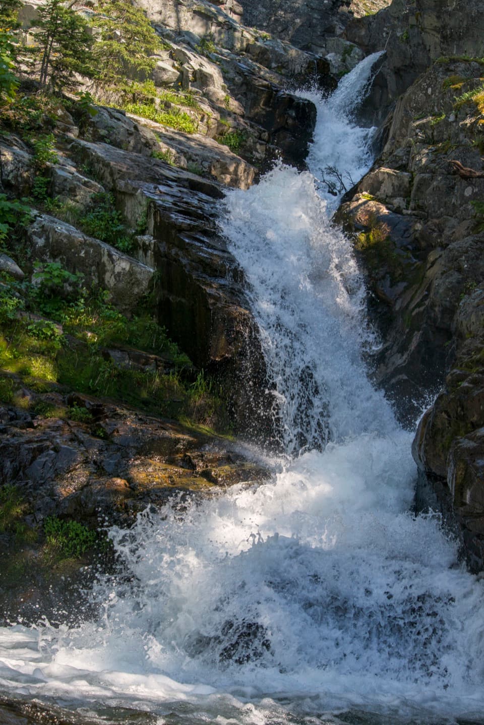 EasyAppistoki Falls Trail1.2 mi · 1 hr · At the trailheadA quick falls walk, with most of the gorge view screened.
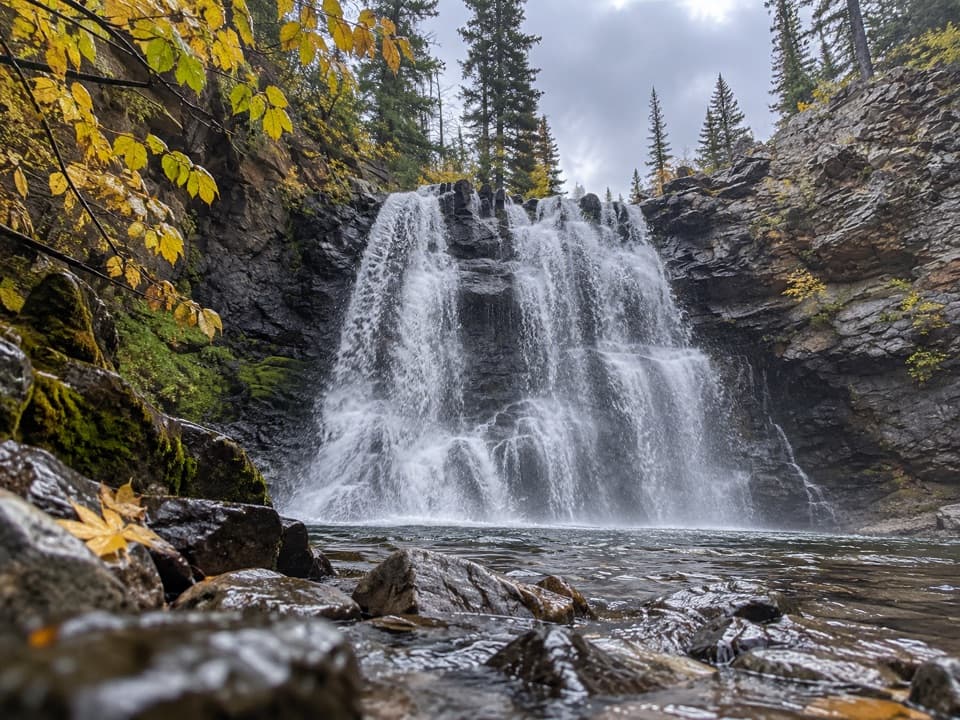 ModerateRockwell Falls Trail7 mi · 4 hr · 0.4 mi awayBeaver ponds and lake views set up two wooded cascades.
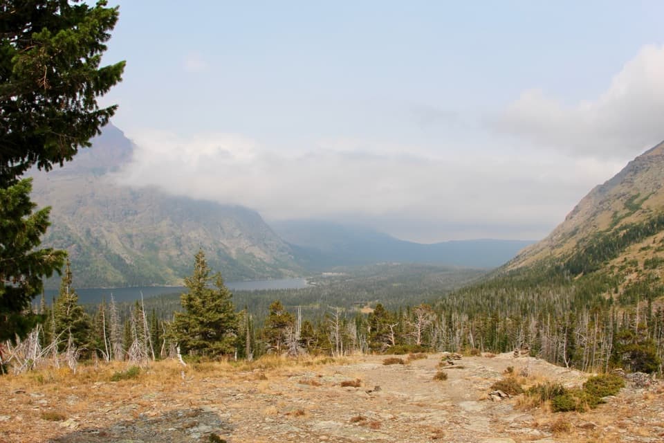 ModerateAster Park Trail4 mi · 3 hr · 0.4 mi awayA steep climb ends above Two Medicine Lake.
 EasyAster Falls Trail2.8 mi · 2 hr · 0.4 mi awayA forested walk to a tiered cascade beside Aster Creek.
 ChallengingCobalt Lake Trail11.6 mi · 7 hr · 0.4 mi awayWaterfalls and beaver ponds lead to a high alpine lake.
 ChallengingTwo Medicine Pass Trail16 mi · 10 hr · 0.4 mi awayA long climb from waterfalls and lake into a windy alpine pass.
 EasyParadise Point Trail1.2 mi · 45 min · 0.4 mi awayA short forest walk to a small beach on Two Medicine Lake.
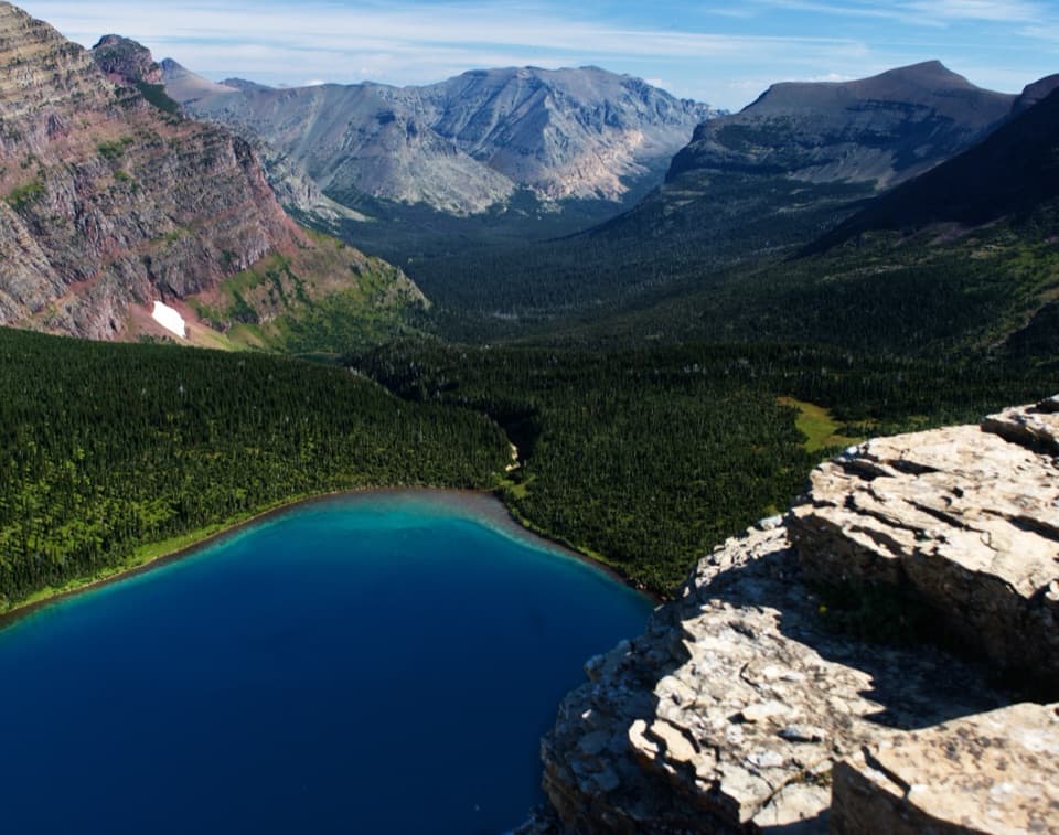 ChallengingDawson–Pitamakan Pass Loop17.4 mi · 10 hr · 0.5 mi awayTwo alpine passes and a narrow ridge make this a full day.
 Campground · 0.3 mi awayTwo Medicine CampgroundA shady lakeside base with hikes starting from camp.
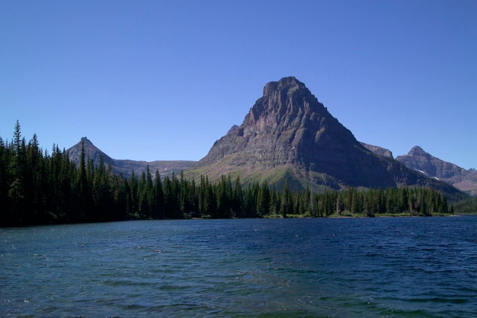 Sight · 0.4 mi awayTwo Medicine LakeA boat ride adds a fresh angle on Sinopah Mountain.
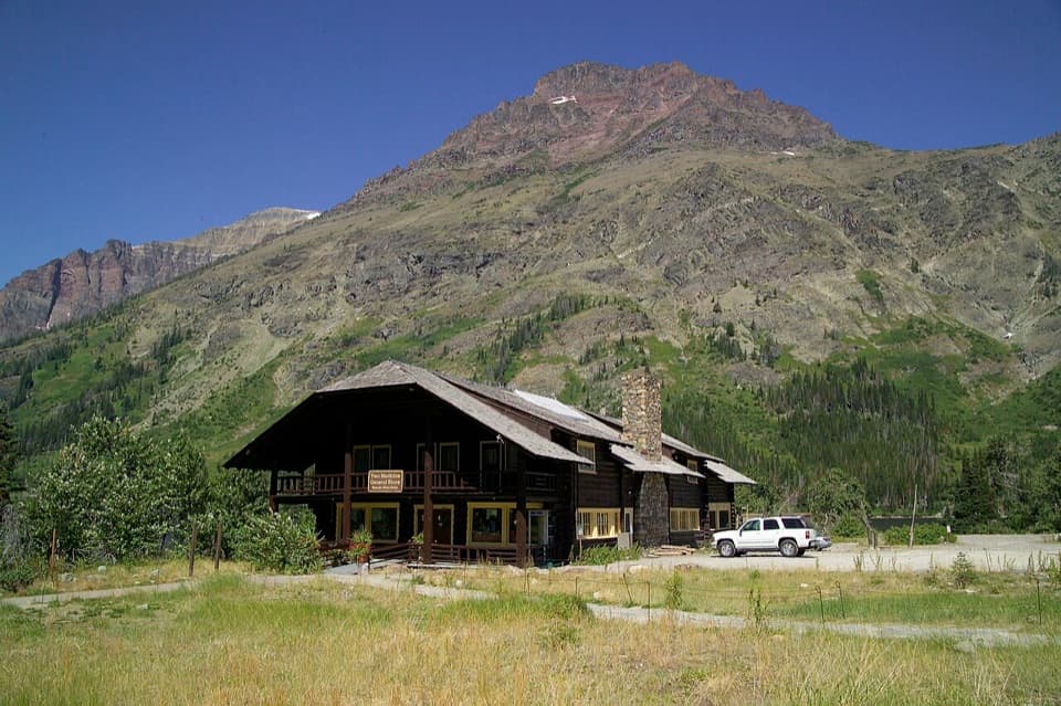 Store · 0.4 mi awayTwo Medicine CampstorePick up supplies in a historic chalet hall beside the lake.Sight · 0.5 mi awayAppistoki FallsA short waterfall walk with a partly screened view.Beach · 0.7 mi awayParadise PointA short walk to a small beach with striking Two Medicine views.
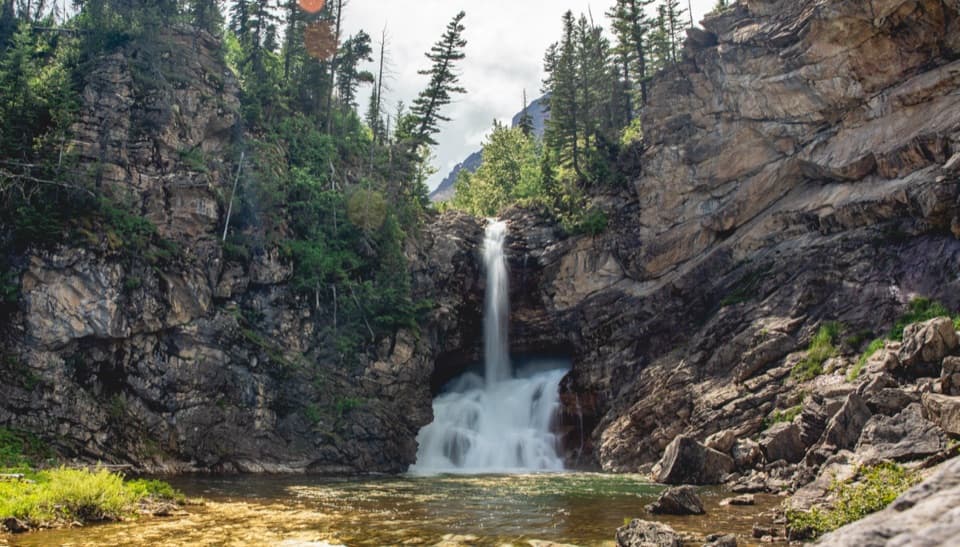 Sight · 1 mi awayRunning Eagle FallsSeasonal flow changes which tier of the falls shows.
 Sight · 1.1 mi awayAster FallsA forest walk to a 20-foot cascade in three drops.
 Entrance station · 2 mi awayTwo Medicine Entrance StationA separate entrance for Two Medicine's lake and trail area.
Parkwolf’s Glacier ranking

The audio tour guide for the drive, plus offline maps, trails, and wildlife heatmaps for when the signal drops.





