Parking
Start at Raspberry Creek car park at the end of the West Matukituki access road, about 54 km west of Wānaka. The final 30 km are gravel, with several fords in the last 10 km; heavy rain can make them impassable.

Mount Aspiring National Park, OT · WC
Long valley flats lead to a hut beneath the Southern Alps.
Overview
Map & elevation
Plan your hike

The highest, rockiest slopes around here are a summer buffet for grizzly bears.
Mount Aspiring Tour Guide
Parkwolf is a GPS audio tour guide for Mount Aspiring National Park. As you drive, it chimes in with what’s ahead: hidden gems, upcoming stops, history, geology, and wildlife, right through your car’s speakers.
See the Mount Aspiring audio tourRecorded for this trailhead
Raspberry Creek and Rob Roy Glacier“You're approaching Raspberry Creek car park, the start of the Rob Roy Glacier walk. For hanging glacier ice and waterfalls dropping from high cliffs, this is a walk I'd choose.”
Plays as you drive up to this trailhead in the Parkwolf Mount Aspiring Tour Guide.
More stories near here in the app
“Fantastic app with many points of information… It’s great to just turn on while you’re driving and it gives you an audio tour of the national Park. We love it!!!!”


Trail guide
Aspiring Hut Track is the Raspberry Creek to Aspiring Hut section of West Matukituki Track: 9 km each way, or 18 km (11.2 mi) out and back. The mapped line follows the valley to the hut once; you return on the same track. Allow 2–2.5 hours each way, or about four to five hours walking before breaks. The distance is the commitment more than the climb. Most of the approach crosses open grassed flats, with a couple of small bluffs, so it feels gentler than the mileage suggests. The hut makes a clear destination for a long day in the valley.
The marked route crosses private farmland before reaching conservation land. It follows grassy flats and climbs over a couple of small bluffs that are easy to negotiate. Views open up and down the valley from these higher spots. Stay on the marked track, leave gates as you found them, and give livestock room. No camping is allowed before the conservation land boundary. The wider West Matukituki route carries on beyond Aspiring Hut; this walk stops at the hut and turns back.
From the last bluff, the locked historic Cascade Hut comes into view. Aspiring Hut is about 20 minutes farther along, so don't mistake Cascade Hut for the overnight destination. The valley continues to feel open and spacious here, with the river flats below and steep mountain country rising around them.
Start at Raspberry Creek car park at the end of the West Matukituki access road, about 54 km and 1 hour 20 minutes west of Wānaka. The final 30 km are gravel, and several fords cross the last 10 km. These crossings can become impassable after heavy rain; after a dry spell they are usually manageable in a two-wheel-drive vehicle. Check road advice before the drive and never push through high or fast-rising water. Parking capacity and a fee were not confirmed, so plan around the named car park rather than roadside overflow.
Aspiring Hut has 32 bunks, heating, lighting and non-flush toilets. Bunks must be booked year-round for an overnight stay; day walkers do not need a bunk booking. Tap water is untreated and must be boiled. There is no food service on the walk, so bring what you need. Dogs are not permitted on this track.
Māori travelled from Foveaux Strait and coastal Otago to inland lakes to gather forest birds, and Kāti Māmoe and Kāi Tahu communities lived around Lakes Wānaka and Hāwea. Surveyor James Hector first explored West Matukituki in 1862, and farming began in the valley in the 1870s. The lower route still crosses working farmland, so the gates and livestock are part of the landscape visitors pass through, not a reason to leave the marked line.
The Southern Alps began forming more than 220 million years ago from seafloor sediment and rock later uplifted; glaciers then carved the valleys. The open flats and bluffs give you a good look at that broad valley shape. Red beech grows just below Aspiring Hut, and the valley's beech forest is home to small native birds such as the tītīpounamu, or rifleman; sightings are never guaranteed. For a photo, use the open flats or a bluff and keep the river or gravel foreground beneath the mountain wall. That gives the frame the same sense of scale the walk has on foot.
Wildlife
 60 sightingsKeaMost seen around 5 PMSighting map
 112 sightingsRockwrenMost seen around 8 AMSighting map
 26 sightingsYellowheadMost seen around 8 AMSighting map
 13 sightingsTūīMost seen around 7 AMSighting map
 27 sightingsBellbirdMost seen around 7 AMSighting map
 35 sightingsRiflemanMost seen around 8 AMSighting map
Sighting maps show where each species has been reported across Mount Aspiring. Wildlife moves, so no sighting is guaranteed.
Keep exploring
 ModerateRob Roy Track10 km · 4.5 hr · At the trailheadA swingbridge, beech forest and glacier views reward the climb.
 ChallengingLiverpool Track30 km · 13 hr · At the trailheadA long, exposed climb to a hut above Matukituki Valley.
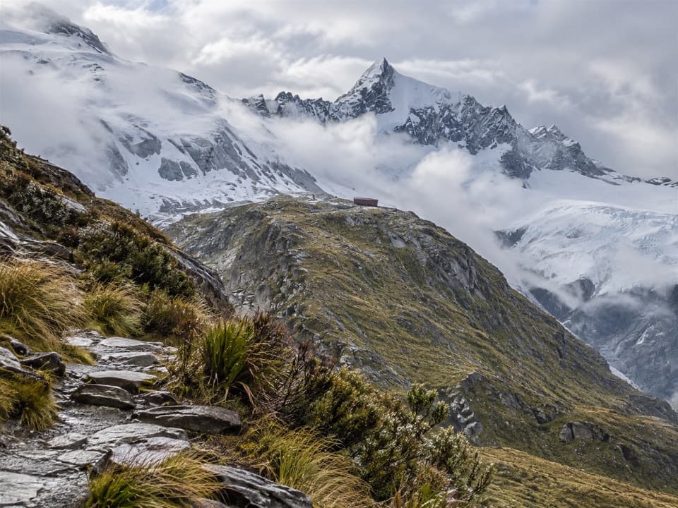 ChallengingFrench Ridge Track32.4 km · 13.5 hr · At the trailheadClimb from grassy valley flats to a hut above the alpine bushline.
 ChallengingWest Matukituki Track34.4 km · 11.5 hr · At the trailheadA long out-and-back into the upper West Matukituki Valley.
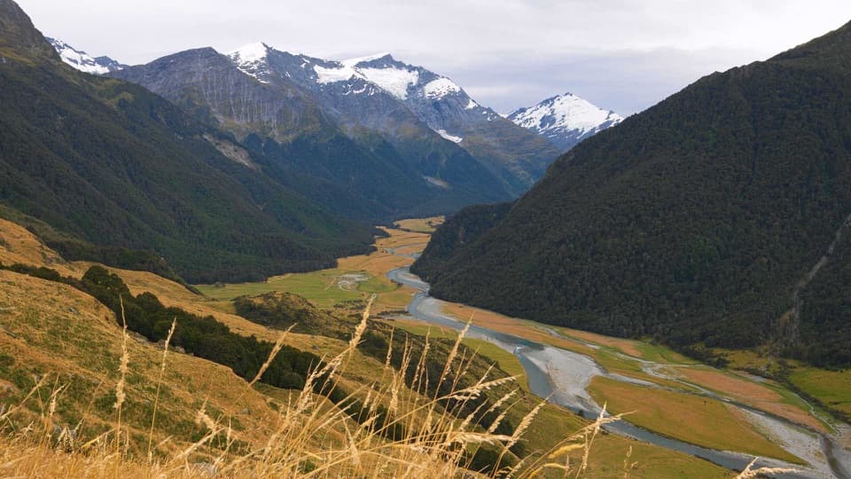 ChallengingShotover Saddle Route16 km · 9 hr · At the trailheadA steep, rough climb to a tarn shelf above the West Matukituki.
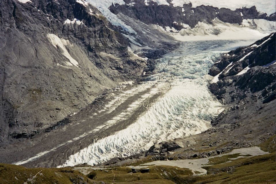 ChallengingCascade Saddle Route25 km · 12.5 hr · At the trailheadAn expert alpine crossing above the Dart Glacier.
 ChallengingKitchener Track to Aspiring Flats30 km · 11 hr · 3.7 km awayA rough, full-day route to a big Kitchener Cirque view
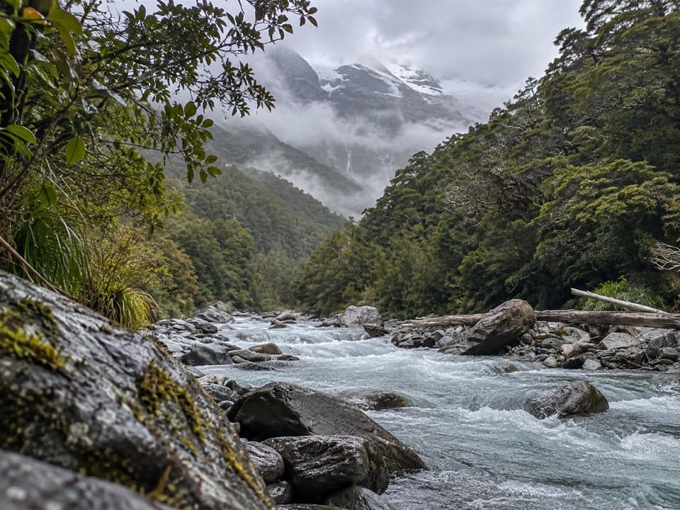 ChallengingGlacier Burn Track (East Matukituki)14 km · 5 hr · 3.7 km awayA long valley tramp to Glacier Burn and an Avalanche Glacier view.
 Sight · 2.1 km awayWishbone FallsA tall branching waterfall breaks up the long valley drive.
 Sight · 3.8 km awayRob Roy GlacierA glacier view worth a long walk and a rough drive.
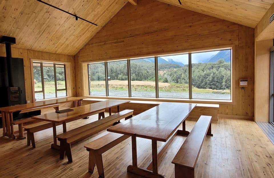 Lodging · 7.6 km awayAspiring HutA historic stone hut reached by a two-hour valley walk.
 Campground · 7.7 km awayAspiring CampsiteBackcountry tent camping beside a historic stone-walled hut.
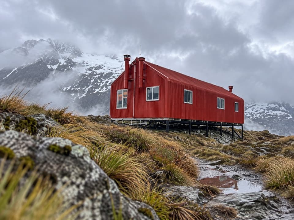 Lodging · 9.9 km awayFrench Ridge HutA high alpine hut for serious Mount Aspiring climbs.
 Lodging · 10.8 km awayLiverpool HutA red alpine hut earned by a steep, exposed climb.
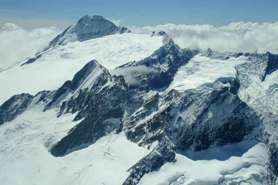 Sight · 14.1 km awayMount Aspiring / TititeaA 3,033 m horn for mountaineers, not day hikers.
 Lodging · 15 km awayDart HutA remote hut beneath walls from the Dart Glacier's former reach.
Parkwolf’s Mount Aspiring ranking

The audio tour guide for the drive, plus offline maps, trails, and wildlife heatmaps for when the signal drops.




