Chelan Summit Trail in North Cascades National Park

North Cascades National Park, WA

Chelan Summit Trail

Open larch meadows climb to a remote high-country pass.

Length
2.4mi
Time
2hr
Elev. change
745ft
Difficulty
Moderate
  • No dogs
  • High point 7,224 ft
Parkwolf audio tour83 stories across North Cascades’s roads

Overview

About Chelan Summit Trail

Why go

  • Open meadow and larch scenery with high-country views
  • Links into longer Sawtooth Wilderness routes

Heads up

  • The trail segment is remote; reaching it requires a long backcountry approach

Map & elevation

The route

Loading the North Cascades map
Full map
Elevation6,480–7,224 ft
TrailheadSummit Trail junction beyond Juanita Lake48.32092, -120.58799
Keep this map with you offline in the Parkwolf app

Plan your hike

Before you go

Parking

No vehicle access at the start beyond Juanita Lake. Reach the basin on foot via the 8-mile approach from Stehekin Landing or the 9.3-mile War Creek Trail from Twisp River Road. A Northwest Forest Pass or America the Beautiful pass is required at War Creek.

Best time to go

Snow can cover the trails around Juanita Lake into early July and make route-finding difficult. Larch needles turn yellow in autumn. Juanita Lake’s meadows are fragile, so stay on the tread or other durable surfaces. Pets are not allowed on this National Park segment.

Safety

Snow may cover the route into early July and complicate route-finding. Stay on durable surfaces around Juanita Lake’s fragile meadows. Pets are prohibited on this National Park segment.

7 active North Cascades alerts

  • InfoLimited services at Stehekin Landing after flood damageMentions Stehekin Landing, referenced in this guideSome services at Stehekin Landing remain limited after the December 2025 flood damaged the wastewater treatment plant and other basic infrastructure.Official details
  • ClosureWildfire closures and Stehekin fire advisoryWildfire-related closures remain in effect; stay out of all closed trails, camps, and areas.Official details
See all 7 alerts
A park ranger sits on a dash-mounted phone, talking, as Parkwolf’s Tour Guide plays “Army Cutworm Moths: A Grizzly Bear Buffet” on Grand Loop Road below Dunraven Pass in Yellowstone
Parkwolf Tour GuideThe highest, rockiest slopes around here are a summer buffet for grizzly bears.

North Cascades Tour Guide

Your drive to Chelan Summit Trail, narrated.

Parkwolf is a GPS audio tour guide for North Cascades National Park. As you drive, it chimes in with what’s ahead: hidden gems, upcoming stops, history, geology, and wildlife, right through your car’s speakers.

See the North Cascades audio tour

More stories near here in the app

  • Stehekin Landing and Golden West
  • The Garden: Stehekin's Farm Stand
  • Stehekin Pastry Company: Cinnamon Rolls and Coffee
  • Rainbow Loop: A Traverse with Lake Views
  • 83 audio storiesacross North Cascades’s roads, triggered by GPS as you drive
  • Wildlife heatmapsfor Mountain Goat, Black Bear, Mule Deer, and 10 more
  • Works offlinemaps, 88 trails, 76 places, and audio download before you lose signal
  • CarPlay readysimple controls built for the drive
★★★★★
“Fantastic app with many points of information… It’s great to just turn on while you’re driving and it gives you an audio tour of the national Park. We love it!!!!”
JMJamesApp Store review
Download Parkwolf on the App StoreGet Parkwolf on Google Play

4.7 from 8,600+ ratings

Trail guide

Hiking Chelan Summit Trail

What this segment coversThis is a 2.

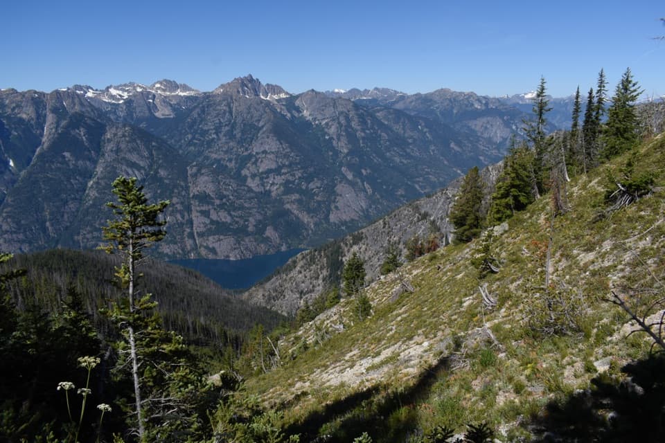
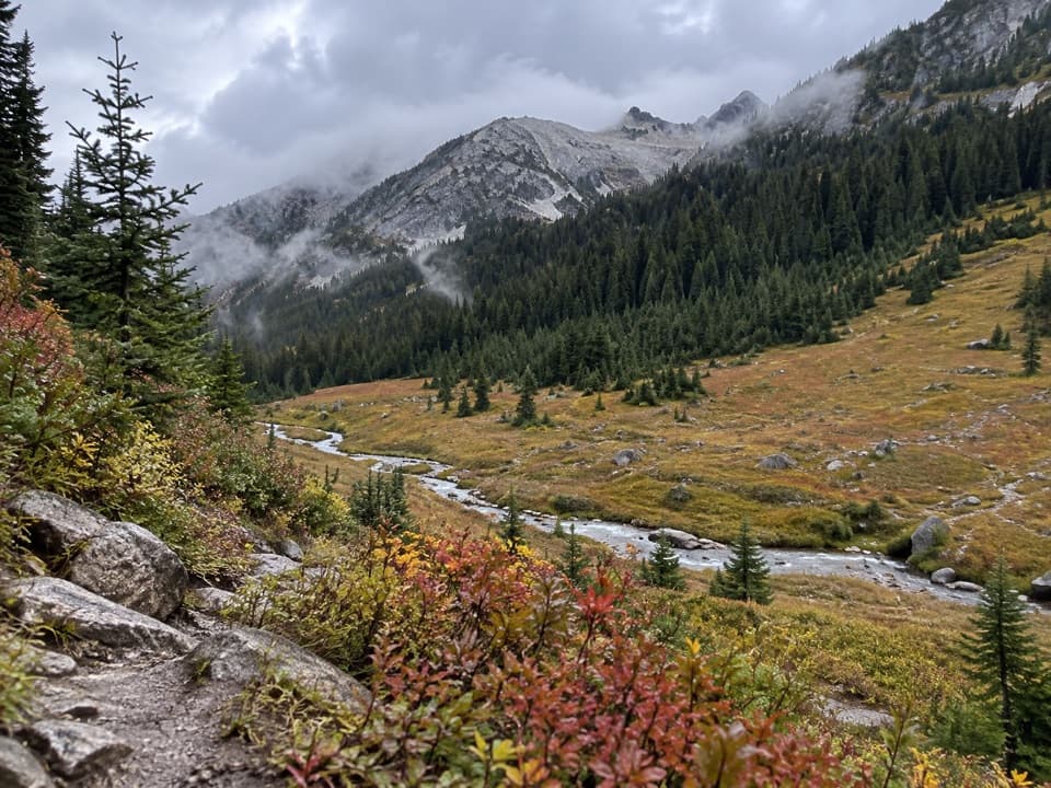
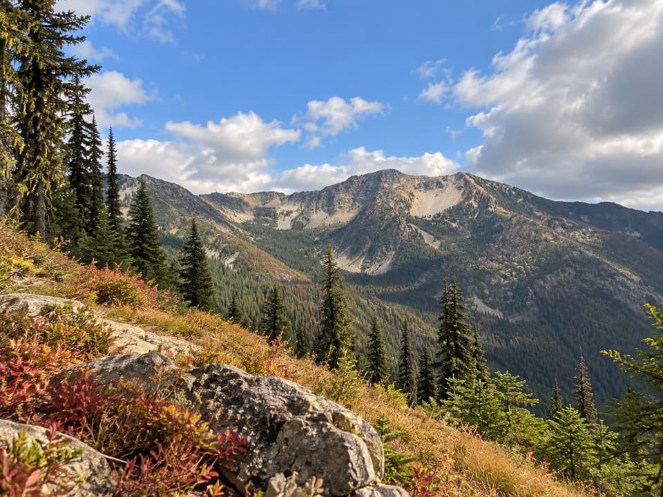
This is a 2.4-mile one-way point-to-point section from the Summit Trail junction just beyond Juanita Lake to a high pass at the North Cascades boundary. It crosses open meadow and larch country before a steeper rise to the pass, where the views open across the surrounding high country. Budget about two hours for this segment. Returning to Juanita Lake the same way makes it 4.8 miles.

The climbThe route starts in the Juanita Lake basin and gradually traverses south through meadows, larch…

The route starts in the Juanita Lake basin and gradually traverses south through meadows, larch stands and some whitebark pine. The grade steepens near the pass. This is a short but high-elevation section, best understood as part of a longer backcountry itinerary; the route beyond the boundary continues into the Lake Chelan–Sawtooth Wilderness.

Reaching the startJuanita Lake has no road access.

Juanita Lake has no road access. From Stehekin Landing, the approach via Imus and Purple Creek is about 8 miles with 5,800 feet of gain. The alternative War Creek Trail approach from Twisp River Road is 9.3 miles with 3,600 feet of gain. Those are separate approach miles, not part of this 2.4-mile segment. Overnight camping at the lake requires a limited backcountry permit, and campfires are not allowed.

Wildlife

Wildlife in North Cascades

All North Cascades wildlife maps

Sighting maps show where each species has been reported across North Cascades. Wildlife moves, so no sighting is guaranteed.

Keep exploring

Near Chelan Summit Trail

See it all on the map

Trails that start nearby

Places near the trailhead

Parkwolf’s North Cascades ranking

Top-rated trails in North Cascades

All 88 trails
  1. 1Sahale Arm TrailChallenging · 11.8 mi
  2. 2Cascade Pass TrailModerate · 7.4 mi
  3. 3Heather–Maple Pass LoopChallenging · 7.2 mi
  4. 4Hidden Lake TrailChallenging · 9 mi
  5. 5Copper Ridge / Chilliwack River LoopChallenging · 33.5 mi
  6. 6Thunder Knob TrailModerate · 3.8 mi

Take Parkwolf to North Cascades.

The audio tour guide for the drive, plus offline maps, trails, and wildlife heatmaps for when the signal drops.

4.7 from 8,600+ ratings

Download Parkwolf on the App StoreGet Parkwolf on Google Play