Overview
About Warumbul Picnic Area
Why stop
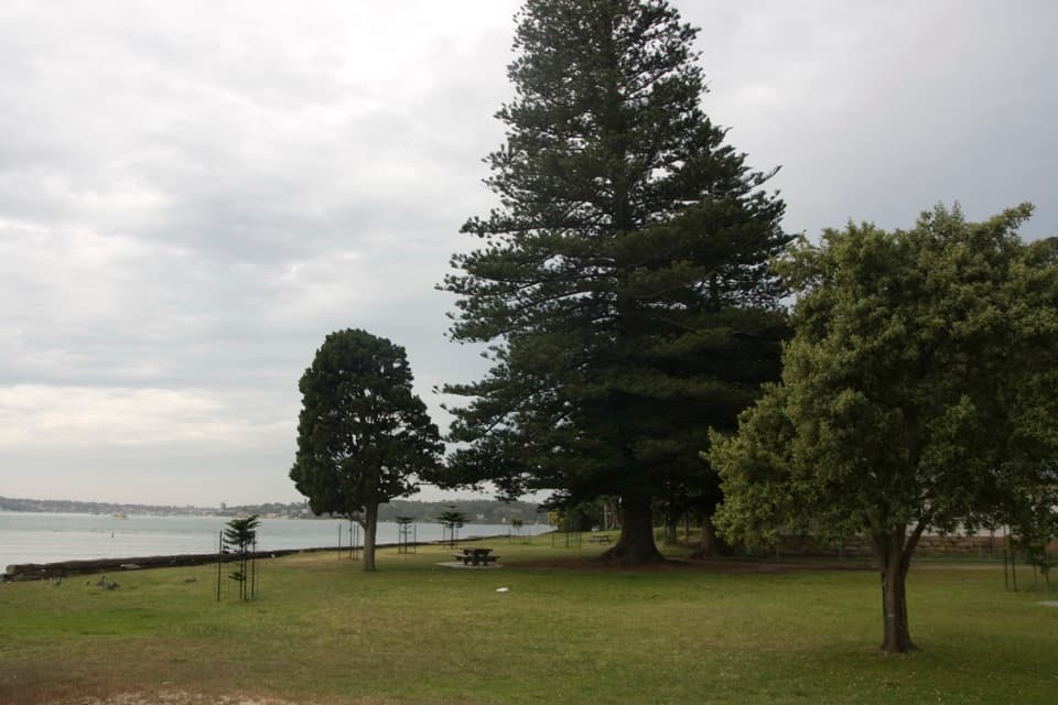
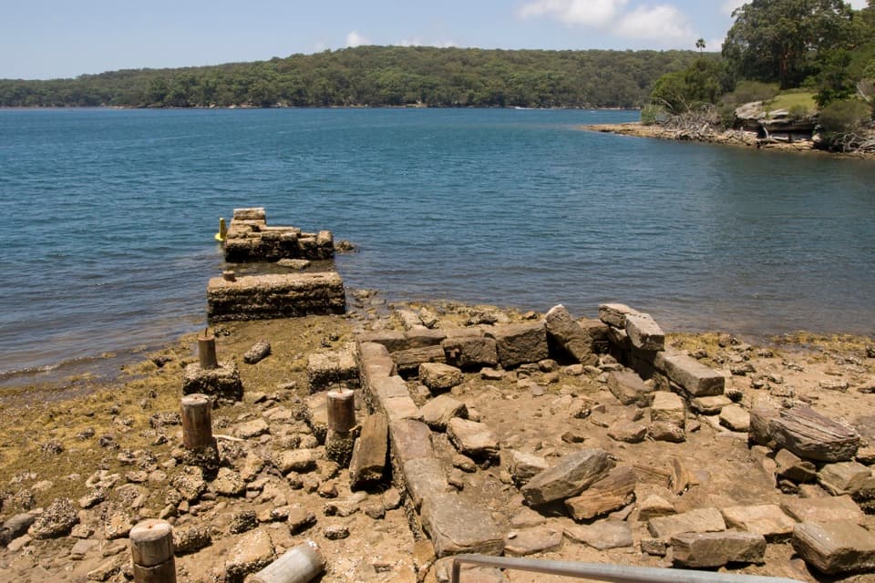
- Bush-framed water views reach toward Gooseberry Bay and Costens Point.
Heads up
- The unsealed access road needs 4WD in wet weather.
Map
Where it is

The highest, rockiest slopes around here are a summer buffet for grizzly bears.
Royal Tour Guide
Your drive to Warumbul Picnic Area, narrated.
Parkwolf is a GPS audio tour guide for Royal National Park. As you drive, it chimes in with what’s ahead: hidden gems, upcoming stops, history, geology, and wildlife, right through your car’s speakers.
See the Royal audio tourRecorded for this place
Warumbul Picnic Area and South West Arm“Warumbul Picnic Area is ahead, with tables overlooking South West Arm toward Gooseberry Bay and Costens Point.”
Plays as you drive up to Warumbul Picnic Area in the Parkwolf Royal Tour Guide.
More stories near here in the app
- An Echidna’s Prickly Nursery
- Costens Point Walk to the Shore
- A Humpback’s Tail Signature
- How Rusa Deer Got Here
- 43 audio storiesacross Royal’s roads, triggered by GPS as you drive
- Wildlife heatmapsfor Humpback Whale, White-bellied Sea-Eagle, Koala, and 13 more
- Works offlinemaps, 69 trails, 58 places, and audio download before you lose signal
- CarPlay readysimple controls built for the drive
“Fantastic app with many points of information… It’s great to just turn on while you’re driving and it gives you an audio tour of the national Park. We love it!!!!”


Guide
More about Warumbul Picnic Area
Picnic beside South West ArmWarumbul is a bushland picnic area on South West Arm, on the northern shore of Port Hacking.
Warumbul is a bushland picnic area on South West Arm, on the northern shore of Port Hacking. The tables look across the water toward Gooseberry Bay and Costens Point. NPWS describes a short walk to the picnic area, with the shoreline there to explore after lunch. Keep it in mind for a slower meal and a change of pace from the park's beaches.
The drive inFrom Audley, cross Audley Weir, follow Sir Bertram Stevens Drive for about 2 km, then turn onto…
From Audley, cross Audley Weir, follow Sir Bertram Stevens Drive for about 2 km, then turn onto Warumbul Road. At Rathane Road, continue through the gate on the unsealed access road. Two-wheel drive is listed for dry conditions; four-wheel drive is required in wet weather, and long vehicles can't use the road. Parking may be limited on weekends. The site has picnic tables, flush toilets and drinking water.
A sit-and-look stopThe ground slopes unevenly toward the water, with little level space for children to run around.
The ground slopes unevenly toward the water, with little level space for children to run around. This suits a meal and a short look along the shore better than spreading out for games.
Wildlife
Wildlife in Royal
 56 sightingsHumpback WhaleMost seen around 11 AMSighting map
 70 sightingsWhite-bellied Sea-EagleMost seen around 9 AMSighting map
 12 sightingsKoalaMost seen around 6 PMSighting map
 34 sightingsJavan RusaMost seen around 6 PMSighting map
 70 sightingsShort-beaked EchidnaMost seen around 5 PMSighting map
 11 sightingsRed FoxMost seen around 5 PMSighting map
Sighting maps show where each species has been reported across Royal. Wildlife moves, so no sighting is guaranteed.