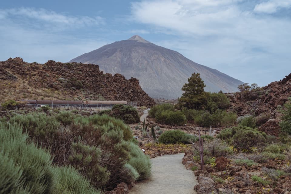
PR-TF 41 Playa del Socorro–La Rambleta Trail in Teide National Park

Teide National Park, TF

PR-TF 41 Playa del Socorro–La Rambleta Trail

A sea-level start for a 3,619 m climb to La Rambleta.

Photo: Wikimedia Commons
Length
26.5km
Time
14.5hr
Elev. change
3,550m
Difficulty
Challenging
  • No dogs
  • High point 3,550 m
  • #22 of 62 in Teide
Parkwolf audio tour39 stories across Teide’s roads

Overview

About PR-TF 41 Playa del Socorro–La Rambleta Trail

Why go

  • A full crossing from Tenerife’s north coast into high volcanic terrain
  • Views open at La Corona, El Asomadero and La Rambleta

Heads up

  • A 14½-hour one-way climb with 3,619 m of ascent
  • The shared PNT 07 section needs advance authorization and mandatory gear

Map & elevation

The route

Loading the Teide map
Full map
Elevation0–3,550 m
TrailheadPlaya del Socorro, Los Realejos28.39369, -16.60358
Keep this map with you offline in the Parkwolf app

Plan your hike

Before you go

Parking

Start at Playa del Socorro’s beach promenade, where the route authority lists a parking area with reserved spaces for people with reduced mobility. This is a one-way route ending at La Rambleta, so arrange a legal descent or transfer before setting off.

Safety

This is an extreme high-mountain ascent with steep gradients, loose and unstable ground, fall risk, rapid temperature changes and reduced oxygen at 3,555 m. The PNT 07 section requires advance authorization and mandatory mountain equipment; hikers without the required gear can be turned back. The park conditions access to the Teide stratovolcano sector on weather and limits it to experienced mountaineers with a responsible declaration. Pets are prohibited on PNT 07 except guide dogs. The PNT 10 summit spur beyond La Rambleta is separate and needs its own authorization. Plan your descent from the upper station before starting. The route is officially classified as inaccessible to people with reduced mobility.

3 active Teide alerts

  • CautionControlled foot access to La RambletaMentions La Rambleta, referenced in this guideTenerife ON currently lists provisional surveillance, supervision and control for visitors ascending on foot to La Rambleta, the Teide cable-car upper station.Official details
  • CautionActive wildfire risk and preventive measuresTenerife ON currently lists wildfire risk and preventive wildfire measures; check the live restrictions before visiting Teide National Park.Official details
See all 3 alerts
A park ranger sits on a dash-mounted phone, talking, as Parkwolf’s Tour Guide plays “Army Cutworm Moths: A Grizzly Bear Buffet” on Grand Loop Road below Dunraven Pass in Yellowstone
Parkwolf Tour GuideThe highest, rockiest slopes around here are a summer buffet for grizzly bears.

Teide Tour Guide

Your drive to PR-TF 41 Playa del Socorro–La Rambleta Trail, narrated.

Parkwolf is a GPS audio tour guide for Teide National Park. As you drive, it chimes in with what’s ahead: hidden gems, upcoming stops, history, geology, and wildlife, right through your car’s speakers.

  • 39 audio storiesacross Teide’s roads, triggered by GPS as you drive
  • Wildlife heatmapsfor Short-finned Pilot Whale, Tenerife Lizard, West Canary Skink, and 10 more
  • Works offlinemaps, 62 trails, 49 places, and audio download before you lose signal
  • CarPlay readysimple controls built for the drive
★★★★★
“Fantastic app with many points of information… It’s great to just turn on while you’re driving and it gives you an audio tour of the national Park. We love it!!!!”
JMJamesApp Store review
Download Parkwolf on the App StoreGet Parkwolf on Google Play

4.7 from 8,600+ ratings

Trail guide

Hiking PR-TF 41 Playa del Socorro–La Rambleta Trail

The full ascentPR-TF 41 is a 26.

PR-TF 41 is a 26.5 km one-way climb from sea level at Playa del Socorro to La Rambleta, beside Teide’s upper cable-car station at 3,555 m. The park’s estimate is 14½ hours, with 3,619 m of ascent and very little descent. This is an extreme mountain day for fit, experienced hikers who are ready for altitude; it is not a short way to reach the summit. The route ends at La Rambleta, not Teide’s peak, and it is not a loop. Work out how you will descend before setting off.

The final approach shares the PNT 07 trail from Montaña Blanca to La Rambleta, which requires advance authorization and specific mountain equipment; the rest of Route 040 is listed as free access without a reservation. The separate PNT 10 path from La Rambleta to Teide’s summit needs another authorization and is not part of this route. Keep those two permit steps clear when planning; the summit is beyond this trail’s finish.

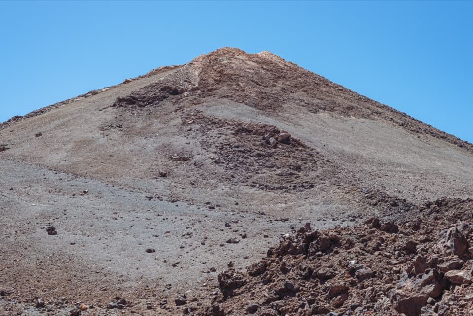
Coast to TigaigaThe route begins on the black sand at Playa del Socorro, then climbs the rural slopes of…

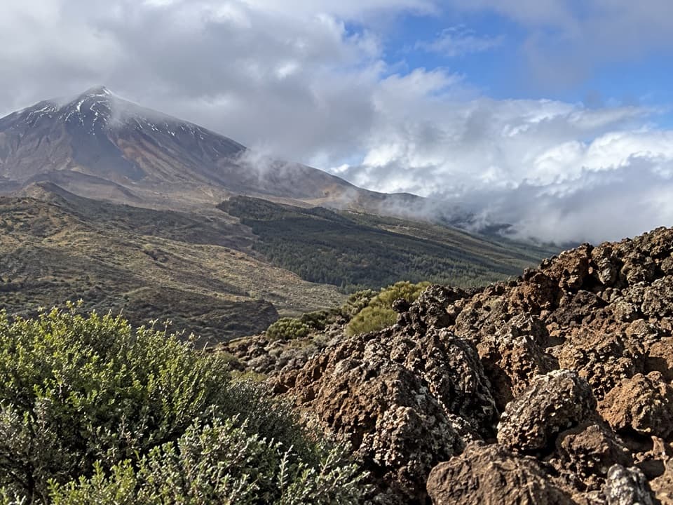
The route begins on the black sand at Playa del Socorro, then climbs the rural slopes of Tigaiga. The first viewpoints are La Corona, above Risco Blanco, and El Asomadero at about 1,100 m. El Asomadero is where Teide and the Orotava Valley open up together, a striking change from the coast behind you. The climb is already steep here, so settle into a pace you can keep for hours.

Through the pine forestHigher up, the path enters the Corona Forestal and winds through dense Canarian pine toward El…

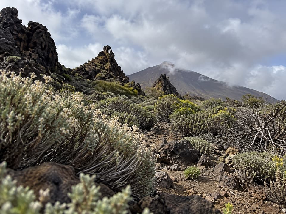
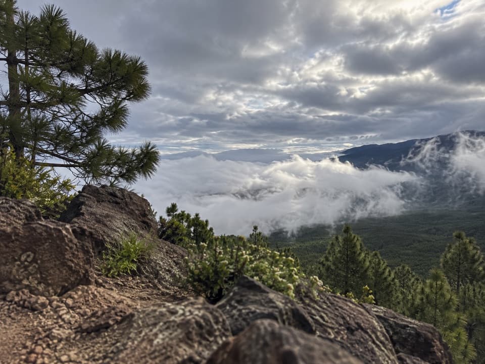
Higher up, the path enters the Corona Forestal and winds through dense Canarian pine toward El Cabezón, around 2,172 m. The forest thins into high-mountain scrub as you enter the national park. At El Cabezón, the PR-TF 41.1 branch heads toward Portillo Alto; stay on the main route for the long ascent to La Rambleta. The park warns of loose rock, uneven ground and steep slopes, so this is a route where tired legs and rushed footing matter.

La Fortaleza and the high approachLa Fortaleza, roughly 2,190 m, is a long reddish and ochre ridge made of phonolitic lava.

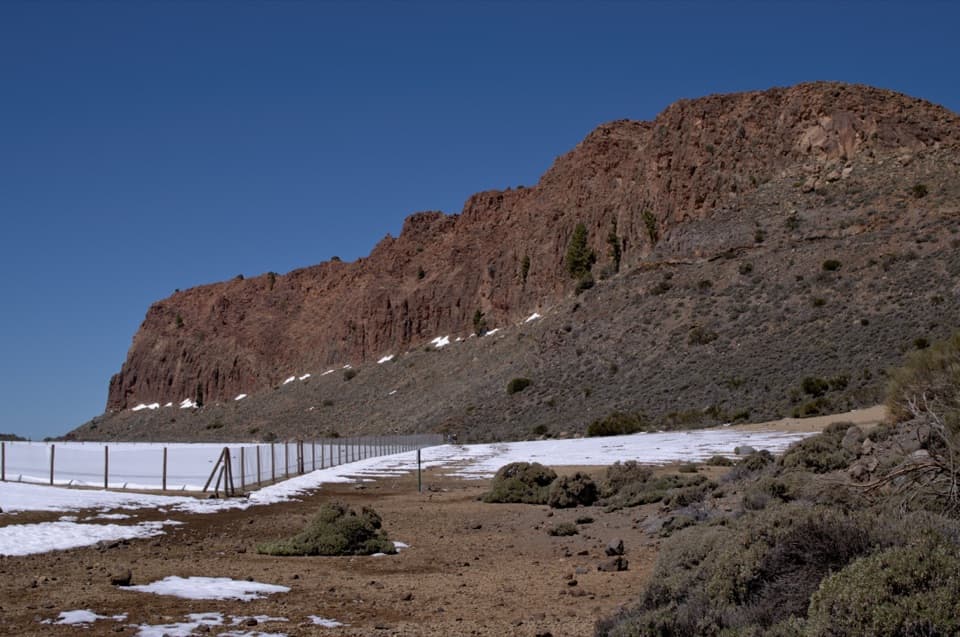
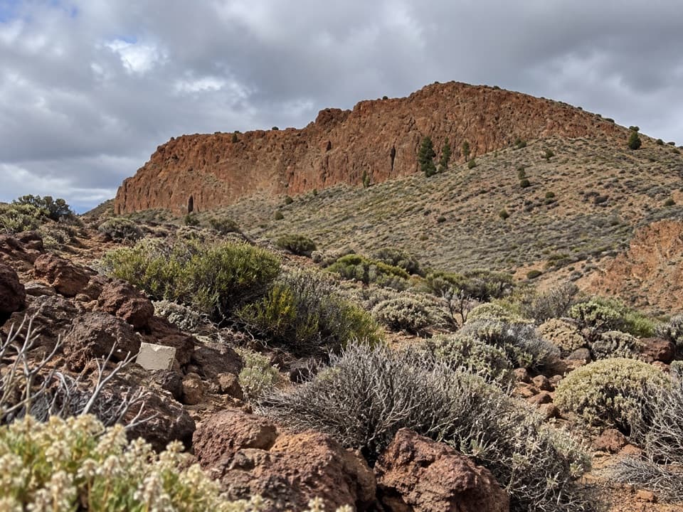
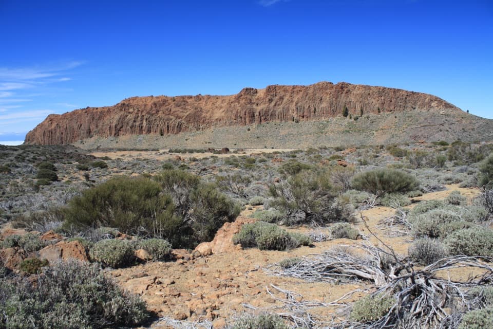
La Fortaleza, roughly 2,190 m, is a long reddish and ochre ridge made of phonolitic lava. Local accounts describe it as the remnant of the older Las Cañadas volcanic edifice. Beyond it, the route climbs into open volcanic terrain, then follows the authorized PNT 07 corridor to La Rambleta. Conditions change quickly at this height: the park conditions access in the Teide stratovolcano sector on weather and limits it to experienced mountaineers with a responsible declaration. PNT 07 also prohibits pets except guide dogs. Its required gear includes mountain footwear, long trousers, warm layers, an emergency blanket, hat and gloves, water, a charged phone and a torch; missing equipment can mean denied entry.

Old paths with a modern nameThe route opened in 2020 after restoration of historic paths that linked Los Realejos…

The route opened in 2020 after restoration of historic paths that linked Los Realejos farmsteads and hamlets with Las Cañadas and the south of Tenerife. Eighteenth-century scientists and naturalists also crossed Los Realejos on their way from Puerto de la Cruz to Teide, leaving accounts of the landscape, plants and local guides. The climb is demanding, but it follows a much older way through the island.

Reaching La RambletaLa Rambleta is a broad volcanic platform formed when later Teide eruptions buried an older…

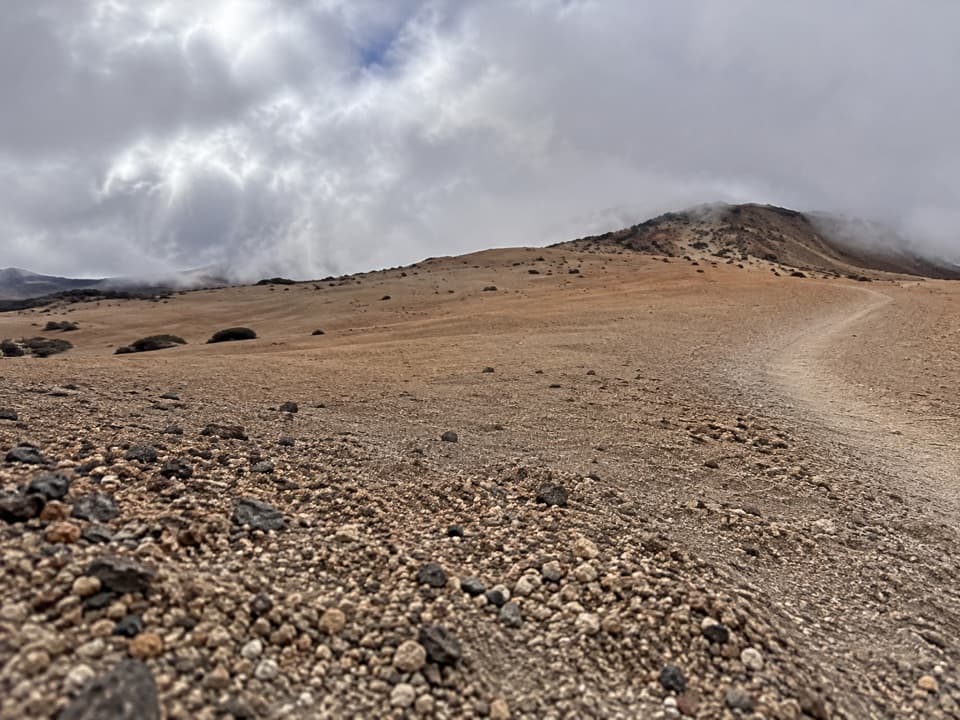
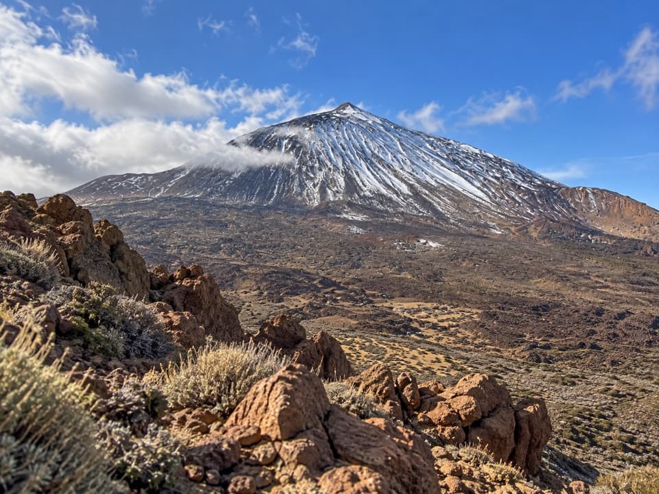
La Rambleta is a broad volcanic platform formed when later Teide eruptions buried an older crater. From the endpoint, look across the park from the cable-car station’s public viewpoint; the bare slopes and Teide’s cone make this the route’s signature view. A water vending machine is documented at the upper station, but it works only when the cable car is operating and may run out, so do not count on it during the ascent. Playa del Socorro has beach bars and restaurants, toilets, showers and promenade parking for the start. The 630 m summit path begins beyond La Rambleta and is a separate, permit-controlled hike.

Wildlife

Wildlife in Teide

All Teide wildlife maps

Sighting maps show where each species has been reported across Teide. Wildlife moves, so no sighting is guaranteed.

Keep exploring

Near PR-TF 41 Playa del Socorro–La Rambleta Trail

See it all on the map

Trails that start nearby

Places near the trailhead

Parkwolf’s Teide ranking

Top-rated trails in Teide

All 62 trails
  1. 1Telesforo Bravo Trail (PNT 10)Challenging · 1.4 km
  2. 2PNT 03 Roques de García LoopModerate · 3.5 km
  3. 3Alto de Guajara Summit LoopChallenging · 11.1 km
  4. 4Mirador de Pico Viejo Trail (PNT 12)Moderate · 1.5 km
  5. 5PNT 07 Montaña Blanca–La Rambleta TrailChallenging · 8.3 km
  6. 6Sámara Loop TrailModerate · 4.6 km

Take Parkwolf to Teide.

The audio tour guide for the drive, plus offline maps, trails, and wildlife heatmaps for when the signal drops.

4.7 from 8,600+ ratings

Download Parkwolf on the App StoreGet Parkwolf on Google Play