Riemannhaus–Wimbachbrücke Alpine Traverse in Berchtesgaden National Park

Berchtesgaden National Park, BY

Riemannhaus–Wimbachbrücke Alpine Traverse

Cross a pale limestone sea before dropping through a vast gravel valley

Photo: Wikimedia Commons
Length
22.5km
Time
10.5hr
Elev. change
1,636m
Difficulty
Challenging
  • Dogs allowed
  • High point 2,271 m
Parkwolf audio tour25 stories across Berchtesgaden’s roads

Overview

About Riemannhaus–Wimbachbrücke Alpine Traverse

Why go

  • A rare high-plateau crossing that finishes in a vast gravel valley
  • Seasonal huts sit along the route for a staged hut-to-hut trip

Heads up

  • A 10½-hour one-way day with about 2,350 m of cumulative descent
  • An exposed cable-assisted step lies on the steep descent below Trischübel

Map & elevation

The route

Loading the Berchtesgaden map
Full map
Elevation635–2,271 m
TrailheadRiemannhaus47.45816, 12.91469
Keep this map with you offline in the Parkwolf app

Plan your hike

Before you go

Parking

This point-to-point route starts at Riemannhaus, a high-mountain hut reached on foot; the approach to the hut is not included. It ends at Wimbachbrücke, which has a car park and bus stop. Arrange a transfer or hut plan before setting out; this is not a loop.


Safety

The replacement path below Trischübel has an exposed steep step with about 25 m of steel cable and footholds; a fall would be serious. The route is considered unsuitable for dogs, even though leashed dogs are generally permitted in the park. Fog can make the bare limestone plateau hard to navigate, and snow may linger into spring or cover the plateau in summer.

3 active Berchtesgaden alerts

  • ClosureKlausbachtal trails closed for bridge and flood-protection workAvoid the closed Klausbachtal trail sections; the Klausbach cannot be crossed at the affected bridges. - Trail No.Official details
  • ClosureKönigsbach Waterfall Gumpen area closedDo not enter the area around the “Gumpen” pools at the Königsbach Waterfall on Königssee.Official details
See all 3 alerts
A park ranger sits on a dash-mounted phone, talking, as Parkwolf’s Tour Guide plays “Army Cutworm Moths: A Grizzly Bear Buffet” on Grand Loop Road below Dunraven Pass in Yellowstone
Parkwolf Tour GuideThe highest, rockiest slopes around here are a summer buffet for grizzly bears.

Berchtesgaden Tour Guide

Your drive to Riemannhaus–Wimbachbrücke Alpine Traverse, narrated.

Parkwolf is a GPS audio tour guide for Berchtesgaden National Park. As you drive, it chimes in with what’s ahead: hidden gems, upcoming stops, history, geology, and wildlife, right through your car’s speakers.

  • 25 audio storiesacross Berchtesgaden’s roads, triggered by GPS as you drive
  • Wildlife heatmapsfor Bearded Vulture, Golden Eagle, Red Deer, and 13 more
  • Works offlinemaps, 71 trails, 57 places, and audio download before you lose signal
  • CarPlay readysimple controls built for the drive
★★★★★
“Fantastic app with many points of information… It’s great to just turn on while you’re driving and it gives you an audio tour of the national Park. We love it!!!!”
JMJamesApp Store review
Download Parkwolf on the App StoreGet Parkwolf on Google Play

4.7 from 8,600+ ratings

Trail guide

Hiking Riemannhaus–Wimbachbrücke Alpine Traverse

The full crossingThis is a 22.5 km (about 14 mile) one-way alpine traverse from Riemannhaus to Wimbachbrücke.

This is a 22.5 km (about 14 mile) one-way alpine traverse from Riemannhaus to Wimbachbrücke. It crosses the bare limestone of the Steinernes Meer, works over the rocky basins below Großer Hundstod to Hundstodgatterl, then drops past Trischübel into Wimbachtal. Published stage times add to about 10½ hours of walking, before stops. Expect roughly 800 m of ascent and 2,350 m of cumulative descent over rough ground. The route starts at a high mountain hut, not a valley trailhead, and the approach to Riemannhaus is not included.

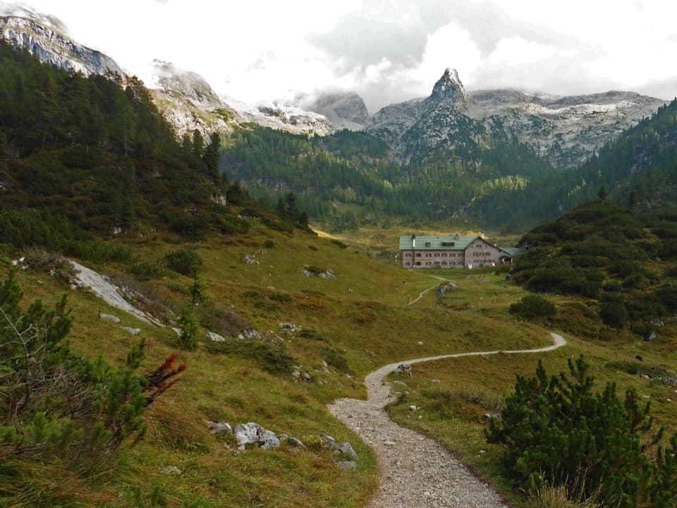
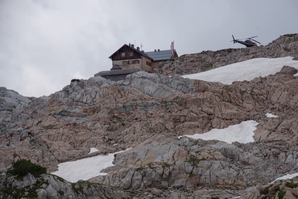
The stone seaFrom Riemannhaus, the Eichstätter Weg traverses open limestone toward Ingolstädter Haus.

From Riemannhaus, the Eichstätter Weg traverses open limestone toward Ingolstädter Haus. Pale slabs and broken karst give the Steinernes Meer its name: from above, the rolling ridges look like waves frozen into rock. It is a big, exposed landscape, and fog can make the route hard to follow; lingering or summer snow can cover parts of the rocky plateau.

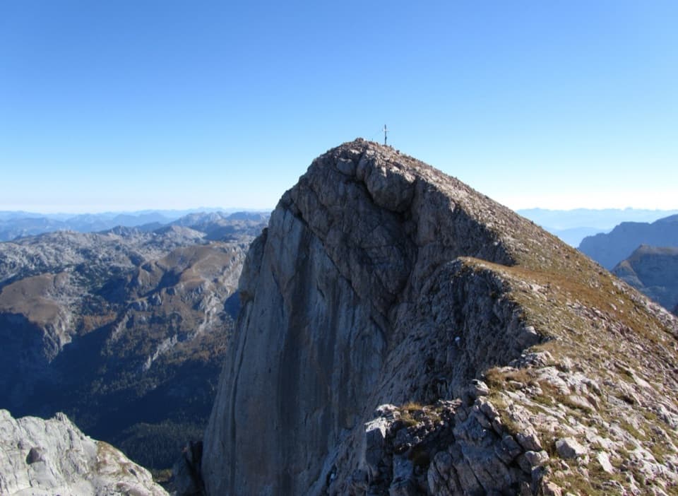
Hundstodgatterl to TrischübelBeyond Ingolstädter Haus, the way climbs steeply over rough limestone to Hundstodgatterl (2,188…

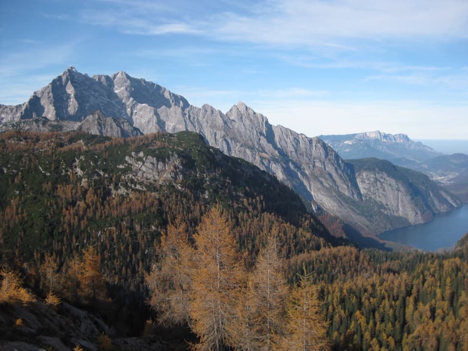
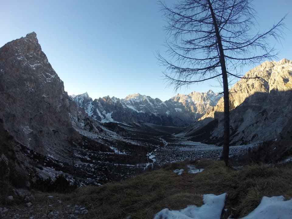
Beyond Ingolstädter Haus, the way climbs steeply over rough limestone to Hundstodgatterl (2,188 m). The high route then dips and climbs across several basins beneath Großer Hundstod before a short counter-climb and a descent along a pine-covered ridge to Trischübelpass (1,764 m). The route changes character at the pass: turn around for the best view back into Wimbachtal, where a broad pale gravel floor runs between dark pine and steep rock walls.

The long valley descentBelow Trischübel, a steep scree crossing and gully bring you to the valley floor.

Below Trischübel, a steep scree crossing and gully bring you to the valley floor. The lower route is longer and broader, winding between gravel channels and mountain-pine woodland. The Wimbachgries is a huge debris stream; the valley's gravel deposits are described as reaching 300 m in thickness. Near the upper valley, Wimbachgrieshütte is an on-route seasonal hut. Farther down, the route passes Wimbachschloss before reaching Wimbachbrücke.

Huts and the finishIngolstädter Haus and Wimbachgrieshütte are staffed seasonally, so check opening dates before…

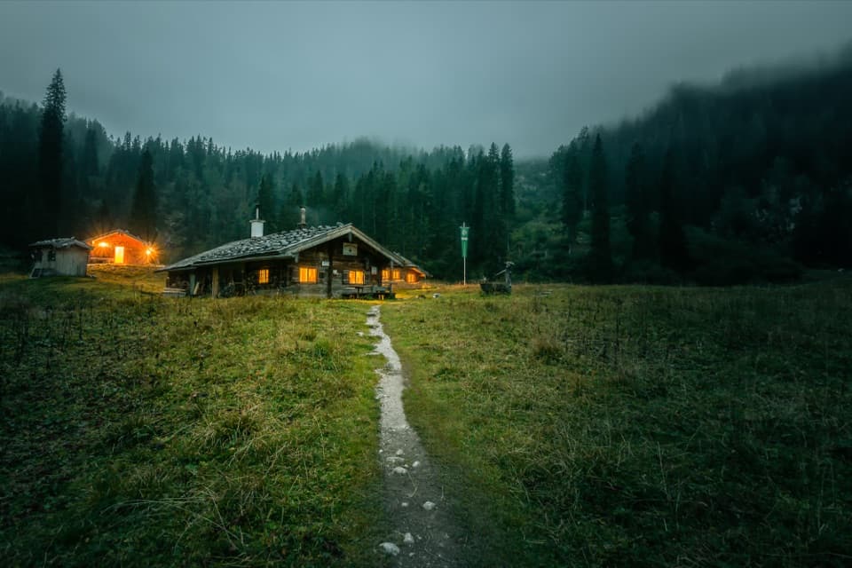
Ingolstädter Haus and Wimbachgrieshütte are staffed seasonally, so check opening dates before relying on food or shelter. The Wimbachgrieshütte stands on the site of the older Griesalm, documented from 1546; the present hut was built in 1922 and opened in 1924. Wimbachschloss is another stop along the valley, but its service dates aren't established here. Wimbachklamm is a separate, fee-charging walk entered from below at the valley end, not a passage through this high route. The traverse ends at Wimbachbrücke, where parking and bus service make the one-way logistics possible.

Wildlife

Wildlife in Berchtesgaden

All Berchtesgaden wildlife maps

Sighting maps show where each species has been reported across Berchtesgaden. Wildlife moves, so no sighting is guaranteed.

Keep exploring

Near Riemannhaus–Wimbachbrücke Alpine Traverse

See it all on the map

Trails that start nearby

Places near the trailhead

Parkwolf’s Berchtesgaden ranking

Top-rated trails in Berchtesgaden

All 71 trails
  1. 1Kleine ReibnChallenging · 18.7 km
  2. 2Obersee – Fischunkelalm – RöthbachfallModerate · 8 km
  3. 3Malerwinkel-RundwegEasy · 3.4 km
  4. 4Wimbachklamm-RundwegModerate · 2.1 km
  5. 5Blaueishütte via SchärtenalmChallenging · 10.5 km
  6. 6Gotzenalm via Hochbahn TrailChallenging · 22.8 km

Take Parkwolf to Berchtesgaden.

The audio tour guide for the drive, plus offline maps, trails, and wildlife heatmaps for when the signal drops.

4.7 from 8,600+ ratings

Download Parkwolf on the App StoreGet Parkwolf on Google Play