Ranger Lake Trail in Kings Canyon National Park

Kings Canyon National Park, CA

Ranger Lake Trail

A long high Sierra route to an alpine lake beneath granite walls.

Length
18.2mi
Time
12hr
Elev. change
1,293ft
Difficulty
Challenging
  • No dogs
  • High point 9,213 ft
Parkwolf audio tour55 stories across Kings Canyon’s roads

Overview

About Ranger Lake Trail

Why go

  • Ranger Lake is a rewarding overnight destination beneath a granite ridge
  • The approach links meadows, lakes and high-country passes

Heads up

  • 18.2 miles round trip at high elevation
  • Forks near Rowell Meadow require careful wayfinding

Map & elevation

The route

Loading the Kings Canyon map
Full map
Elevation7,920–9,213 ft
TrailheadRowell Meadow Trailhead36.72317, -118.76483
Keep this map with you offline in the Parkwolf app

Plan your hike

Before you go

Parking

Rowell Meadow Trailhead is off Big Meadows Road (Forest Road 14S11). The trailhead has a vault toilet but no potable water or bear lockers. Vehicle access is commonly closed by snow in winter and early spring, often until late May; reopening depends on conditions.

Safety

This 18.2-mile backcountry route reaches about 9,200 feet and includes repeated climbs and descents. Obtain the required wilderness permit before entering Kings Canyon National Park from Jennie Lakes Wilderness. Rowell Meadow has no potable water; late-season streams can dwindle, so carry a filter. Ordinary pets are prohibited on National Park Service trails.

8 active Kings Canyon alerts

  • CautionStage 1 fire restrictionsStage 1 fire restrictions are active because high fire danger raises the risk of accidental human-caused fires that could threaten visitors and employees.Official details
  • ClosureGrant Grove trails and areas closed for prescribed fireSome trails and areas around Grant Grove and the General Grant Tree are closed during an active prescribed burn; stay out until crews clear hazards and reopen them.Official details
See all 8 alerts
A park ranger sits on a dash-mounted phone, talking, as Parkwolf’s Tour Guide plays “Army Cutworm Moths: A Grizzly Bear Buffet” on Grand Loop Road below Dunraven Pass in Yellowstone
Parkwolf Tour GuideThe highest, rockiest slopes around here are a summer buffet for grizzly bears.

Kings Canyon Tour Guide

Your drive to Ranger Lake Trail, narrated.

Parkwolf is a GPS audio tour guide for Kings Canyon National Park. As you drive, it chimes in with what’s ahead: hidden gems, upcoming stops, history, geology, and wildlife, right through your car’s speakers.

See the Kings Canyon audio tour

More stories near here in the app

  • Grizzly Falls
  • The Songbird That Walks Underwater
  • A Black Bear Can Be Blond
  • 55 audio storiesacross Kings Canyon’s roads, triggered by GPS as you drive
  • Wildlife heatmapsfor Black Bear, Mule Deer, Marmot, and 13 more
  • Works offlinemaps, 77 trails, 61 places, and audio download before you lose signal
  • CarPlay readysimple controls built for the drive
★★★★★
“…The kids and my husband and I all agree that the narration really added to our experience driving through the parks. We learned so much about the history and the flora & fauna.”
JessestblondeApp Store review
Download Parkwolf on the App StoreGet Parkwolf on Google Play

4.7 from 8,600+ ratings

Trail guide

Hiking Ranger Lake Trail

The full commitmentRanger Lake Trail is an 18.2-mile out-and-back from Rowell Meadow Trailhead to Ranger Lake.

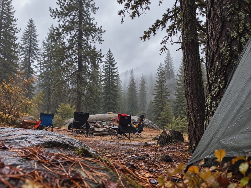
Ranger Lake Trail is an 18.2-mile out-and-back from Rowell Meadow Trailhead to Ranger Lake. The route follows the Rowell Meadow and Seville Lakes corridors, then Belle Canyon and Silliman Pass North. The lake is the destination; this is a long, high-elevation wilderness hike rather than a short lakeside loop. Budget about 12 hours of walking for the return, plus breaks. An overnight trip is a better fit for many hikers.

Through Rowell MeadowThe trailhead sits near 7,900 feet.

The trailhead sits near 7,900 feet. The first switchbacks climb alongside Rowell Creek before the grade eases toward Rowell Meadow. Several paths meet in the meadow, so confirm the branch toward Seville Lakes before continuing. A past party added three or four miles after taking the wrong fork; carry a detailed map and keep checking it at junctions.

Across Belle CanyonFrom Seville Lakes the route follows the Belle Canyon corridor and climbs toward Silliman Pass…

From Seville Lakes the route follows the Belle Canyon corridor and climbs toward Silliman Pass North. The mapped line rises, drops into lower ground, then climbs again before reaching Ranger Lake. Forest and meadow sections make this a destination hike more than a continuous overlook walk. The high elevation and return distance keep the effort demanding even where the grade eases.

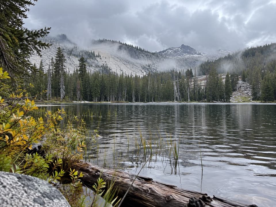
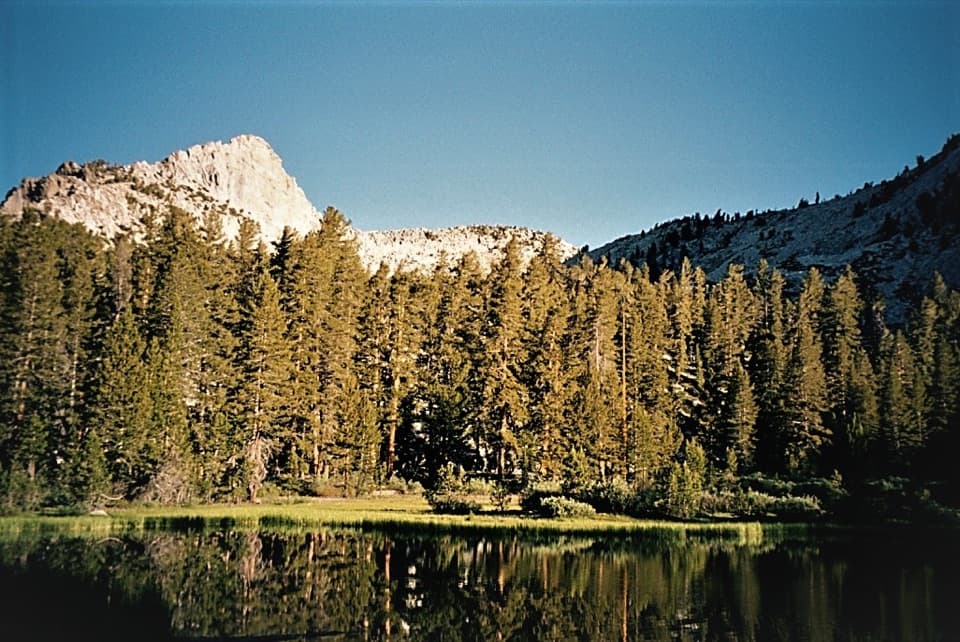
Ranger LakeRanger Lake sits around 9,200 feet, where a rocky shore faces a granite ridge and conifers.

Ranger Lake sits around 9,200 feet, where a rocky shore faces a granite ridge and conifers. This is the route's signature view and natural turnaround. On a calm morning, compose the ridgeline across the water to catch its reflection. There is no shorter loop at the lake in this route; return to Rowell Meadow by the same corridor.

Permits, water, and accessThe route starts in Jennie Lakes Wilderness and enters Kings Canyon National Park.

The route starts in Jennie Lakes Wilderness and enters Kings Canyon National Park. Obtain the required wilderness permit before entering the park from the wilderness. Ordinary pets are prohibited on National Park Service trails; service dogs are permitted. Rowell Meadow has a vault toilet but no potable water or bear lockers. Filter stream water, and do not assume late-season sources will be flowing. Big Meadows Road closes to vehicle traffic for snow in winter and early spring; reopening is weather dependent and often occurs in late May.

Wildlife

Wildlife in Kings Canyon

All Kings Canyon wildlife maps

Sighting maps show where each species has been reported across Kings Canyon. Wildlife moves, so no sighting is guaranteed.

Keep exploring

Near Ranger Lake Trail

See it all on the map

Trails that start nearby

Places near the trailhead

Parkwolf’s Kings Canyon ranking

Top-rated trails in Kings Canyon

All 77 trails
  1. 1Rae Lakes LoopChallenging · 41.4 mi
  2. 2Mist Falls TrailModerate · 8 mi
  3. 3Zumwalt Meadow TrailEasy · 1.5 mi
  4. 4Roaring River Falls TrailEasy · 0.3 mi
  5. 5Panoramic Point TrailEasy · 0.5 mi
  6. 6Big Stump Loop TrailEasy · 1.6 mi

Take Parkwolf to Kings Canyon.

The audio tour guide for the drive, plus offline maps, trails, and wildlife heatmaps for when the signal drops.

4.7 from 8,600+ ratings

Download Parkwolf on the App StoreGet Parkwolf on Google Play