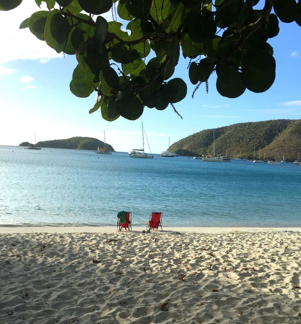
Honeymoon Beach in Virgin Islands National Park

#8 of 38 sights in Virgin Islands

Beach · Virgin Islands National Park

Honeymoon Beach

Clear-water snorkeling rewards the uneven hike to this shaded beach.

Photo: Wikimedia Commons
Type
Beach
Nearest trail
0.5 mi
Audio stories
10 nearby
  • Trailhead
  • Parking
  • Restrooms
  • Picnic tables

Hear the audio tour

Lind Point, Honeymoon and Salomon Beaches

Overview

About Honeymoon Beach

Why stop

  • Palm and seagrape trees shade much of the white-sand shore.

Heads up

  • Beach-club food and facilities are not dependable enough to plan around.
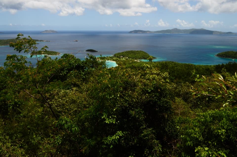
Honeymoon Beach is a white-sand beach on St. John’s north shore, inside Virgin Islands National Park. Palm and seagrape trees shade much of the sand, and clear shallows meet a reef that makes swimming and snorkeling the main draw. It’s a proper beach stop, with a walk in from Cruz Bay or a boat ride to the shore.
Parkwolf’s verdictA beach worth making time for

Map

Where it is

Loading the Virgin Islands map
Full map
BeachHoneymoon Beach18.34069, -64.79083
Keep this map with you offline in the Parkwolf app

Plan your stop

Before you go

1 active Virgin Islands alert

  • ClosureCaneel Bay restricted areas and closed pierMentions Caneel Bay, referenced in this guideAt Caneel Bay, use only designated public areas; other areas and the pier remain closed. - Areas beyond the public areas remain closed because of present safety risks.Official details

Virgin Islands alerts
A park ranger sits on a dash-mounted phone, talking, as Parkwolf’s Tour Guide plays “Army Cutworm Moths: A Grizzly Bear Buffet” on Grand Loop Road below Dunraven Pass in Yellowstone
Parkwolf Tour GuideThe highest, rockiest slopes around here are a summer buffet for grizzly bears.

Virgin Islands Tour Guide

Your drive to Honeymoon Beach, narrated.

Parkwolf is a GPS audio tour guide for Virgin Islands National Park. As you drive, it chimes in with what’s ahead: hidden gems, upcoming stops, history, geology, and wildlife, right through your car’s speakers.

Recorded for this place

Lind Point, Honeymoon and Salomon Beaches
0:00 / 0:34
“The Lind Point trails to Honeymoon and Salomon beaches are coming up. Choose the lower route for a less hilly walk, or the upper route for the view across Cruz Bay and Pillsbury Sound.”

Plays as you drive up to Honeymoon Beach in the Parkwolf Virgin Islands Tour Guide.

More stories near here in the app

  • Caneel Beach and the Old Resort
  • Caneel Hill Trail and Observation Deck
  • Cruz Bay Visitor Center
  • Water Catchment Trail and the Old Basin
  • 26 audio storiesacross Virgin Islands’s roads, triggered by GPS as you drive
  • Wildlife heatmapsfor White-tailed Deer, Green Iguana, Brown Pelican, and 13 more
  • Works offlinemaps, 22 trails, 42 places, and audio download before you lose signal
  • CarPlay readysimple controls built for the drive
★★★★★
“Fantastic app with many points of information… It’s great to just turn on while you’re driving and it gives you an audio tour of the national Park. We love it!!!!”
JMJamesApp Store review
Download Parkwolf on the App StoreGet Parkwolf on Google Play

4.7 from 8,600+ ratings

Guide

More about Honeymoon Beach

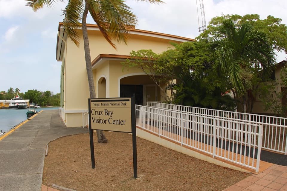
Walk in from Cruz BayA common approach follows Lind Point Trail from the Cruz Bay Visitor Center area.

A common approach follows Lind Point Trail from the Cruz Bay Visitor Center area. Allow about 20 to 40 minutes each way; the path is narrow, rocky and rooty in places, with some uneven climbing. Shoes with grip help, and a light beach bag is easier to carry. Bring drinking water. You can also arrive by boat. Pets are not allowed on park beaches; dogs on trails must stay leashed.

Explore the reefHoneymoon and nearby Salomon are separate beaches.

Honeymoon and nearby Salomon are separate beaches. The reef continues east toward Caneel Bay, and the rocky point between the beaches has brain, lettuce leaf, elkhorn, mustard hill and pillar corals. Fish shelter around the reef, making this the part to explore with a mask when the water is clear. Visibility changes with conditions.

Shade and a few extrasThe palms and seagrapes make it easier to linger between swims, and picnic tables are available.

The palms and seagrapes make it easier to linger between swims, and picnic tables are available. The beach club at the Caneel end offers a restaurant, snacks, drinks and rentals, but visitors report uneven service and facility availability. Bring water and a backup snack instead of counting on every amenity being open.

Frame the shallowsFor a beach photo, get low near the rocky edge and leave a patch of reef in the foreground,…

For a beach photo, get low near the rocky edge and leave a patch of reef in the foreground, with the anchored boats and green hills beyond. That gives the clear water some scale and captures more of the bay than a sky-heavy shot.

Wildlife

Wildlife in Virgin Islands

All Virgin Islands wildlife maps

Sighting maps show where each species has been reported across Virgin Islands. Wildlife moves, so no sighting is guaranteed.

Keep exploring

Near Honeymoon Beach

See it all on the map

Trails nearby

More stops nearby

Parkwolf’s Virgin Islands ranking

Top sights in Virgin Islands

All 42 places
  1. 1Trunk Bay BeachBeach
  2. 2Maho Bay BeachBeach
  3. 3Annaberg Sugar PlantationSight
  4. 4Cinnamon Bay BeachBeach
  5. 5Waterlemon CaySight
  6. 6Reef Bay PetroglyphsSight

Take Parkwolf to Virgin Islands.

The audio tour guide for the drive, plus offline maps, trails, and wildlife heatmaps for when the signal drops.

4.7 from 8,600+ ratings

Download Parkwolf on the App StoreGet Parkwolf on Google Play