Gordon Falls to Katoomba walk in Blue Mountains National Park

Blue Mountains National Park, NSW

Gordon Falls to Katoomba walk

A cliffside crossing of waterfalls, sandstone steps and valley views.

Photo: Public Domain
Length
8km
Time
3.5hr
Elev. change
87m
Difficulty
Moderate
  • No dogs
  • High point 974 m
  • #37 of 110 in Blue Mountains

Hear the audio tour

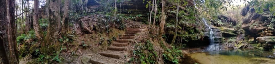
Gordon Falls and Pool of Siloam

Overview

About Gordon Falls to Katoomba walk

Why go

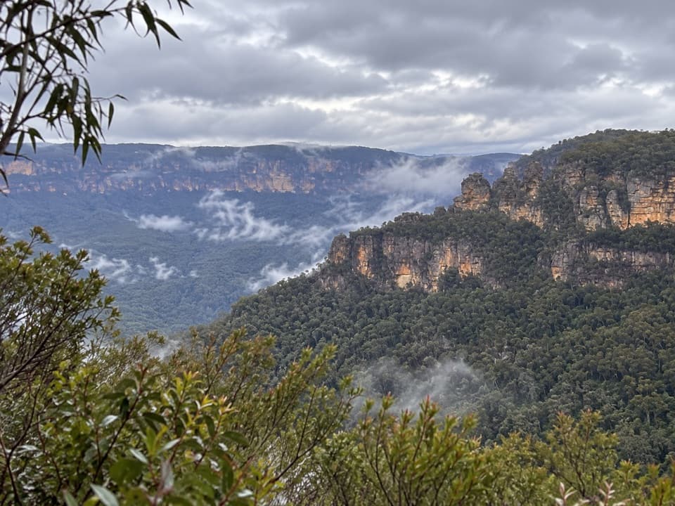
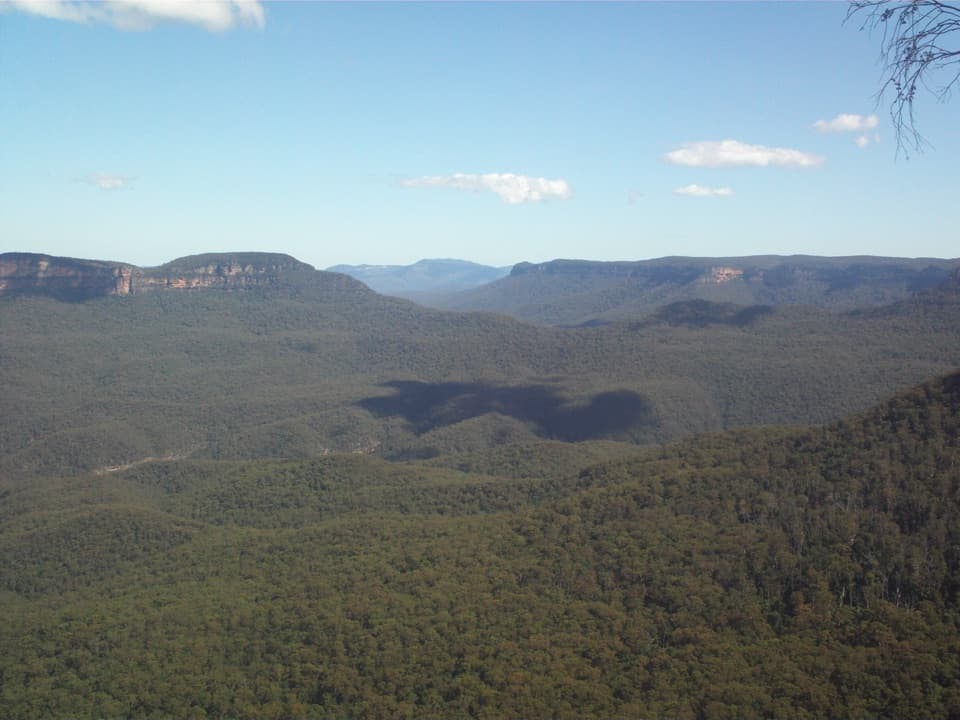
  • A long run of Jamison Valley views toward Mount Solitary.
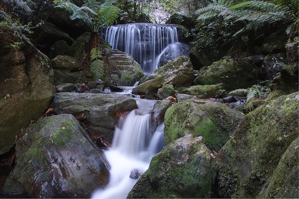
  • Leura Cascades, Bridal Veil Falls and Buttenshaw Bridge on one walk.

Heads up

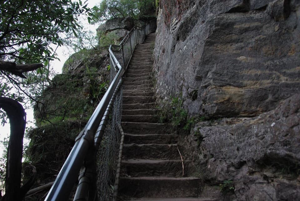
  • Many steps and short steep climbs.
  • The one-way finish requires a return-transport plan.
Gordon Falls to Katoomba is an 8 km (about 5 mile) one-way walk from Gordon Falls Picnic Area to Scenic World, the Katoomba end of the Grand Cliff Top Walk’s second day. Allow 3–4 hours. The formed track follows the Jamison Valley escarpment through waterfall gullies and cliff lookouts, with recurring views toward Mount Solitary and the Three Sisters. It’s a rewarding half-day if you want a full escarpment walk; it’s too long to treat as a quick lookout visit. The official walk details give 8 km, while the same page’s metadata lists 8.3 km, so plan for about five miles.
Parkwolf’s verdictIs this the hike for you?

Map & elevation

The route

Loading the Blue Mountains map
Full map
Elevation887–974 m
TrailheadGordon Falls Picnic Area-33.72546, 150.33200
Keep this map with you offline in the Parkwolf app

Plan your hike

Before you go

Parking

Start at Gordon Falls Picnic Area at the end of Olympian Parade in Leura. The official directions do not establish parking capacity at this access. The walk finishes at Scenic World, so arrange a pickup or public-transport return. Gordon Falls is 1.8 km from Leura station; Scenic World can also be reached by bus from Katoomba station.

Safety

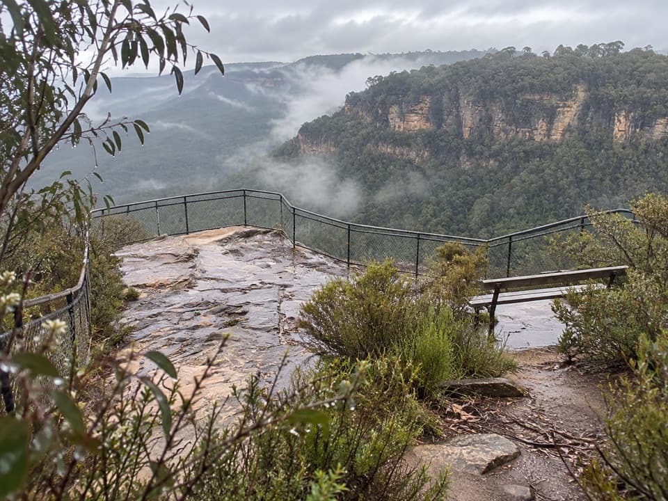
Grade 3 track with many steps, short steep hills and cliff-edge viewpoints above Jamison Valley. Wet sandstone can be slippery. Carry water; no reliable refill point along the route was confirmed. Domestic pets are prohibited except certified assistance animals.

3 active Blue Mountains alerts

  • ClosureRoads and tracks closed across Blue Mountains National ParkMany roads, fire trails and walking tracks across Blue Mountains National Park are closed; do not enter closed areas.Official details
  • CautionPark-wide solid-fuel fire banA park fire ban is active across Blue Mountains National Park: campfires and solid-fuel barbecues and stoves are prohibited. - Gas and electric cookers are permitted, subject to safety rules.Official details
See all 3 alerts
A park ranger sits on a dash-mounted phone, talking, as Parkwolf’s Tour Guide plays “Army Cutworm Moths: A Grizzly Bear Buffet” on Grand Loop Road below Dunraven Pass in Yellowstone
Parkwolf Tour GuideThe highest, rockiest slopes around here are a summer buffet for grizzly bears.

Blue Mountains Tour Guide

Your drive to Gordon Falls to Katoomba walk, narrated.

Parkwolf is a GPS audio tour guide for Blue Mountains National Park. As you drive, it chimes in with what’s ahead: hidden gems, upcoming stops, history, geology, and wildlife, right through your car’s speakers.

See the Blue Mountains audio tour

Recorded for this trailhead

Gordon Falls and Pool of Siloam
0:00 / 0:33
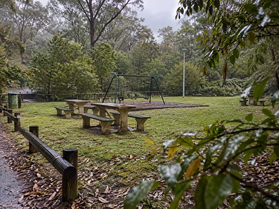
“Gordon Falls picnic area is coming up, a good stop for a family lunch with a valley view nearby. Bring your own food; the reserve has tables, barbecues and a playground.”

Plays as you drive up to this trailhead in the Parkwolf Blue Mountains Tour Guide.

More stories near here in the app

  • Elysian and Olympian Rocks
  • Leura Cascades and the Fern-lined Creek
  • Sublime Point Lookout
  • The Shadow Above the Horizon
  • 188 audio storiesacross Blue Mountains’s roads, triggered by GPS as you drive
  • Wildlife heatmapsfor Grey Kangaroo, Wombat, Red-necked Wallaby, and 13 more
  • Works offlinemaps, 110 trails, 84 places, and audio download before you lose signal
  • CarPlay readysimple controls built for the drive
★★★★★
“Fantastic app with many points of information… It’s great to just turn on while you’re driving and it gives you an audio tour of the national Park. We love it!!!!”
JMJamesApp Store review
Download Parkwolf on the App StoreGet Parkwolf on Google Play

4.7 from 8,600+ ratings

Trail guide

Hiking Gordon Falls to Katoomba walk

Plan for a one-way finishStart at Gordon Falls Picnic Area, at the end of Olympian Parade in Leura, and finish at Scenic…

Start at Gordon Falls Picnic Area, at the end of Olympian Parade in Leura, and finish at Scenic World. This is not a loop, so arrange a pickup or a public-transport return before setting out. The approach from Leura station adds 1.8 km and is outside the mapped trail; Scenic World can also be reached by bus from Katoomba station.

Steps and cliff edgesThis is a Grade 3 walk on a formed track, with many steps and short steep hills.

This is a Grade 3 walk on a formed track, with many steps and short steep hills. The route has sandstone stairs, bridges and boardwalks; wet stone can be slippery. The full track is not wheelchair-accessible, though some lookouts such as Echo Point have separate accessible access. Several viewpoints sit along the escarpment above Jamison Valley.

Waterfalls and the long viewFrom Gordon Falls, the route heads past Leura Cascades and Bridal Veil Falls, then reaches Echo…

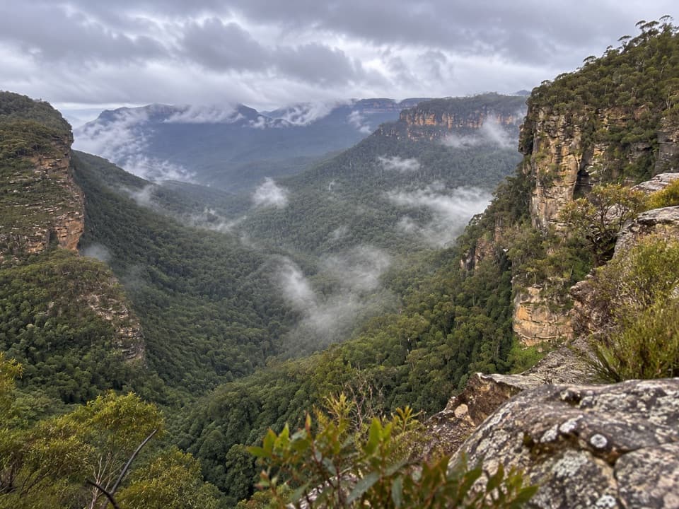
From Gordon Falls, the route heads past Leura Cascades and Bridal Veil Falls, then reaches Echo Point and the Three Sisters before continuing west to Scenic World. Take time at the open lookouts: the view runs across the forested Jamison Valley toward Mount Solitary. For a wide photo, Gordon Falls lookout gives you the sandstone escarpment with the forested valley beyond.

A bridge in Gundungurra CountryThe walk crosses Buttenshaw Bridge, built in 1935, and passes the Three Sisters Aboriginal…

The walk crosses Buttenshaw Bridge, built in 1935, and passes the Three Sisters Aboriginal Place. This is Gundungurra Country, and the Three Sisters hold deep cultural significance for Gundungurra People.

Listen in the gulliesLyrebirds, yellow-tailed black cockatoos and crimson rosellas are among the birds noted along…

Lyrebirds, yellow-tailed black cockatoos and crimson rosellas are among the birds noted along the route. Near creeks, look for eastern water dragons; sightings depend on conditions, so listen and watch rather than expecting a guaranteed encounter.

Facilities and petsToilets are available at Gordon Falls, Echo Point and Scenic World.

Toilets are available at Gordon Falls, Echo Point and Scenic World. Cafés and restaurants are in Leura and Katoomba, off the bush track. Carry water for the walk; no reliable refill point along the route was confirmed. Pets and domestic animals are not permitted, except certified assistance animals.

Wildlife

Wildlife in Blue Mountains

All Blue Mountains wildlife maps

Sighting maps show where each species has been reported across Blue Mountains. Wildlife moves, so no sighting is guaranteed.

Keep exploring

Near Gordon Falls to Katoomba walk

See it all on the map

Trails that start nearby

Places near the trailhead

Parkwolf’s Blue Mountains ranking

Top-rated trails in Blue Mountains

All 110 trails
  1. 1Grand Canyon trackModerate · 6.3 km
  2. 2Three Sisters walkEasy · 0.8 km
  3. 3Lockley Pylon walking trackModerate · 7 km
  4. 4National PassChallenging · 5.1 km
  5. 5Wentworth Pass loop walking trackChallenging · 5 km
  6. 6Prince Henry Cliff walkModerate · 7 km

Take Parkwolf to Blue Mountains.

The audio tour guide for the drive, plus offline maps, trails, and wildlife heatmaps for when the signal drops.

4.7 from 8,600+ ratings

Download Parkwolf on the App StoreGet Parkwolf on Google Play