Crimora Lake Overlook in Shenandoah National Park

Scenic pullout · Shenandoah National Park

Crimora Lake Overlook

A valley view with a manganese mine hiding in plain sight.

Photo: National Park Service
Type
Scenic pullout
Nearest trail
1.3 mi
Audio stories
6 nearby
  • Pullout
  • Scenic viewpoint
  • Parking
  • #45 of 114 sights

Hear the audio tour

Crimora Lake Overlook: The Mine Below the Ridges

Overview

About Crimora Lake Overlook

Why stop

  • A broad valley panorama with the remains of a major manganese mine in view.

Heads up

  • The mine is seen from a brief roadside stop, not explored up close.

Map

Where it is

Loading the Shenandoah map
Full map
Scenic pulloutCrimora Lake Overlook38.14642, -78.77611
Keep this map with you offline in the Parkwolf app

Plan your stop

Before you go

2 active Shenandoah alerts

  • ClosureOld Rag Trailhead main lot closedThe Old Rag Trailhead main parking lot is closed to vehicles and pedestrians for infrastructure improvements; use the existing overflow lots. - Work is expected to be completed by November 2026.Official details
  • ClosureBackcountry camping and zone closuresBackcountry camping is prohibited on the Appalachian Trail from Lewis Mountain to Big Meadows, and the Naked Creek backcountry zone is closed.Official details

Shenandoah alerts
A park ranger sits on a dash-mounted phone, talking, as Parkwolf’s Tour Guide plays “Army Cutworm Moths: A Grizzly Bear Buffet” on Grand Loop Road below Dunraven Pass in Yellowstone
Parkwolf Tour GuideThe highest, rockiest slopes around here are a summer buffet for grizzly bears.

Shenandoah Tour Guide

Your drive to Crimora Lake Overlook, narrated.

Parkwolf is a GPS audio tour guide for Shenandoah National Park. As you drive, it chimes in with what’s ahead: hidden gems, upcoming stops, history, geology, and wildlife, right through your car’s speakers.

See the Shenandoah audio tour

Recorded for this place

Crimora Lake Overlook: The Mine Below the Ridges
0:00 / 0:26
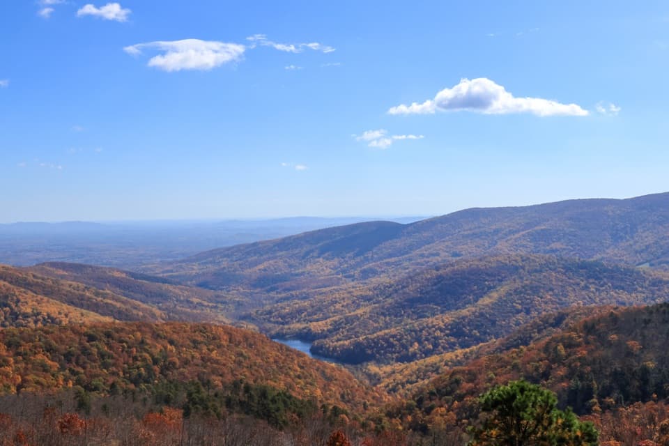
“Crimora Lake Overlook is coming up, with a valley view that includes the remains of a manganese mine. Once you've stopped, look below the ridges for dark Crimora Lake and the pale green flooded mine pit.”

Plays as you drive up to Crimora Lake Overlook in the Parkwolf Shenandoah Tour Guide.

More stories near here in the app

  • Moormans River Overlook: The Reservoir and the Flood
  • Turk Mountain Overlook: The Mountain Without the Climb
  • Riprap Overlook: Wildcat Ridge’s Fire Tower
  • Turk Mountain: A Rocky Summit and Fossil Burrows
  • 146 audio storiesacross Shenandoah’s roads, triggered by GPS as you drive
  • Wildlife heatmapsfor Black Bear, Bald Eagle, White-tailed Deer, and 13 more
  • Works offlinemaps, 163 trails, 142 places, and audio download before you lose signal
  • CarPlay readysimple controls built for the drive
★★★★★
“Fantastic app with many points of information… It’s great to just turn on while you’re driving and it gives you an audio tour of the national Park. We love it!!!!”
JMJamesApp Store review
Download Parkwolf on the App StoreGet Parkwolf on Google Play

4.7 from 8,600+ ratings

Guide

More about Crimora Lake Overlook

A quick stop with a storyCrimora Lake Overlook is a roadside pullout on Skyline Drive, high above the Shenandoah Valley.

Crimora Lake Overlook is a roadside pullout on Skyline Drive, high above the Shenandoah Valley. It’s a short stop rather than a hike, and the view has an extra layer: the water and pale cut in the hills are remnants of a manganese mine. Stop if you like seeing how much history can hide in a mountain landscape; if you’re in a hurry for a string of ridge panoramas, this one is brief.

Read the ridgesThe overlook faces northwest.

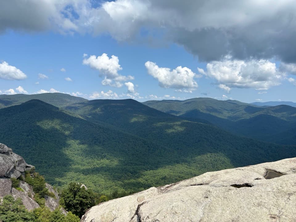
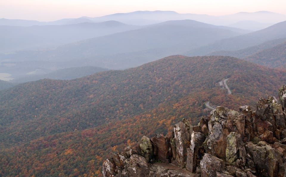
The overlook faces northwest. Turk Mountain is at the far left, Wildcat Ridge rises on the right, and Rocks Mountain sits beyond it with a small pale talus slope. Look below the ridges for two different colors of water: Crimora Lake is dark and just right of straight ahead, while a pale green flooded mine pit lies farther left. Include both waters and the ridgeline in a photo so the old workings are part of the scene, not just another distant valley.

A mine in the viewCrimora was Shenandoah’s largest and most productive manganese mine, worked as an open cut.

Crimora was Shenandoah’s largest and most productive manganese mine, worked as an open cut. The small man-made lakes were part of processing the ore, and the filled cuts still show from the overlook. Mining ended in 1946. The deposit was among the largest in the country, but its ore carried enough silica and phosphorus to make it unsuitable for steelmaking. Accounts differ on the start year, so the safe takeaway is that the mine belongs to the late nineteenth-century mining era.

Find it on Skyline DriveThe pullout is at mile 92.6, between Swift Run Gap and Rockfish Gap.

The pullout is at mile 92.6, between Swift Run Gap and Rockfish Gap. Skyline Drive has a 35 mph limit in most places, so leave time for the drive and stops. Inclement weather can close the road; check access before setting out.

Wildlife

Wildlife in Shenandoah

All Shenandoah wildlife maps

Sighting maps show where each species has been reported across Shenandoah. Wildlife moves, so no sighting is guaranteed.

Keep exploring

Near Crimora Lake Overlook

See it all on the map

Trails nearby

More stops nearby

Parkwolf’s Shenandoah ranking

Top sights in Shenandoah

All 142 places
  1. 1Old Rag MountainSight
  2. 2Big MeadowsSight
  3. 3Hawksbill SummitSight
  4. 4Stony Man SummitSight
  5. 5Dark Hollow FallsSight
  6. 6Marys RockSight

Take Parkwolf to Shenandoah.

The audio tour guide for the drive, plus offline maps, trails, and wildlife heatmaps for when the signal drops.

4.7 from 8,600+ ratings

Download Parkwolf on the App StoreGet Parkwolf on Google Play