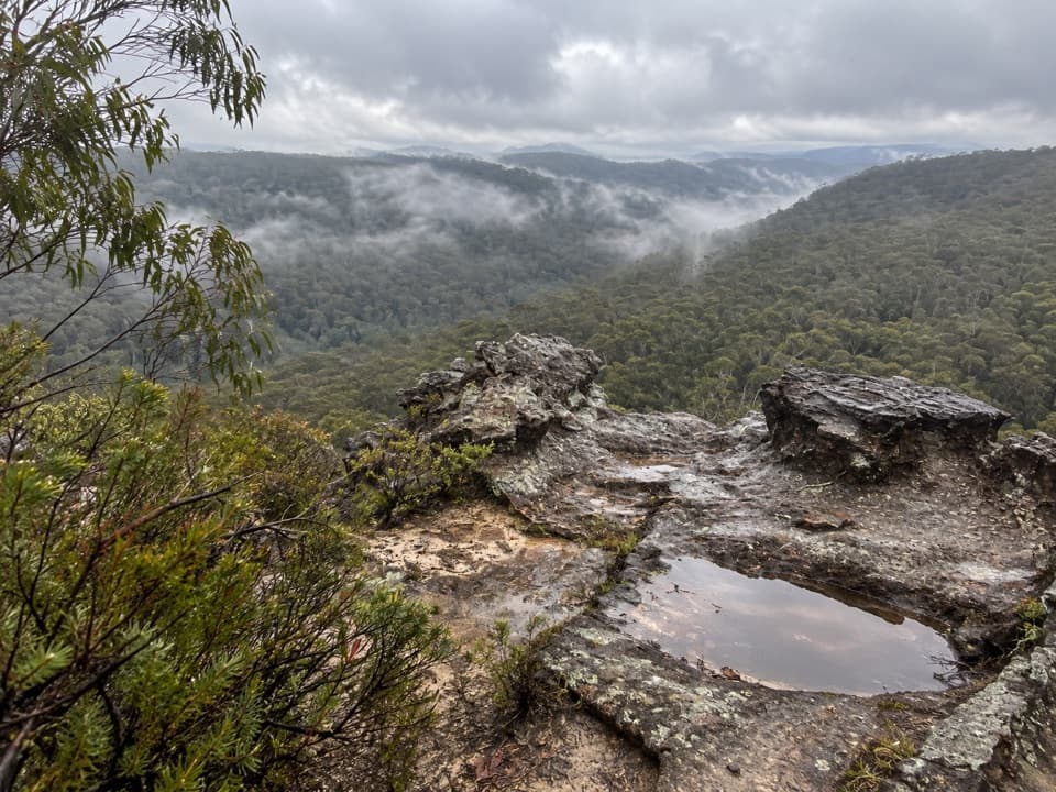
Linden Ridge Firetrail in Blue Mountains National Park

Blue Mountains National Park, NSW

Linden Ridge Firetrail

A long ridge firetrail with intermittent sandstone views.

Length
14.5km
Time
3.5hr
Elev. change
138m
Difficulty
Moderate
  • No dogs
  • High point 595 m

Hear the audio tour

The Wattle Changes Its Leaves

Overview

About Linden Ridge Firetrail

Why go

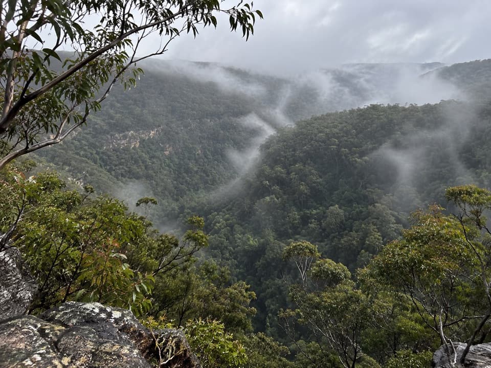
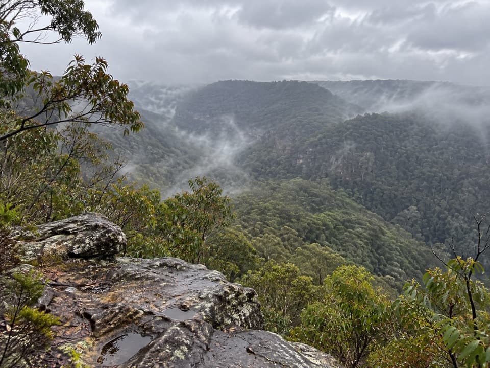
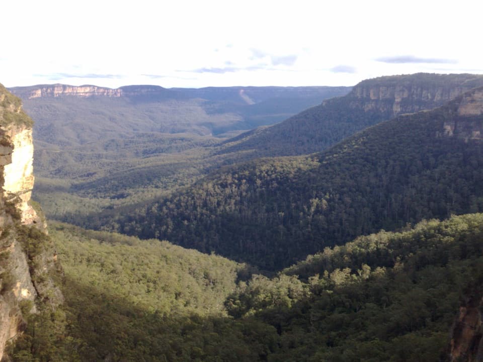
  • Occasional sandstone openings look across forested valleys.

Heads up

  • The full mapped return is long and climbs back to the gate.
  • Access and roadside parking at Glossop Road are uncertain or limited.

Map & elevation

The route

Loading the Blue Mountains map
Full map
Elevation457–595 m
TrailheadGlossop Road Firetrail gate-33.69974, 150.49026
Keep this map with you offline in the Parkwolf app

Plan your hike

Before you go

Parking

The described start is the locked gate at the end of Glossop Road. No dedicated trailhead car park was confirmed, and roadside space is reported to be very limited; do not block gates or nearby access. Linden railway station is about 5.5 km away by the described approach.

Safety

Public walking access across adjoining water-authority land has not been confirmed by its manager. Check posted signs and permission before entering, and remain on the named firetrail away from water infrastructure. The mapped route drops about 130 m toward its far end, so the return climbs back to the gate. Ordinary pets are prohibited in Blue Mountains National Park; certified assistance animals are excepted.

3 active Blue Mountains alerts

  • ClosureRoads and tracks closed across Blue Mountains National ParkMany roads, fire trails and walking tracks across Blue Mountains National Park are closed; do not enter closed areas.Official details
  • CautionPark-wide solid-fuel fire banA park fire ban is active across Blue Mountains National Park: campfires and solid-fuel barbecues and stoves are prohibited. - Gas and electric cookers are permitted, subject to safety rules.Official details
See all 3 alerts
A park ranger sits on a dash-mounted phone, talking, as Parkwolf’s Tour Guide plays “Army Cutworm Moths: A Grizzly Bear Buffet” on Grand Loop Road below Dunraven Pass in Yellowstone
Parkwolf Tour GuideThe highest, rockiest slopes around here are a summer buffet for grizzly bears.

Blue Mountains Tour Guide

Your drive to Linden Ridge Firetrail, narrated.

Parkwolf is a GPS audio tour guide for Blue Mountains National Park. As you drive, it chimes in with what’s ahead: hidden gems, upcoming stops, history, geology, and wildlife, right through your car’s speakers.

See the Blue Mountains audio tour

Recorded for this area

The Wattle Changes Its Leaves
0:00 / 0:27
“A young wattle can show you two different ways of being leafy. Many start with feathery leaves divided into tiny leaflets, then replace them as they grow.”

Plays on the road 2.5 km from the trailhead in the Parkwolf Blue Mountains Tour Guide.

More stories near here in the app

  • The Tail That Keeps Wriggling
  • The Hotel That Made Its Own Power
  • A Mushroom Making Its Own Light
  • A Telescope at Woodford House
  • 188 audio storiesacross Blue Mountains’s roads, triggered by GPS as you drive
  • Wildlife heatmapsfor Grey Kangaroo, Wombat, Red-necked Wallaby, and 13 more
  • Works offlinemaps, 110 trails, 84 places, and audio download before you lose signal
  • CarPlay readysimple controls built for the drive
★★★★★
“Fantastic app with many points of information… It’s great to just turn on while you’re driving and it gives you an audio tour of the national Park. We love it!!!!”
JMJamesApp Store review
Download Parkwolf on the App StoreGet Parkwolf on Google Play

4.7 from 8,600+ ratings

Trail guide

Hiking Linden Ridge Firetrail

The walkLinden Ridge Firetrail is a long out-and-back along a winding ridge track, with occasional…

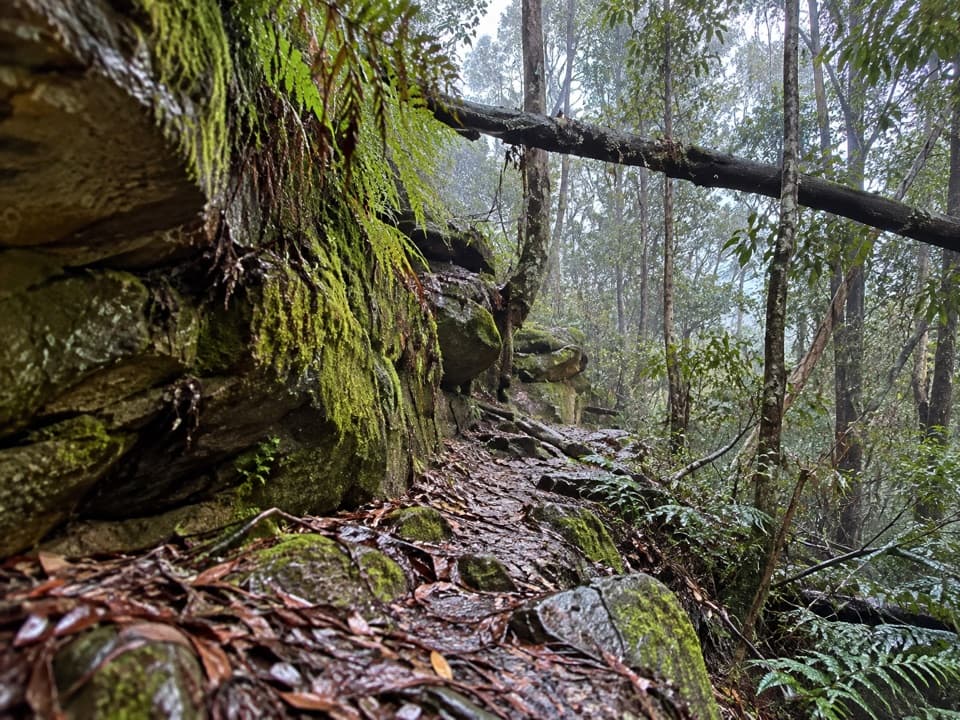
Linden Ridge Firetrail is a long out-and-back along a winding ridge track, with occasional west-facing openings over forested valleys. The mapped line runs about 7.25 km one way; following it back makes the full walk roughly 14.5 km (9 miles) return. A walking account gives 12 km return, but its turnaround is not clear, so use the mapped distance for the full line and choose a turnaround before you set out. Allow about 3–4 hours for the full return.

Access and effortThe described start is a locked gate at the end of Glossop Road.

The described start is a locked gate at the end of Glossop Road. The firetrail trends down toward its northern end, about 130 m below the gate, so the return includes a sustained climb back. The access is around 5.5 km from Linden railway station; arriving by train adds a substantial walk. No dedicated trailhead parking or facilities were confirmed, and roadside space is reported to be very limited. Public walking access across adjoining water-authority land has not been confirmed by its manager: check signs and permission before entering. Dogs are not permitted in the national park except certified assistance animals.

Ridge views and heritageExpect a bush track with scattered sandstone formations and occasional views rather than an…

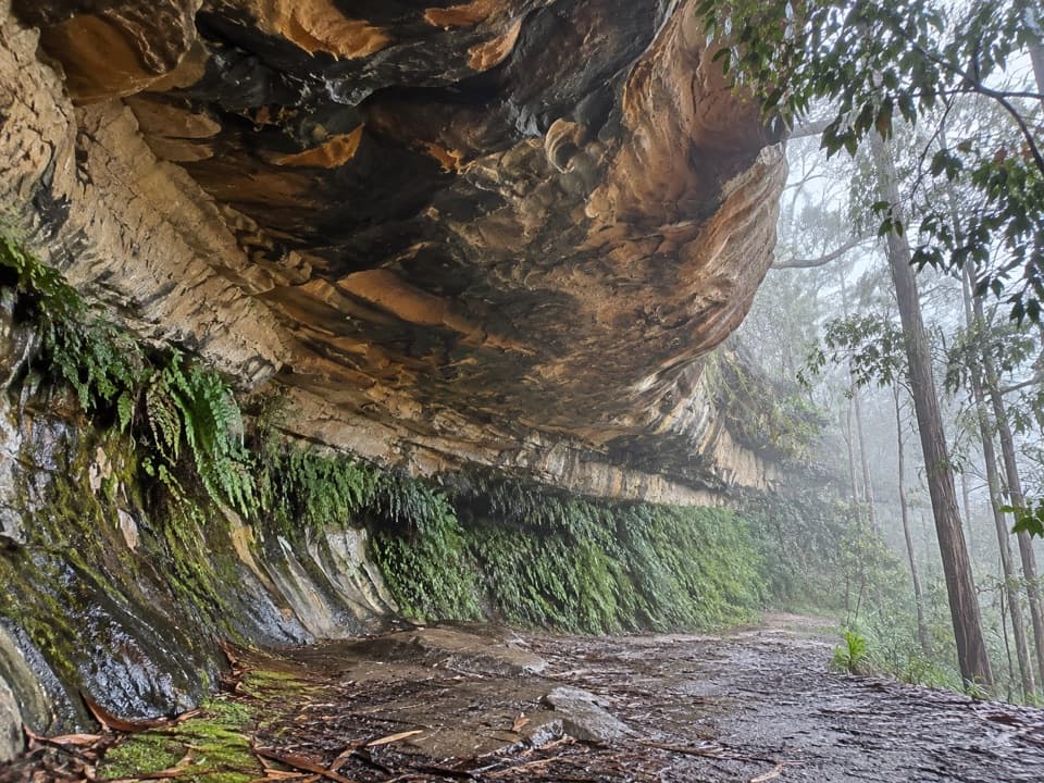
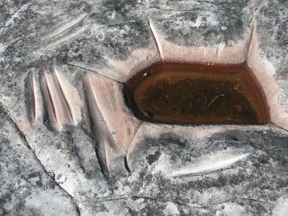
Expect a bush track with scattered sandstone formations and occasional views rather than an uninterrupted lookout walk; one west-facing opening is near the start. The ridge is on Dharug and Gundungurra Country, and accounts identify Aboriginal engravings, stone arrangements and grinding grooves along the walk. Treat cultural places with care: stay on the main firetrail, do not touch or disturb material, and avoid sharing sensitive locations.

Wildlife

Wildlife in Blue Mountains

All Blue Mountains wildlife maps

Sighting maps show where each species has been reported across Blue Mountains. Wildlife moves, so no sighting is guaranteed.

Keep exploring

Near Linden Ridge Firetrail

See it all on the map

Trails that start nearby

Places near the trailhead

Parkwolf’s Blue Mountains ranking

Top-rated trails in Blue Mountains

All 110 trails
  1. 1Grand Canyon trackModerate · 6.3 km
  2. 2Three Sisters walkEasy · 0.8 km
  3. 3Lockley Pylon walking trackModerate · 7 km
  4. 4National PassChallenging · 5.1 km
  5. 5Wentworth Pass loop walking trackChallenging · 5 km
  6. 6Prince Henry Cliff walkModerate · 7 km

Take Parkwolf to Blue Mountains.

The audio tour guide for the drive, plus offline maps, trails, and wildlife heatmaps for when the signal drops.

4.7 from 8,600+ ratings

Download Parkwolf on the App StoreGet Parkwolf on Google Play