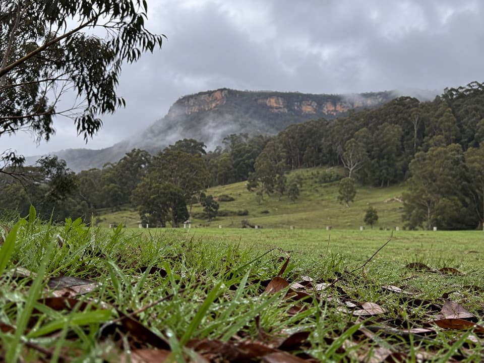
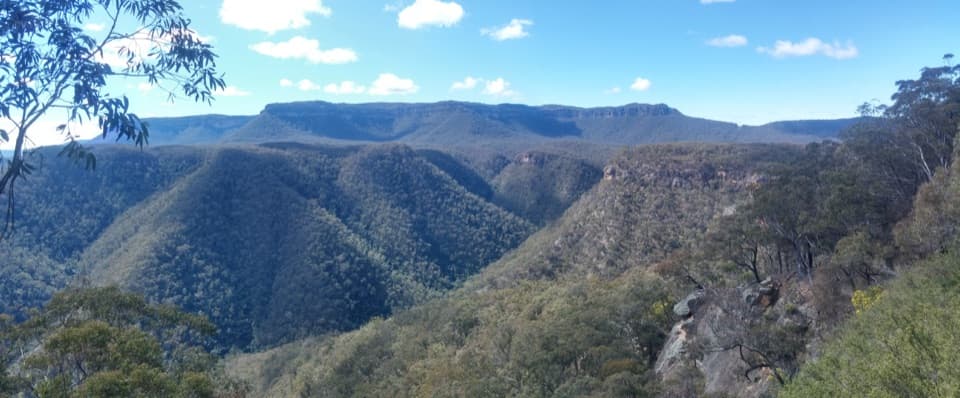
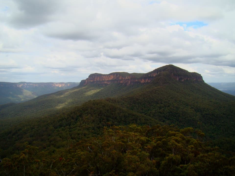
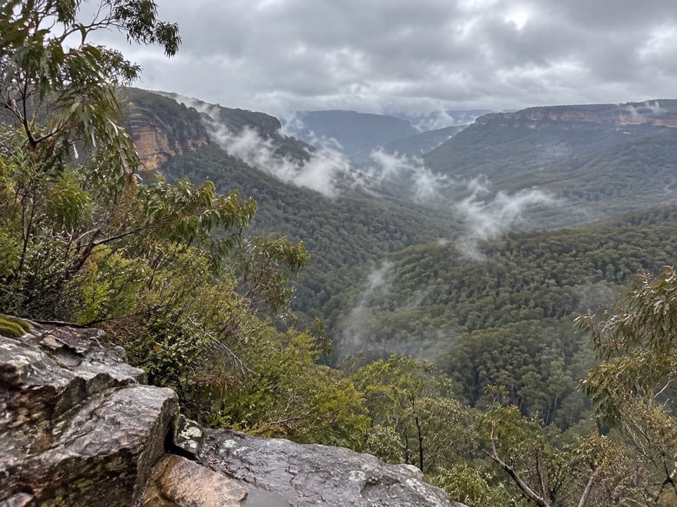
Splendour Rock from Dunphys campground in Blue Mountains National Park

Blue Mountains National Park, NSW

Splendour Rock from Dunphys campground

A remote two-day circuit to a cliff-top war memorial.

Length
23.5km
Time
9hr
Elev. change
595m
Difficulty
Challenging
  • Loop
  • No dogs
  • High point 930 m
  • #23 of 110 in Blue Mountains

Hear the audio tour

Dunphys Campground and the Wild Dog Mountains

Overview

About Splendour Rock from Dunphys campground

Why go

  • The sandstone memorial platform gives the circuit a clear, meaningful destination.
  • A full ridge-and-valley loop avoids retracing the route.

Heads up

  • Faint pads, scrambling and exposed ledges make navigation and footing demanding.
  • Unreliable natural water and the overnight commitment take careful planning.
Splendour Rock from Dunphys campground is a 14.6-mile (23.5 km) loop through the Wild Dog Mountains. It links management tracks and faint ridge pads to a sandstone lookout above Coxs River, the Gangerang Range and, to the east, Lake Burragorang. This remote two-day walk suits people comfortable navigating an unsigned backcountry route. The memorial outcrop is a compelling destination, but the route involves long rough stretches and repeated climbs. Treat it as an overnight trip, not an ambitious half-day.
Parkwolf’s verdictIs this the hike for you?

Map & elevation

The route

Loading the Blue Mountains map
Full map
Elevation335–930 m
TrailheadDunphys campground-33.78973, 150.23021
Keep this map with you offline in the Parkwolf app

Plan your hike

Before you go

Parking

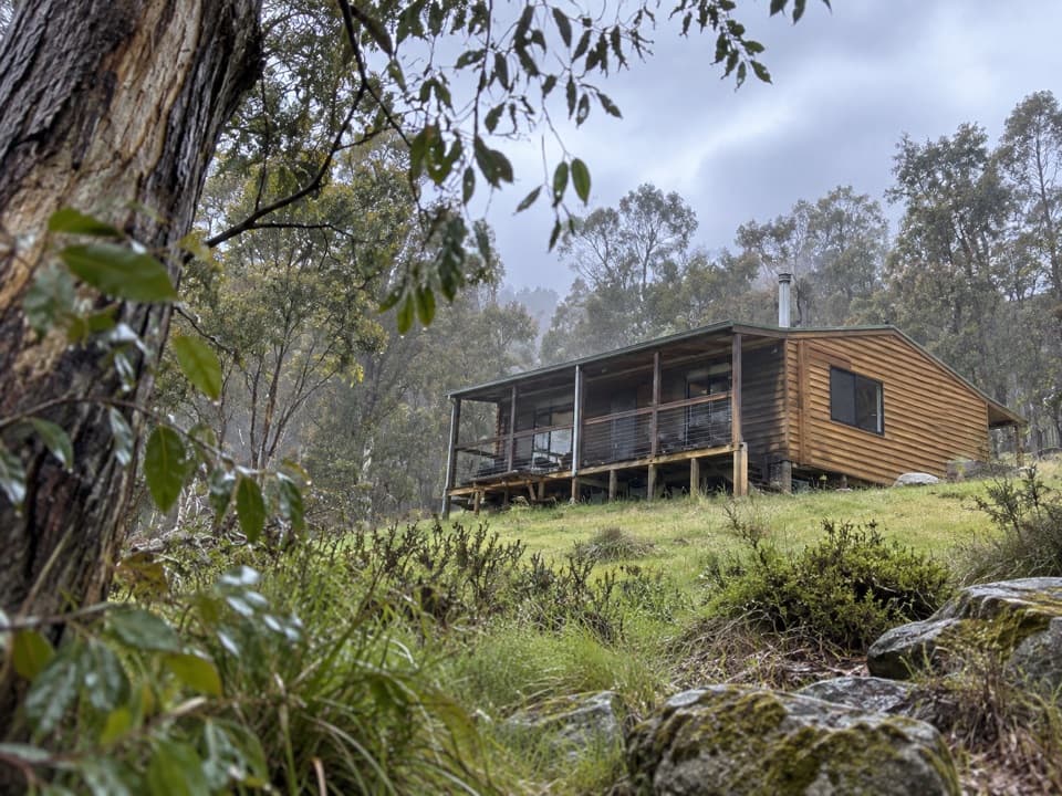
Start at the Dunphys campground car park, 2071 Megalong Road in Megalong Valley. The access road crosses private property; shut gates and watch for stock. The campground has toilets, picnic tables and barbecues but no drinking water or food outlet.

Safety

Remote, informal route with faint pads and difficult navigation. Sloping shaded sections can be slippery; expect a small-tunnel scramble, exposed cliff ledges, steep descents and repeated creek crossings. Carry all drinking water and do not rely on natural sources.

3 active Blue Mountains alerts

  • ClosureRoads and tracks closed across Blue Mountains National ParkMany roads, fire trails and walking tracks across Blue Mountains National Park are closed; do not enter closed areas.Official details
  • CautionPark-wide solid-fuel fire banA park fire ban is active across Blue Mountains National Park: campfires and solid-fuel barbecues and stoves are prohibited. - Gas and electric cookers are permitted, subject to safety rules.Official details
See all 3 alerts
A park ranger sits on a dash-mounted phone, talking, as Parkwolf’s Tour Guide plays “Army Cutworm Moths: A Grizzly Bear Buffet” on Grand Loop Road below Dunraven Pass in Yellowstone
Parkwolf Tour GuideThe highest, rockiest slopes around here are a summer buffet for grizzly bears.

Blue Mountains Tour Guide

Your drive to Splendour Rock from Dunphys campground, narrated.

Parkwolf is a GPS audio tour guide for Blue Mountains National Park. As you drive, it chimes in with what’s ahead: hidden gems, upcoming stops, history, geology, and wildlife, right through your car’s speakers.

See the Blue Mountains audio tour

Recorded for this trailhead

Dunphys Campground and the Wild Dog Mountains
0:00 / 0:34
“You're nearing Dunphys campground, a grassy clearing with views toward Mount Cloudmaker and the Wild Dog Mountains. I'd choose it for a remote camping base, with a chance of kangaroos or wombats visiting the grass.”

Plays as you drive up to this trailhead in the Parkwolf Blue Mountains Tour Guide.

More stories near here in the app

  • Why Gum Trees Let the Sun Through
  • How a Ridge Makes a Cloud
  • The Memorial on Mount Dingo
  • The Ant's Takeaway Seed
  • 188 audio storiesacross Blue Mountains’s roads, triggered by GPS as you drive
  • Wildlife heatmapsfor Grey Kangaroo, Wombat, Red-necked Wallaby, and 13 more
  • Works offlinemaps, 110 trails, 84 places, and audio download before you lose signal
  • CarPlay readysimple controls built for the drive
★★★★★
“Fantastic app with many points of information… It’s great to just turn on while you’re driving and it gives you an audio tour of the national Park. We love it!!!!”
JMJamesApp Store review
Download Parkwolf on the App StoreGet Parkwolf on Google Play

4.7 from 8,600+ ratings

Trail guide

Hiking Splendour Rock from Dunphys campground

Follow the mapped loopFrom Dunphys, the circuit reaches Black Horse Ridge, then climbs through the Blue Dog and…

From Dunphys, the circuit reaches Black Horse Ridge, then climbs through the Blue Dog and Yellow Dog ridge country toward Mobbs Soak. It passes the Dingo Gap and Thommo's Chains area before reaching Mt Dingo and Splendour Rock. The return runs beneath Wombat Parade and along White Dog Ridge, then follows the Medlow Gap and Bellbird Ridge tracks back to the campground. This is a full loop, not an out-and-back; the stored line excludes optional sidetracks.

Expect management trails mixed with narrow footpads rather than one consistently built walking track. Some connecting pads are faint, and there is no continuous trail marking to follow. Keep the route visible on a map and check junctions carefully.

The rough ridge crossingsWombat Parade traverses below the eastern cliffs of Mt Warrigal.

Wombat Parade traverses below the eastern cliffs of Mt Warrigal. Its track is narrow, sloping and can be slippery in shade. A short scramble through a small rock tunnel climbs to the plateau near Mt Merrimerrigal; across the rocky high ground, the tread becomes indistinct. The route then follows narrow ridges toward Dingo Gap and Mt Dingo. Where pads fade, progress can be slow and route finding takes attention.

At Splendour RockThe outcrop sits at the southern end of Mt Dingo.

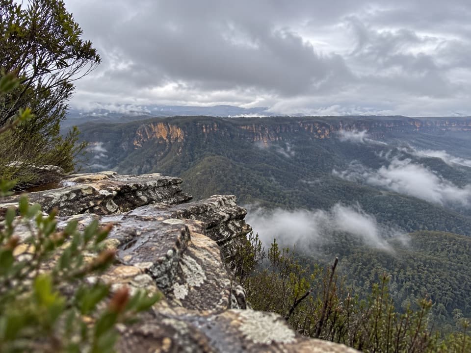
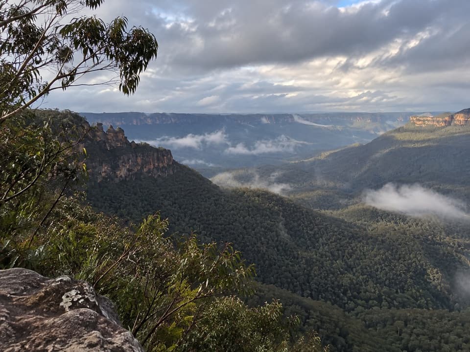
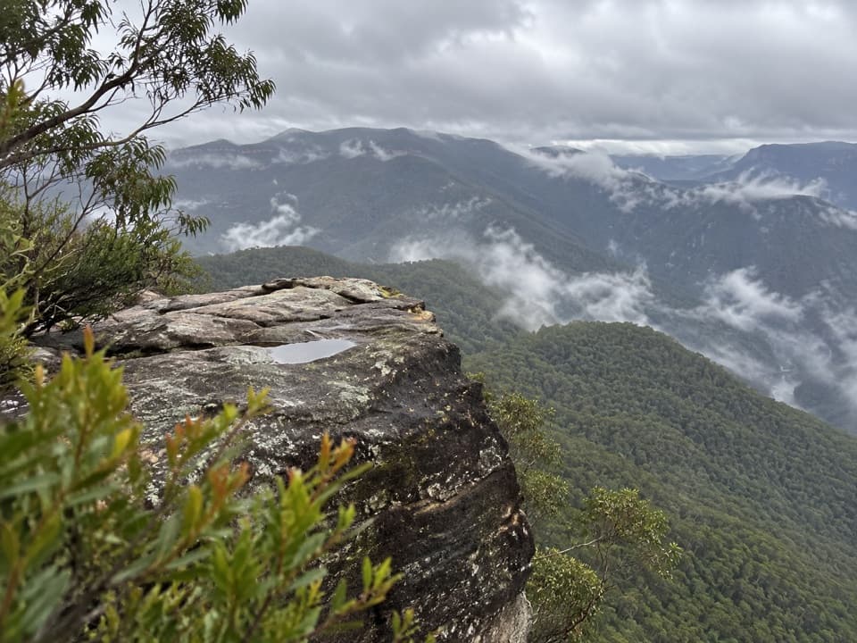
The outcrop sits at the southern end of Mt Dingo. From its sandstone edge, look across the forested Gangerang Range and Coxs River, with Lake Burragorang farther east. A logbook and memorial plaques honor bushwalkers who died in the Second World War. The rock has also been used for a dawn Anzac Day service.

Give the view more than a quick stop. For a photo, frame a band of the sandstone platform in the foreground with the valley and ridges beyond; it helps show the drop and distance.

The return is still hardThe circuit follows Mt Dingo's western cliff edge and descends a steep pass with exposed…

The circuit follows Mt Dingo's western cliff edge and descends a steep pass with exposed scrambling toward Mobbs Swamp. It climbs again over Black Horse Ridge, then drops steeply to Breakfast Creek. The final country has repeated Carlon Creek crossings and stinging nettles, so the last stretch can feel longer than the map mileage suggests.

Published ascent figures disagree sharply: an older route description lists 640 m, while a terrain-model estimate is near 1,300 m. The methods and route details differ, and no verified total was found. Plan for substantial climbing rather than relying on the lower figure.

Start, water and accessStart at the Dunphys campground car park.

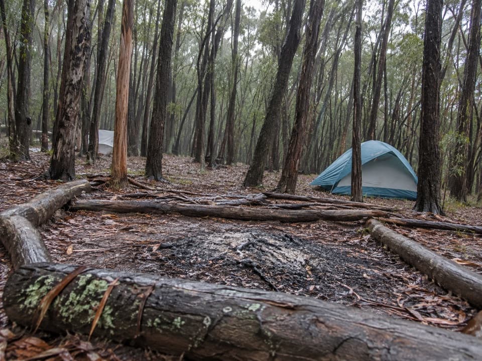
Start at the Dunphys campground car park. The access road passes through private property, so leave gates as you find them and watch for livestock. The campground has toilets, picnic tables and barbecue facilities, but no drinking water or food outlet. Natural water at Breakfast Creek and Mobbs Swamp is not dependable, especially after dry weather. Dogs are not permitted in the national park, except trained assistance animals working in public areas.

Is this the hike for you?The best documented itinerary divides the loop into about 13 km and 11 km.

The best documented itinerary divides the loop into about 13 km and 11 km. Allow roughly 9 hours of walking across both days, plus time for camp and the view. A digital map estimate gives 6 hours 50 minutes of moving time before breaks, but it is not a field-checked completion time; faint pads can slow you down. Carry enough drinking water, and check current park rules before choosing an overnight campsite.

Wildlife

Wildlife in Blue Mountains

All Blue Mountains wildlife maps

Sighting maps show where each species has been reported across Blue Mountains. Wildlife moves, so no sighting is guaranteed.

Keep exploring

Near Splendour Rock from Dunphys campground

See it all on the map

Trails that start nearby

Places near the trailhead

Parkwolf’s Blue Mountains ranking

Top-rated trails in Blue Mountains

All 110 trails
  1. 1Grand Canyon trackModerate · 6.3 km
  2. 2Three Sisters walkEasy · 0.8 km
  3. 3Lockley Pylon walking trackModerate · 7 km
  4. 4National PassChallenging · 5.1 km
  5. 5Wentworth Pass loop walking trackChallenging · 5 km
  6. 6Prince Henry Cliff walkModerate · 7 km

Take Parkwolf to Blue Mountains.

The audio tour guide for the drive, plus offline maps, trails, and wildlife heatmaps for when the signal drops.

4.7 from 8,600+ ratings

Download Parkwolf on the App StoreGet Parkwolf on Google Play